Download
Preview
Add to list
More
Trail length
10.1 km
Time
~2 hrs 22 min
Elevation Gain
212 m
Hike Type
Point-to-Point
“Explore the scenic Havelhöhenweg trail near Berlin, rich in history and natural beauty.”
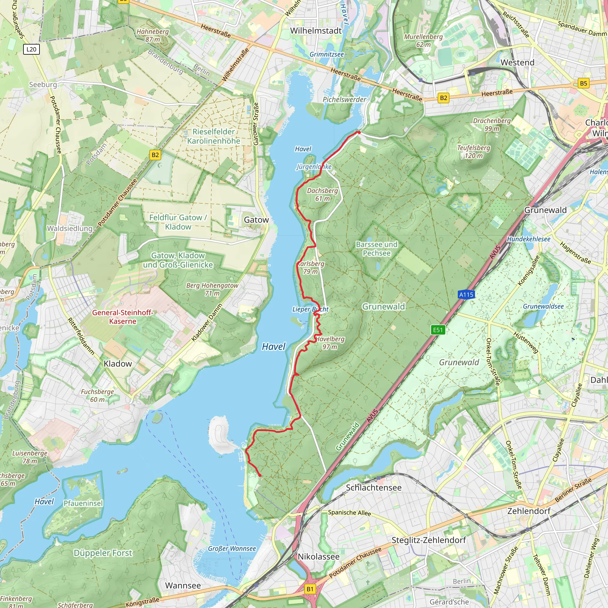
Starting near Berlin, Germany, the Havelhöhenweg trail stretches approximately 10 kilometers (6.2 miles) with an elevation gain of around 200 meters (656 feet). This point-to-point trail is estimated to be of medium difficulty, making it suitable for moderately experienced hikers.
Getting There To reach the trailhead, you can take public transport from Berlin. The nearest significant landmark is the Wannsee S-Bahn station. From there, you can take a bus or a short taxi ride to the starting point. If you prefer to drive, there are parking facilities available near the trailhead.
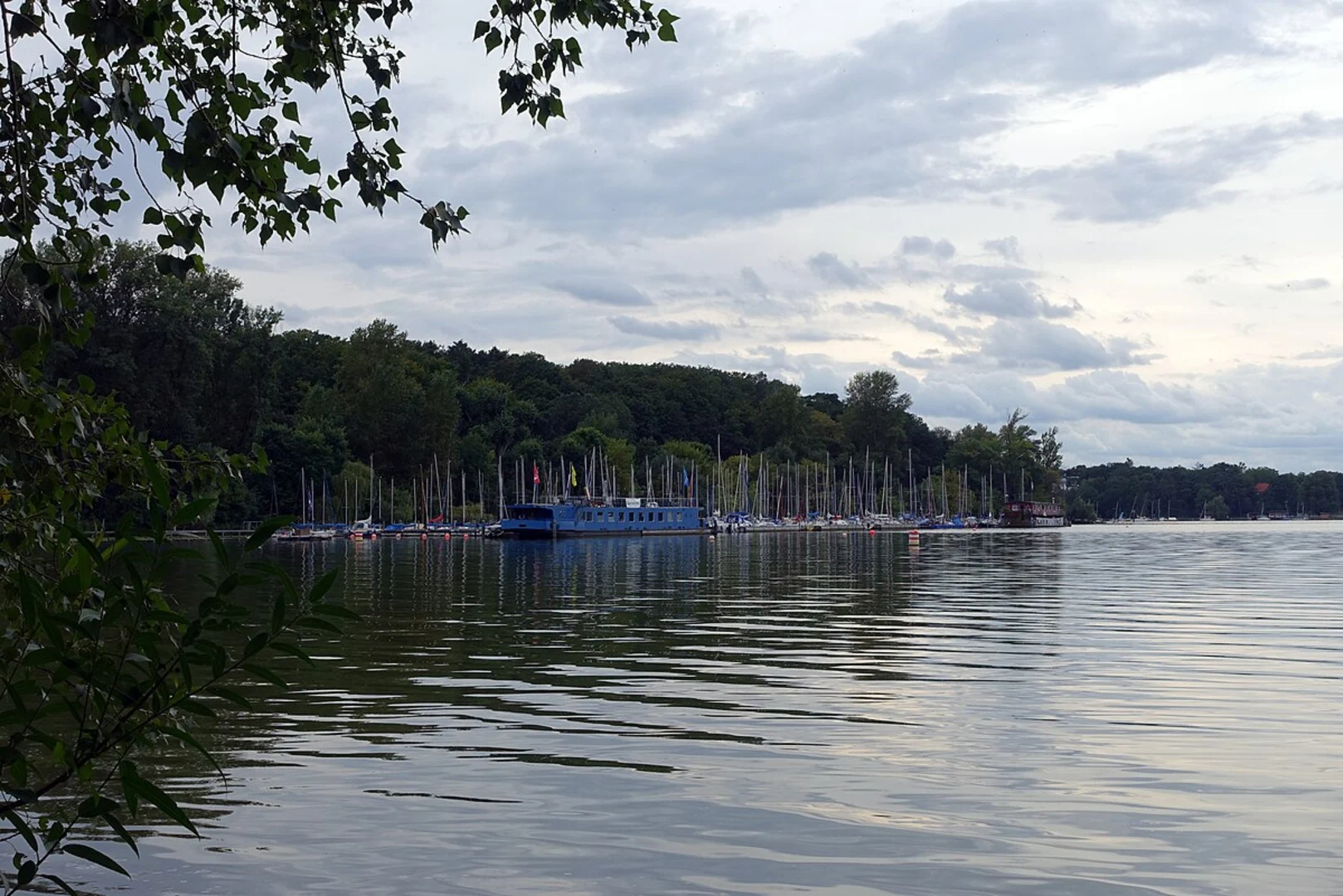
Trail Overview The Havelhöhenweg trail offers a scenic journey through the lush forests and along the banks of the Havel River. The trail is well-marked, but it's advisable to use HiiKER for navigation to ensure you stay on the correct path.
Key Landmarks and Points of Interest - **Grunewald Forest**: As you begin your hike, you'll traverse through the Grunewald Forest, a large woodland area that provides a serene and shaded environment. This section is relatively flat, making it a gentle start to your hike. - **Havel River Views**: Approximately 3 kilometers (1.9 miles) into the hike, you'll start to encounter stunning views of the Havel River. The trail runs parallel to the river, offering several vantage points where you can pause and take in the scenery. - **Teufelsberg**: Around the 5-kilometer (3.1 miles) mark, you'll come across Teufelsberg, an artificial hill made from rubble after World War II. This site has historical significance as it was used by the U.S. for surveillance during the Cold War. The hill provides panoramic views of Berlin and the surrounding areas. - **Peacock Island (Pfaueninsel)**: Near the 7-kilometer (4.3 miles) point, you can take a short detour to visit Peacock Island, a UNESCO World Heritage site. The island is home to a variety of wildlife, including peacocks, and features a picturesque palace.
Flora and Fauna The trail is rich in biodiversity. In the Grunewald Forest, you'll encounter a variety of tree species such as oak, beech, and pine. The underbrush is home to numerous bird species, making it a great spot for birdwatching. Along the Havel River, keep an eye out for waterfowl and other aquatic wildlife.
Elevation and Terrain The trail's elevation gain of 200 meters (656 feet) is spread out over the 10 kilometers (6.2 miles), with some steep sections, particularly as you approach Teufelsberg. The terrain varies from forest paths to riverside trails, with some rocky and uneven sections. Good hiking boots are recommended.
Historical Significance The Havelhöhenweg trail is steeped in history. Teufelsberg, with its Cold War history, is a significant landmark. Additionally, the trail passes through areas that were once part of the Berlin Wall's border zone, offering a glimpse into Germany's divided past.
Practical Tips - **Water and Snacks**: There are limited facilities along the trail, so bring enough water and snacks to sustain you. - **Weather**: Check the weather forecast before you go. The trail can be muddy and slippery after rain. - **Safety**: While the trail is generally safe, always let someone know your hiking plans and expected return time.
Using HiiKER for navigation will ensure you have a smooth and enjoyable hike on the Havelhöhenweg trail.
Comments and Reviews
User comments, reviews and discussions about the Havelhoehenweg, Germany.
4.67
average rating out of 5
3 rating(s)

