Download
Preview
Add to list
More
6.2 km
~1 hrs 15 min
12 m
Point-to-Point
“Explore history and nature on the 6 km Fort Hahneberg to Spandau trail.”
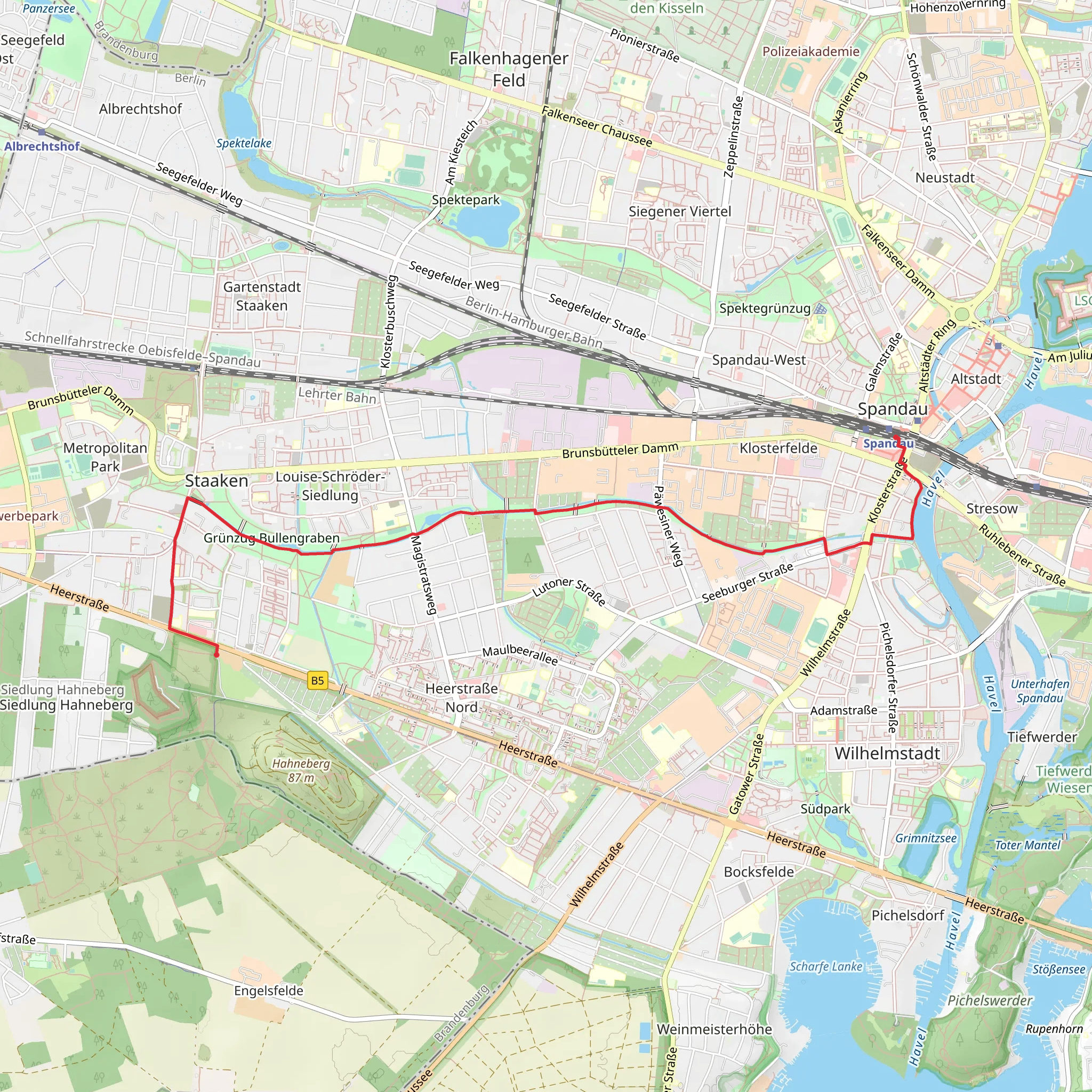
Starting near Berlin, Germany, this 6 km (approximately 3.7 miles) point-to-point trail from Fort Hahneberg to Spandau via Bullengrabenweg offers a unique blend of historical intrigue and natural beauty. With an elevation gain of around 0 meters, this trail is relatively flat, making it accessible for hikers of various skill levels, though it is rated as medium difficulty due to its length and terrain.
Getting There
To reach the trailhead, you can use public transport or drive. If you're taking public transport, the nearest significant landmark is the Spandau Citadel. From there, you can catch a bus or take a short taxi ride to Fort Hahneberg. If driving, set your GPS to Fort Hahneberg, located at Hahnebergweg, 13591 Berlin, Germany. There is limited parking available near the fort.
Historical Significance
Fort Hahneberg, constructed in the late 19th century, is a fascinating starting point. This Prussian fortification was built to defend Berlin but never saw combat. Today, it stands as a monument to military architecture and offers guided tours if you wish to explore before starting your hike.
Trail Description
From Fort Hahneberg, the trail heads eastward, initially passing through a mix of open fields and wooded areas. The first 1 km (0.6 miles) is relatively straightforward, with well-marked paths. Keep an eye out for the diverse bird species that inhabit this area, including woodpeckers and various songbirds.
Bullengrabenweg
As you continue, you'll enter the Bullengrabenweg section, a green corridor that runs through the urban landscape. This part of the trail is particularly scenic, featuring a series of small ponds and wetlands. The Bullengrabenweg is a haven for wildlife; you might spot frogs, ducks, and even the occasional heron. The path here is well-maintained, making it easy to follow.
Navigation
For navigation, it's highly recommended to use the HiiKER app, which provides detailed maps and real-time updates. This will ensure you stay on track, especially as you navigate through the more urban sections of the trail.
Approaching Spandau
Around the 4 km (2.5 miles) mark, the trail begins to transition from natural landscapes to more urban settings as you approach Spandau. Here, you'll pass through residential areas and small parks. Despite the urban environment, the trail remains peaceful and well-marked.
Spandau Citadel
The trail concludes near the Spandau Citadel, one of the best-preserved Renaissance fortresses in Europe. This historic site, dating back to the 16th century, is worth exploring. The citadel hosts various exhibitions and events throughout the year, providing a perfect end to your hike.
Wildlife and Flora
Throughout the trail, you'll encounter a variety of flora, including oak and beech trees, as well as wildflowers in the spring and summer months. The diverse habitats along the trail support a wide range of wildlife, making it a rewarding experience for nature enthusiasts.
Practical Information
Given the flat terrain and moderate distance, this trail is suitable for families and casual hikers. However, it's advisable to bring water, snacks, and wear comfortable walking shoes. The trail is accessible year-round, but spring and autumn offer the most pleasant weather conditions.
By following this guide, you'll be well-prepared to enjoy the Fort Hahneberg to Spandau via Bullengrabenweg trail, experiencing both the historical and natural wonders it has to offer.
Comments and Reviews
User comments, reviews and discussions about the Fort Hahneberg to Spandau via Bullengrabenweg, Germany.
5.0
average rating out of 5
1 rating(s)

