Download
Preview
Add to list
More
9.3 km
~4 hrs 21 min
1493 m
Point-to-Point
“Embark on a challenging 9 km hike in Berchtesgadener Land, offering breathtaking views and rich history.”
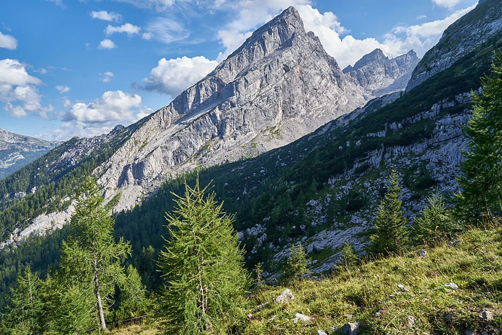
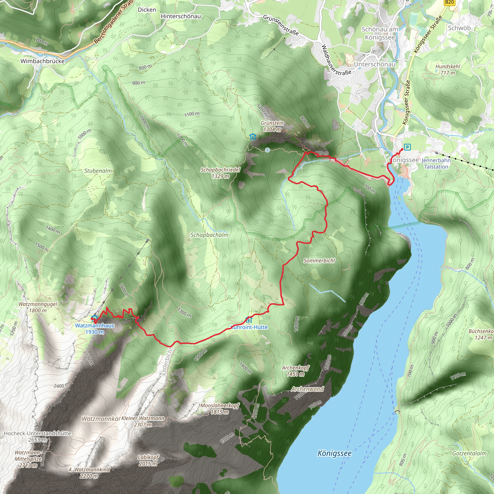
Starting near Berchtesgadener Land in Germany, this 9 km (5.6 miles) point-to-point trail offers a challenging yet rewarding hike with an elevation gain of approximately 1400 meters (4593 feet). The trailhead is accessible by both public transport and car. If you're using public transport, you can take a bus or train to Berchtesgaden, and from there, a local bus will get you close to the trailhead. For those driving, parking is available near the Königssee lake area.### Initial Ascent and Königssee LakeThe hike begins near the picturesque Königssee, a crystal-clear alpine lake surrounded by towering mountains. The initial part of the trail is a steep ascent through dense forest, where you’ll gain significant elevation quickly. This section can be quite strenuous, so be prepared for a workout. The forest is home to a variety of wildlife, including deer and numerous bird species, so keep your eyes peeled.### Middle Section: Alpine Meadows and Panoramic ViewsAs you climb higher, the forest gives way to alpine meadows. Around the 4 km (2.5 miles) mark, you’ll reach a plateau that offers panoramic views of the surrounding peaks and valleys. This is a great spot to take a break and soak in the scenery. The meadows are often dotted with wildflowers in the spring and summer, adding a splash of color to the landscape.### Historical SignificanceThe region around Berchtesgadener Land is steeped in history. During World War II, it was a favorite retreat for high-ranking Nazi officials, including Adolf Hitler. The infamous Eagle's Nest (Kehlsteinhaus) is located nearby and can be seen from various points along the trail. While the trail itself does not pass directly by the Eagle's Nest, its historical significance adds a layer of depth to your hike.### Final Ascent to FalzkopfThe final stretch to Falzkopf is the most challenging part of the hike. The trail becomes steeper and rockier as you approach the summit. Proper hiking boots and poles are recommended for this section. As you near the top, the vegetation becomes sparse, and you’ll be treated to unobstructed views of the surrounding alpine landscape.### Navigation and SafetyGiven the elevation gain and the rugged terrain, it’s crucial to have a reliable navigation tool. HiiKER is an excellent app for this purpose, providing detailed maps and real-time tracking to ensure you stay on course. Weather conditions can change rapidly in the mountains, so always check the forecast before setting out and be prepared for sudden changes.### Wildlife and FloraThe trail passes through diverse ecosystems, from dense forests to alpine meadows. You may encounter marmots, chamois, and even golden eagles. The flora is equally diverse, with everything from towering pines to delicate alpine flowers. The biodiversity of this region is one of its most captivating features.### Reaching FalzkopfUpon reaching Falzkopf, you’ll be rewarded with breathtaking views that make the challenging ascent worthwhile. The summit offers a 360-degree panorama of the Berchtesgaden Alps, a perfect spot for photos and a well-deserved rest. ### Descent and ReturnThe trail ends at Falzkopf, so you’ll need to plan your return route. Many hikers choose to descend via a different path to explore more of the area or return the way they came. Ensure you have enough daylight and energy for the return journey, as the descent can be just as demanding as the ascent.This hike is a fantastic way to experience the natural beauty and historical significance of the Berchtesgadener Land region. Whether you’re an experienced hiker or looking for a challenging adventure, this trail offers something for everyone.
What to expect?
Activity types
Comments and Reviews
User comments, reviews and discussions about the Königssee to Falzkopf Walk, Germany.
4.33
average rating out of 5
3 rating(s)

