Download
Preview
Add to list
More
6.2 km
~2 hrs 29 min
755 m
Loop
“The Grünstein Loop near Königssee offers a moderately challenging 6 km hike with stunning Bavarian Alps views.”
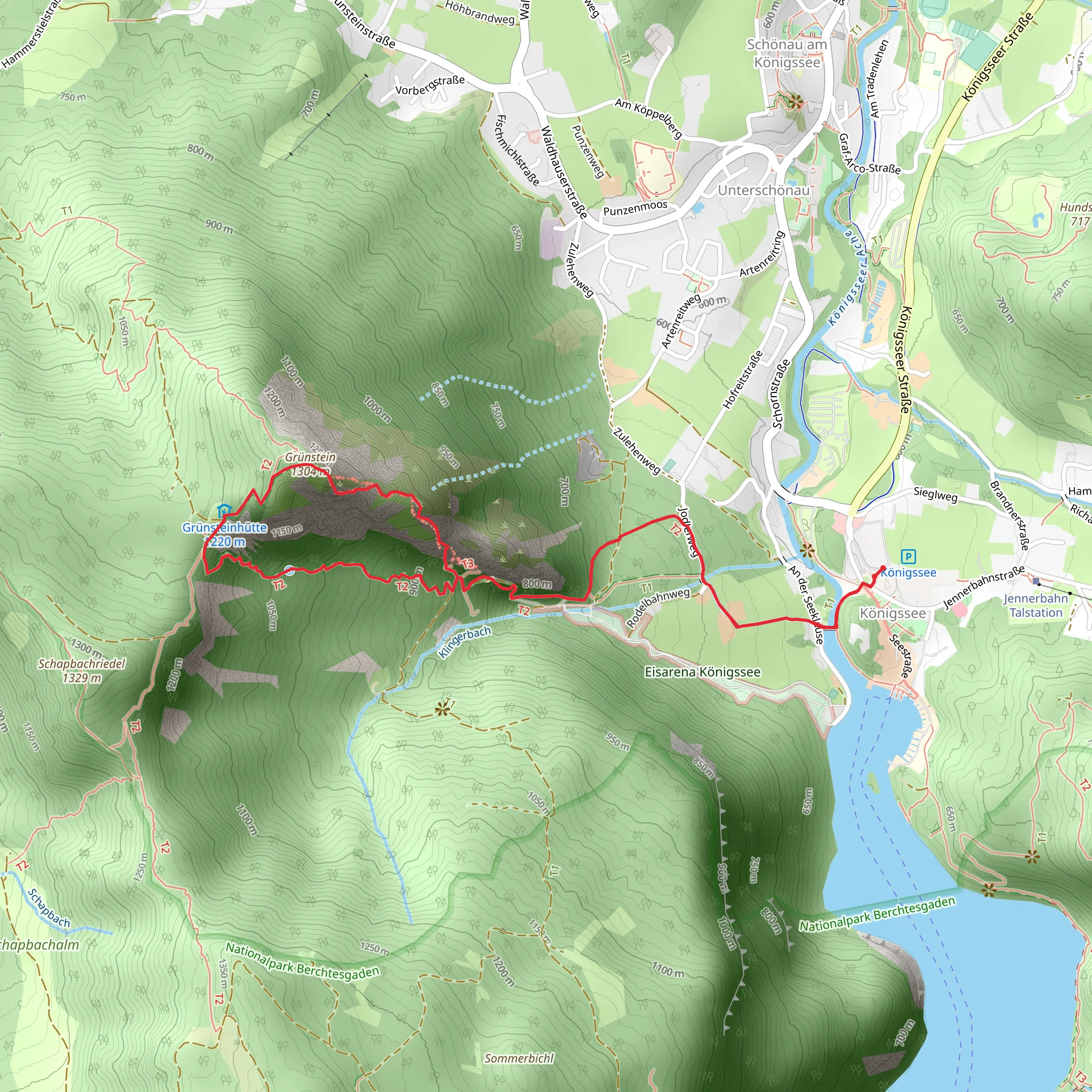
Starting near the picturesque Königssee in Berchtesgadener Land, Germany, the Grünstein Loop is a captivating 6 km (approximately 3.7 miles) trail that offers a moderate challenge with an elevation gain of around 700 meters (2,297 feet). This loop trail is perfect for those looking to experience the natural beauty and historical richness of the Bavarian Alps.
Getting There To reach the trailhead, you can either drive or use public transportation. If you're driving, head towards the Königssee parking area, which is well-signposted and offers ample parking space. For those using public transport, take a train to Berchtesgaden Hauptbahnhof and then a bus to the Königssee bus stop. The trailhead is just a short walk from there.
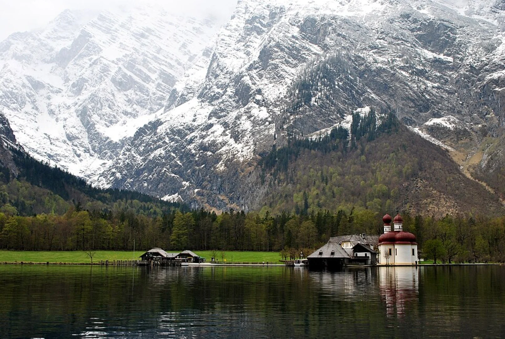
Trail Overview The Grünstein Loop begins near the Königssee, a stunning alpine lake known for its crystal-clear waters and dramatic mountain backdrop. As you start your hike, you'll be greeted by dense forests and well-marked paths. The initial section of the trail is relatively gentle, allowing you to ease into the hike while enjoying the serene surroundings.
Ascent to Grünstein As you progress, the trail begins to ascend more steeply. This section can be challenging, but the well-maintained path and occasional rest spots make it manageable. You'll gain approximately 700 meters (2,297 feet) in elevation, so be prepared for a good workout. Along the way, you'll encounter a variety of flora and fauna, including alpine flowers and possibly some local wildlife like chamois or marmots.
Key Landmarks One of the highlights of the Grünstein Loop is the Grünsteinhütte, a charming mountain hut located about halfway through the hike. This is an excellent spot to take a break, enjoy some traditional Bavarian snacks, and soak in the panoramic views of the surrounding peaks and valleys.
Continuing from the hut, the trail leads you to the Grünstein summit. At an elevation of 1,304 meters (4,278 feet), the summit offers breathtaking views of the Königssee, the Watzmann massif, and the surrounding alpine landscape. This is a perfect spot for photos and to appreciate the natural beauty of the region.
Descent and Return The descent from Grünstein is more gradual, allowing you to enjoy the scenery without the strenuous effort of the ascent. The trail loops back towards the Königssee, passing through lush meadows and dense forests. Keep an eye out for the diverse bird species that inhabit this area, as well as the occasional deer.
Historical Significance The Berchtesgadener Land region is steeped in history. During your hike, you'll be walking through areas that have been inhabited for centuries. The nearby Königssee has been a popular destination since the 19th century, attracting visitors with its natural beauty and tranquil atmosphere. The region also has historical ties to the salt mining industry, which played a significant role in the local economy for many years.
Navigation For navigation, it's highly recommended to use the HiiKER app, which provides detailed maps and real-time updates to ensure you stay on the right path. The trail is well-marked, but having a reliable navigation tool can enhance your hiking experience and provide peace of mind.
Final Stretch As you near the end of the loop, you'll return to the starting point near the Königssee. This final stretch is relatively easy, allowing you to cool down and reflect on the stunning landscapes and rich history you've encountered along the way.
What to expect?
Activity types
Comments and Reviews
User comments, reviews and discussions about the Grünstein Loop from Königssee, Germany.
4.67
average rating out of 5
6 rating(s)

