Download
Preview
Add to list
More
11.3 km
~4 hrs 8 min
1126 m
Out and Back
“Embark on the invigorating Blaueishütte Walk, a 11 km alpine hike through Germany's stunning Berchtesgadener Land.”
Starting your journey near Berchtesgadener Land, Germany, the Blaueishütte Walk is an invigorating out-and-back trail that spans approximately 11 km (6.8 miles) with an elevation gain of around 1100 meters (3609 feet). This trail is rated as medium difficulty, making it suitable for hikers with a moderate level of fitness and some experience in mountainous terrain.
Getting There To reach the trailhead, you can either drive or use public transportation. If you're driving, head towards Ramsau bei Berchtesgaden, a picturesque village that serves as a gateway to the trail. For those using public transport, take a train to Berchtesgaden Hauptbahnhof and then a bus to Ramsau bei Berchtesgaden. From there, it's a short walk to the trailhead.
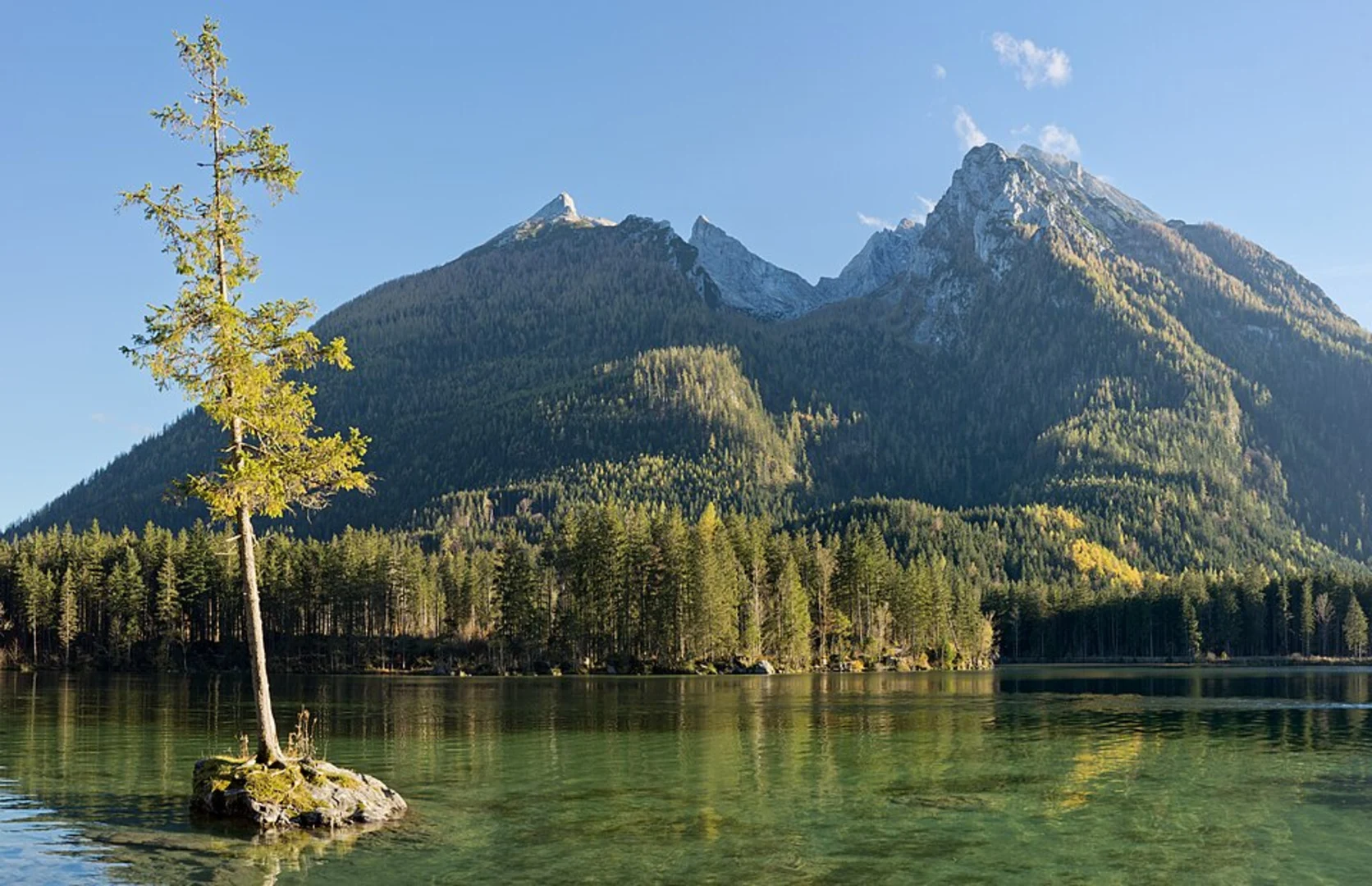
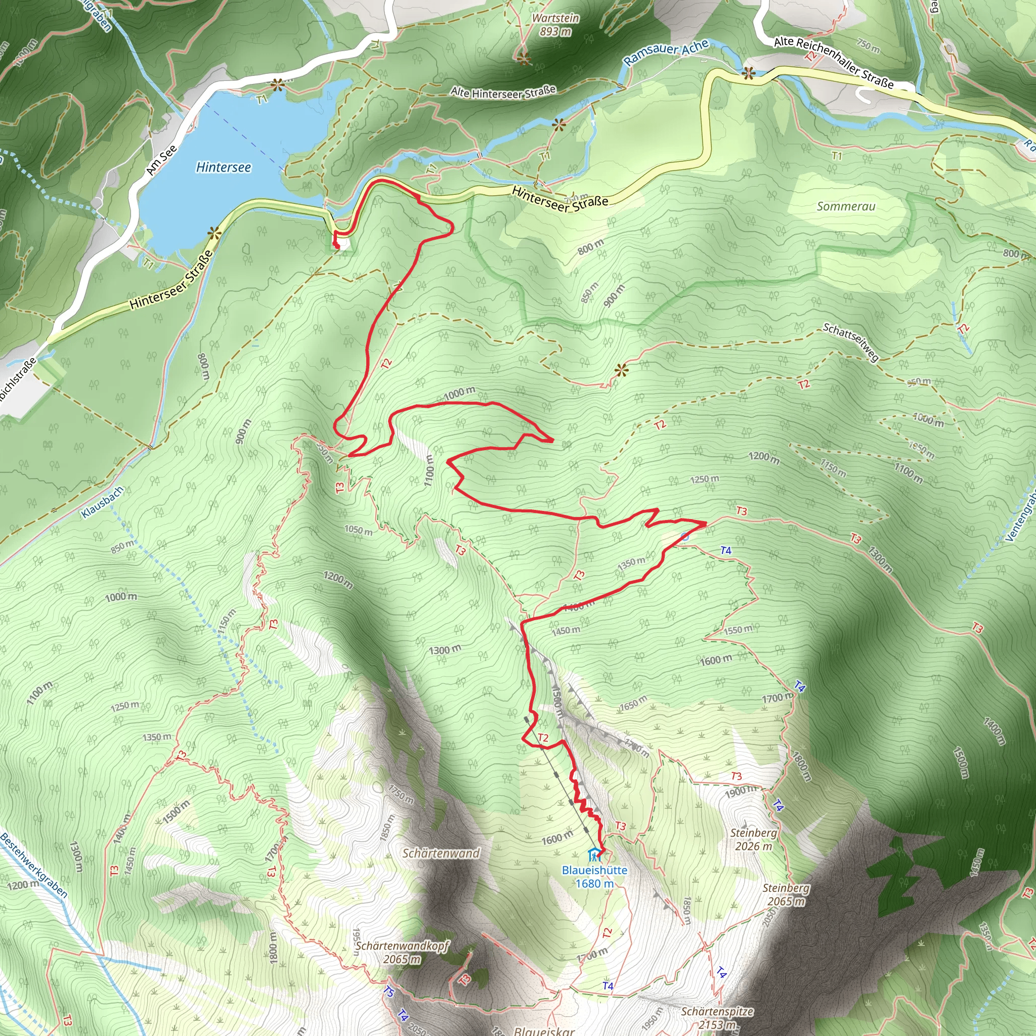
Trail Overview The trail begins near the Hintersee, a stunning alpine lake that offers a serene start to your hike. As you set off, you'll find yourself immersed in dense forests, with the path gradually ascending. The initial 2 km (1.2 miles) are relatively gentle, allowing you to warm up before the more challenging sections.
Key Landmarks and Sections #### Hintersee to Schärtenalm After the first 2 km, you'll reach the Schärtenalm, a charming alpine pasture. This is a great spot to take a short break and enjoy the panoramic views of the surrounding mountains. The elevation gain to this point is about 300 meters (984 feet).
#### Schärtenalm to Blaueishütte From Schärtenalm, the trail becomes steeper and more rugged. The next 3 km (1.9 miles) will see you gaining another 800 meters (2625 feet) in elevation. This section is characterized by rocky paths and switchbacks, so be prepared for a more strenuous climb. Along the way, you'll pass through alpine meadows and might even spot some local wildlife, such as chamois or marmots.
Blaueishütte At around the 5 km (3.1 miles) mark, you'll arrive at the Blaueishütte, a mountain hut situated at an elevation of approximately 1680 meters (5512 feet). The hut offers stunning views of the Blaueis Glacier and the surrounding peaks. It's an ideal place to rest, have a meal, and take in the breathtaking scenery. The hut is also a popular starting point for more advanced alpine climbs, so you might encounter mountaineers preparing for their ascents.
Historical Significance The Berchtesgadener Land region is steeped in history. During World War II, it was a significant area for the Nazi regime, with the infamous Eagle's Nest located nearby. Today, the region is a symbol of peace and natural beauty, attracting hikers and nature enthusiasts from around the world.
Return Journey The return journey follows the same path back to the trailhead. While descending, take your time to enjoy the views you might have missed on the way up. The descent can be tough on the knees, so trekking poles can be helpful.
Navigation For navigation, it's highly recommended to use HiiKER, which provides detailed maps and real-time updates to ensure you stay on the right path.
Wildlife and Flora The trail is home to a variety of flora and fauna. In the lower sections, you'll find dense forests of spruce and fir, while higher up, alpine meadows burst with wildflowers during the summer months. Keep an eye out for golden eagles soaring above and the occasional sighting of red deer.
Preparation Given the elevation gain and the rugged nature of the trail, make sure to wear sturdy hiking boots and bring plenty of water, snacks, and layers of clothing to adjust to changing weather conditions. The trail can be quite exposed in sections, so sun protection is also essential.
This hike offers a perfect blend of natural beauty, physical challenge, and historical context, making it a rewarding experience for those who undertake it.
What to expect?
Activity types
Comments and Reviews
User comments, reviews and discussions about the Blaueishütte Walk, Germany.
4.5
average rating out of 5
4 rating(s)

