Download
Preview
Add to list
More
9.9 km
~2 hrs 25 min
268 m
Loop
“The Trokau Rundwanderweg near Bayreuth blends natural beauty, historical landmarks, and wildlife for a rewarding hike.”
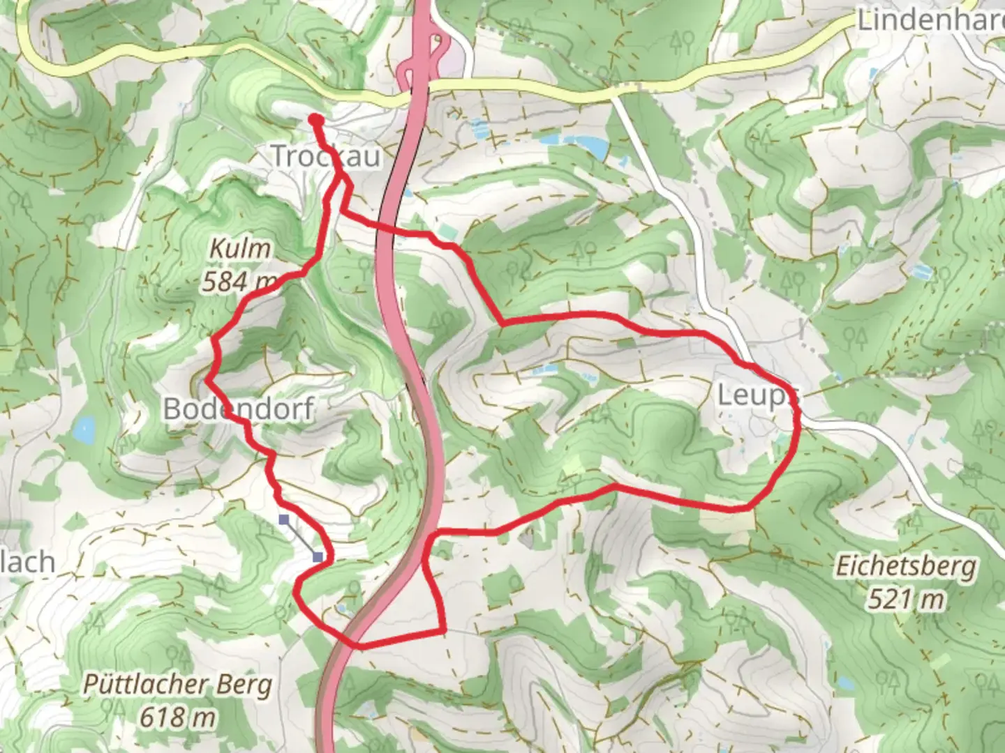
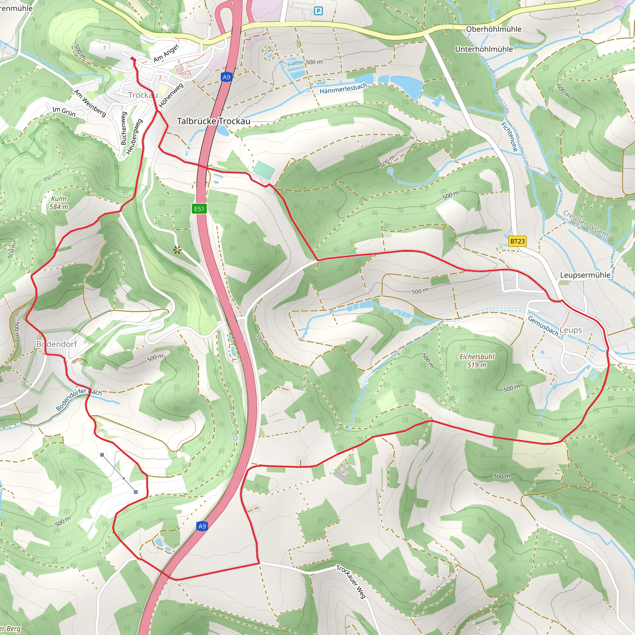
Starting near the picturesque town of Bayreuth, Germany, the Trokau Rundwanderweg is a delightful loop trail that spans approximately 10 kilometers (6.2 miles) with an elevation gain of around 200 meters (656 feet). This medium-difficulty trail offers a blend of natural beauty, historical landmarks, and a touch of local wildlife, making it a rewarding experience for hikers of all levels.
Getting There
To reach the trailhead, you can either drive or use public transport. If you're driving, head towards Bayreuth and look for parking near the outskirts of the town, close to the starting point of the trail. For those using public transport, Bayreuth is well-connected by train and bus services. From the Bayreuth Hauptbahnhof (main train station), you can take a local bus to the nearest stop, which is just a short walk from the trailhead.
Trail Overview
The Trokau Rundwanderweg begins with a gentle ascent through lush forests, offering a serene start to your hike. As you progress, the trail meanders through a mix of deciduous and coniferous trees, providing ample shade and a cool environment, especially during the warmer months. The first significant landmark you'll encounter is the Trokauer Weiher, a small, tranquil pond located about 2 kilometers (1.2 miles) into the hike. This is a great spot for a short break and some bird-watching.
Historical Significance
Around the 4-kilometer (2.5-mile) mark, you'll come across the ruins of an old mill, which dates back to the 18th century. This site offers a glimpse into the region's historical past and is a fascinating spot to explore. The mill was once a vital part of the local economy, grinding grain for the surrounding villages. Today, it stands as a testament to the area's rich history.
Scenic Views and Wildlife
As you continue, the trail opens up to a series of rolling meadows, offering panoramic views of the Franconian landscape. These open areas are perfect for spotting local wildlife, including deer, foxes, and a variety of bird species. The elevation gain is gradual, making the ascent manageable while still providing rewarding vistas.
Navigation and Safety
The trail is well-marked, but it's always a good idea to have a reliable navigation tool. HiiKER is an excellent app for this purpose, offering detailed maps and real-time tracking to ensure you stay on course. The terrain can be uneven in places, so sturdy hiking boots are recommended. Additionally, bring plenty of water and snacks, as there are limited facilities along the route.
Final Stretch
The last few kilometers of the trail take you through a charming mix of forest and farmland, gradually descending back towards the starting point. This section is relatively easy, allowing you to enjoy the final moments of your hike at a leisurely pace. As you near the end, you'll pass by a small chapel, a peaceful spot for reflection and a fitting end to your journey.
The Trokau Rundwanderweg offers a well-rounded hiking experience, combining natural beauty, historical intrigue, and the chance to encounter local wildlife. Whether you're a seasoned hiker or a casual walker, this trail near Bayreuth is sure to leave a lasting impression.
Comments and Reviews
User comments, reviews and discussions about the Trokau Rundwanderweg, Germany.
5.0
average rating out of 5
1 rating(s)
