Download
Preview
Add to list
More
7.8 km
~1 hrs 56 min
219 m
Loop
“This 8 km loop trail near Bayreuth offers scenic views, historical landmarks, and moderate hiking challenges.”
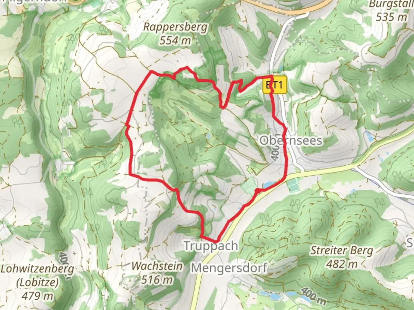
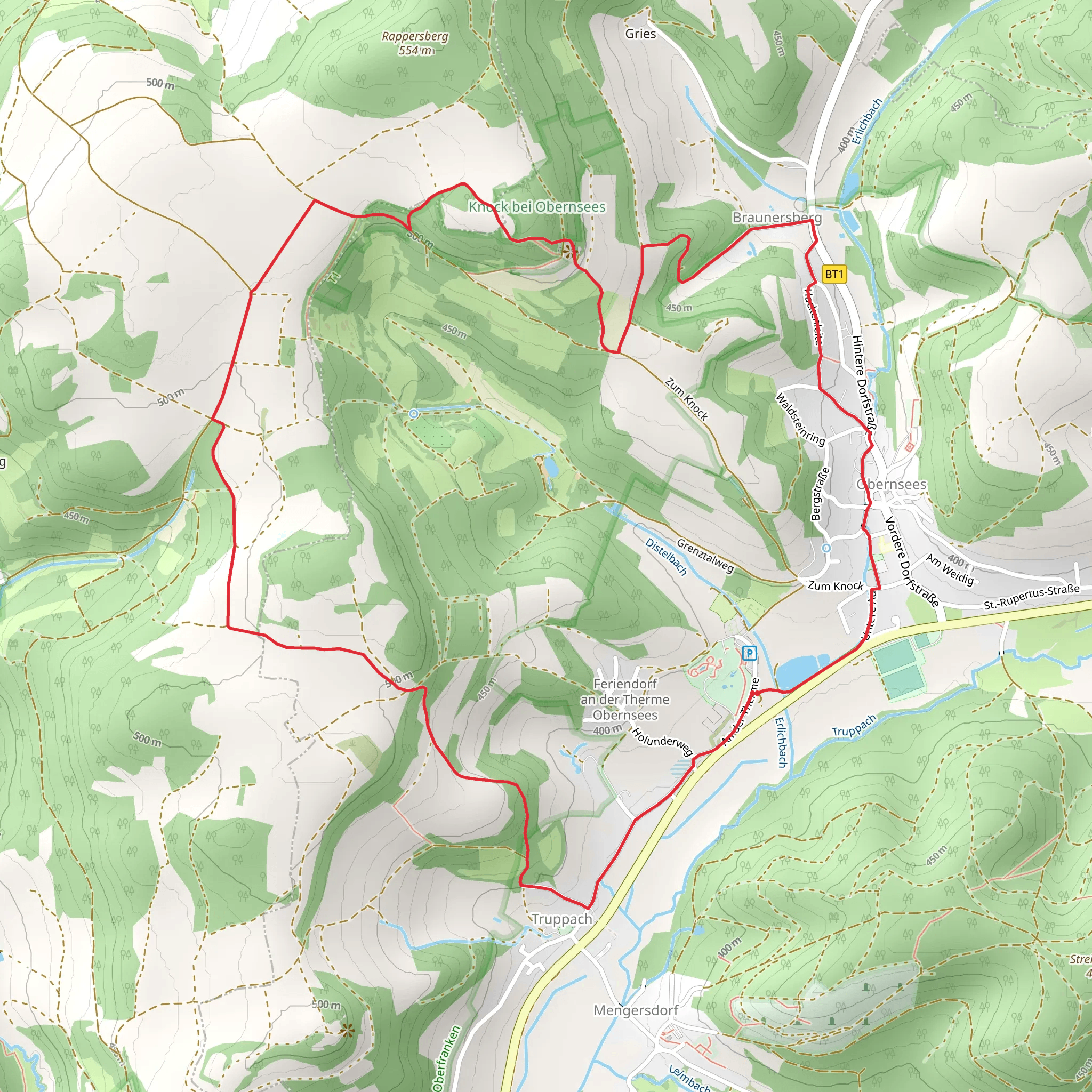
Starting near the picturesque town of Bayreuth, Germany, the Obernsees Rundweg and Fraenkischer Gebirgsweg is a delightful 8 km (approximately 5 miles) loop trail with an elevation gain of around 200 meters (656 feet). This trail offers a medium difficulty rating, making it suitable for moderately experienced hikers looking for a rewarding day hike.
Getting There To reach the trailhead, you can drive or use public transport. If driving, head towards Obernsees, a small village near Bayreuth. There is ample parking available near the village center. For those using public transport, take a train to Bayreuth Hauptbahnhof (Bayreuth Main Station). From there, you can catch a bus to Obernsees, with the nearest bus stop being Obernsees Ortsmitte.
Trail Navigation For navigation, it is highly recommended to use the HiiKER app, which provides detailed maps and real-time updates to ensure you stay on track.
Trail Highlights The trail begins in the charming village of Obernsees, known for its traditional Franconian architecture. As you start your hike, you'll pass through lush meadows and dense forests, offering a serene and tranquil environment. The first significant landmark is the Obernsees Castle, a historical site dating back to the 13th century. Although the castle is now in ruins, it provides a fascinating glimpse into the region's medieval past.
Nature and Wildlife As you continue, the trail meanders through the Franconian Switzerland Nature Park, renowned for its unique rock formations and diverse flora and fauna. Keep an eye out for native wildlife such as deer, foxes, and various bird species. The trail also features several viewpoints offering panoramic vistas of the surrounding countryside, perfect for photography enthusiasts.
Elevation and Terrain The trail's elevation gain is gradual, making it accessible for most hikers. The highest point of the trail is approximately 500 meters (1,640 feet) above sea level, offering stunning views of the Franconian landscape. The terrain varies from well-maintained paths to more rugged sections, so sturdy hiking boots are recommended.
Historical Significance The region is steeped in history, with several ancient relics and landmarks along the way. One notable site is the Fraenkischer Gebirgsweg, an ancient trade route that has been used for centuries. This historical path adds a layer of intrigue and significance to your hike, connecting you with the past as you traverse the same routes once used by traders and travelers.
Practical Information The trail is well-marked, but it's always a good idea to carry a map or use the HiiKER app for navigation. There are several rest areas along the route where you can take a break and enjoy a picnic. Make sure to carry enough water and snacks, as there are limited facilities along the trail.
Final Stretch As you near the end of the loop, you'll descend back into Obernsees, where you can explore the local eateries and perhaps enjoy a traditional Franconian meal. The village also has a thermal spa, perfect for relaxing your muscles after a day of hiking.
This trail offers a perfect blend of natural beauty, historical significance, and moderate physical challenge, making it a must-visit for any hiking enthusiast exploring the Bayreuth region.
What to expect?
Activity types
Comments and Reviews
User comments, reviews and discussions about the Obernsees Rundweg and Fraenkischer Gebirgsweg, Germany.
5.0
average rating out of 5
1 rating(s)
