Download
Preview
Add to list
More
3.4 km
~52 min
119 m
Loop
“Immerse yourself in the lush Black Forest on this 3 km hike blending nature, history, and moderate challenge.”
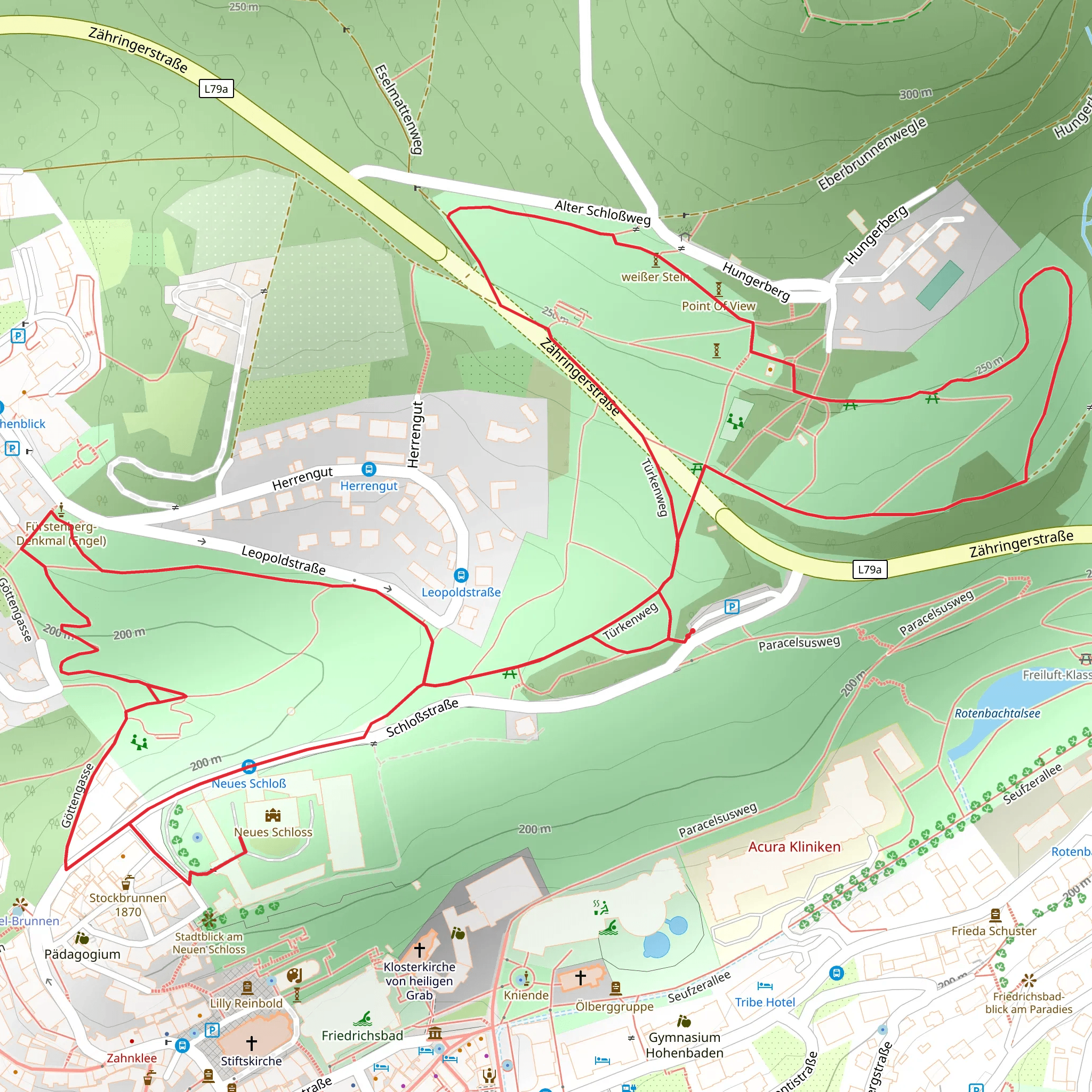
Starting near the picturesque town of Baden-Baden, Germany, the Reitweg and Türkenweg Loop offers a delightful 3 km (1.86 miles) hike with an elevation gain of approximately 100 meters (328 feet). This loop trail is rated as medium difficulty, making it suitable for hikers with some experience.
Getting There To reach the trailhead, you can either drive or use public transport. If driving, head towards the town of Baden-Baden and look for parking near the Lichtentaler Allee, a well-known park and arboretum. For those using public transport, take a train to Baden-Baden Hauptbahnhof and then a bus to the Lichtentaler Allee stop. The trailhead is conveniently located near this area.
Trail Navigation For navigation, it is highly recommended to use the HiiKER app, which provides detailed maps and real-time updates to ensure you stay on track.
Trail Highlights As you begin your hike, you'll find yourself immersed in the lush greenery of the Black Forest. The trail initially meanders through dense woods, offering a serene atmosphere with the sounds of chirping birds and rustling leaves.
#### Reitweg Section The first section, known as Reitweg, is relatively gentle and well-marked. Approximately 1 km (0.62 miles) into the hike, you'll encounter a slight incline, gaining about 50 meters (164 feet) in elevation. This part of the trail is shaded, making it a pleasant walk even on warmer days.
#### Türkenweg Section As you transition into the Türkenweg section, the trail becomes a bit steeper, adding another 50 meters (164 feet) in elevation over the next 1.5 km (0.93 miles). This part of the trail is known for its historical significance. The name "Türkenweg" translates to "Turkish Path," a reference to the Ottoman incursions into Europe during the 17th century. Local legends suggest that this path was used by scouts during those times.
Flora and Fauna The trail is abundant with native flora, including towering pines, oaks, and a variety of ferns. During spring and summer, wildflowers such as bluebells and foxgloves add splashes of color to the landscape. Wildlife enthusiasts might spot deer, foxes, and a variety of bird species, including woodpeckers and owls.
Points of Interest Around the 2 km (1.24 miles) mark, you'll come across a small clearing with a bench, offering a perfect spot to rest and take in the scenic views of the surrounding forest. This area also provides a glimpse of the distant Baden-Baden skyline, a reminder of the town's proximity.
Final Stretch The last kilometer (0.62 miles) of the loop descends gradually, leading you back to the starting point near Lichtentaler Allee. This section is less steep and offers a gentle cooldown as you complete your hike.
Practical Tips - Wear sturdy hiking boots, as some sections can be uneven and slippery, especially after rain. - Bring water and snacks, as there are no facilities along the trail. - Check the weather forecast before heading out, as conditions can change rapidly in the Black Forest.
This trail offers a perfect blend of natural beauty, historical intrigue, and moderate physical challenge, making it a rewarding experience for those who venture onto it.
What to expect?
Activity types
Comments and Reviews
User comments, reviews and discussions about the Reitweg and Türkenweg Loop, Germany.
4.5
average rating out of 5
4 rating(s)

