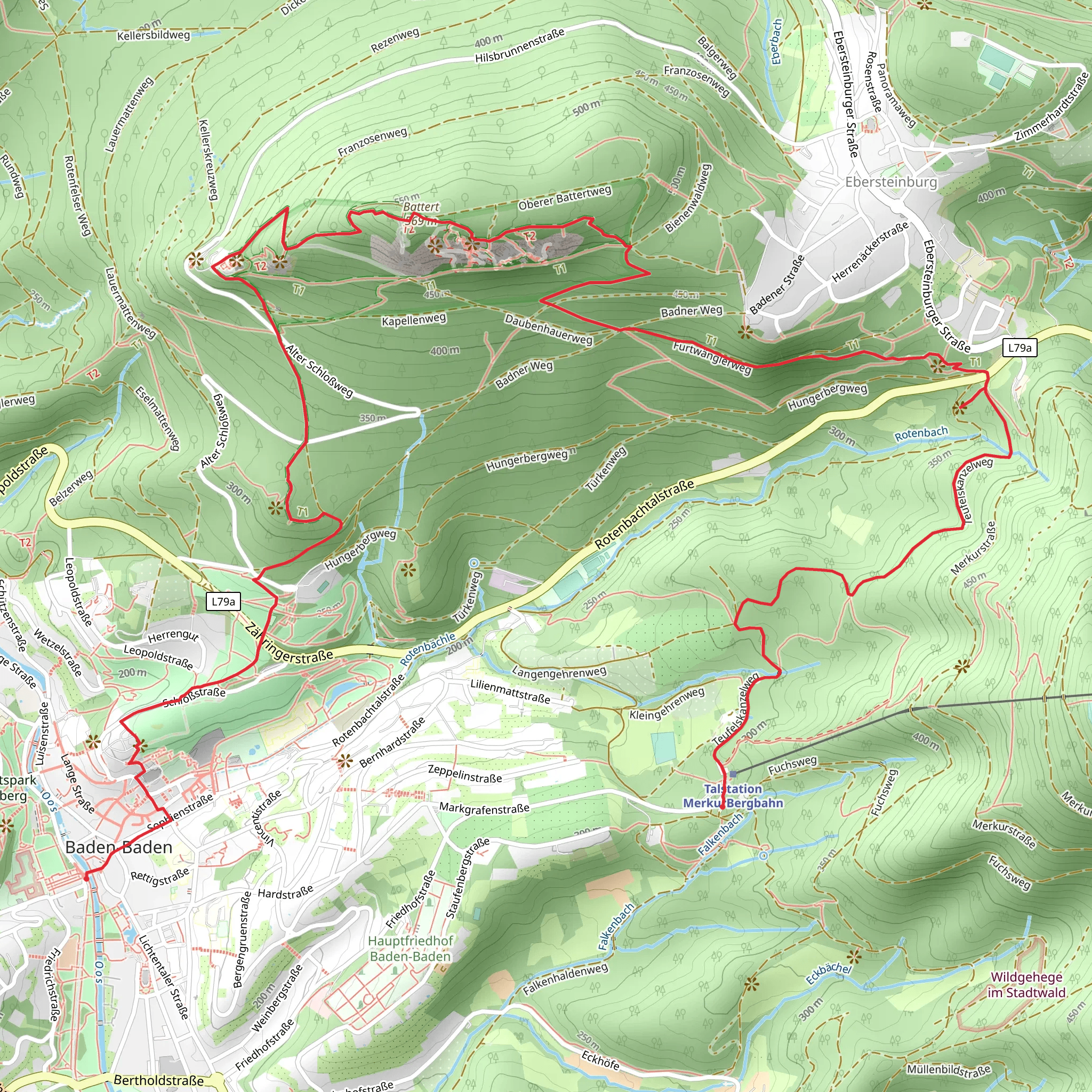
Innenstadt to Merkurbahn Talstation via Battert Rundweg and Ebersteinburg Rundweg
Download
Preview
Add to list
More
8.9 km
~2 hrs 41 min
549 m
Point-to-Point
“Explore the rugged beauty, historical ruins, and serene vistas of the Black Forest's challenging trail.”
Starting your journey near the picturesque town of Baden-Baden, Germany, this challenging point-to-point trail stretches approximately 9 kilometers (about 5.6 miles) with an elevation gain of around 500 meters (approximately 1,640 feet). The trailhead is conveniently accessible by public transport or car. If you're traveling by train, Baden-Baden is well-connected to major cities like Stuttgart and Karlsruhe. From the Baden-Baden train station, local buses can take you closer to the trailhead. For those driving, parking is available in Baden-Baden, and the trailhead is a short walk from the town center.
The Trail Experience
#### Battert Rundweg
The trail begins with the Battert Rundweg, a section known for its rugged beauty and dramatic rock formations. As you ascend, you'll encounter the iconic Battert Rocks, a popular spot for rock climbers. These towering sandstone formations offer breathtaking views of the surrounding Black Forest and the Rhine Valley. Keep an eye out for peregrine falcons, which nest in the cliffs and can often be seen soaring above.
The path here is steep and rocky, requiring careful footing, especially in wet conditions. The dense forest canopy provides shade, but the terrain can be challenging, so sturdy hiking boots are recommended. As you navigate this section, you'll gain approximately 200 meters (about 656 feet) in elevation over the first 3 kilometers (1.9 miles).
#### Ebersteinburg Rundweg
Continuing onto the Ebersteinburg Rundweg, the trail leads you through a mix of forested paths and open clearings. This area is rich in history, with the ruins of Ebersteinburg Castle offering a glimpse into the region's medieval past. The castle, dating back to the 11th century, provides a fascinating stop where you can explore the remnants of its walls and towers. The views from the castle ruins are spectacular, offering a panoramic vista of the surrounding landscape.
This section of the trail is less steep but still requires a good level of fitness. You'll gain another 150 meters (approximately 492 feet) in elevation over the next 3 kilometers (1.9 miles). The path is well-marked, but using a navigation tool like HiiKER can help ensure you stay on track.
Flora and Fauna
Throughout the hike, you'll be immersed in the lush biodiversity of the Black Forest. The trail is lined with towering pines and firs, and in spring and summer, the forest floor is carpeted with wildflowers. Wildlife enthusiasts might spot deer, foxes, and a variety of bird species. The area is also known for its diverse insect life, including colorful butterflies and beetles.
Final Stretch to Merkurbahn Talstation
The final stretch of the trail descends towards the Merkurbahn Talstation. This section is less demanding, allowing you to enjoy the serene beauty of the forest as you make your way down. The Merkurbahn funicular railway, located at the trail's end, is a popular attraction in its own right, offering a scenic ride to the summit of Mount Merkur. From there, you can enjoy panoramic views or take advantage of the restaurant and observation tower.
This trail offers a rewarding experience for those prepared for its challenges, combining natural beauty, historical intrigue, and the unique charm of the Black Forest region.
Comments and Reviews
User comments, reviews and discussions about the Innenstadt to Merkurbahn Talstation via Battert Rundweg and Ebersteinburg Rundweg, Germany.
4.55
average rating out of 5
11 rating(s)
