Download
Preview
Add to list
More
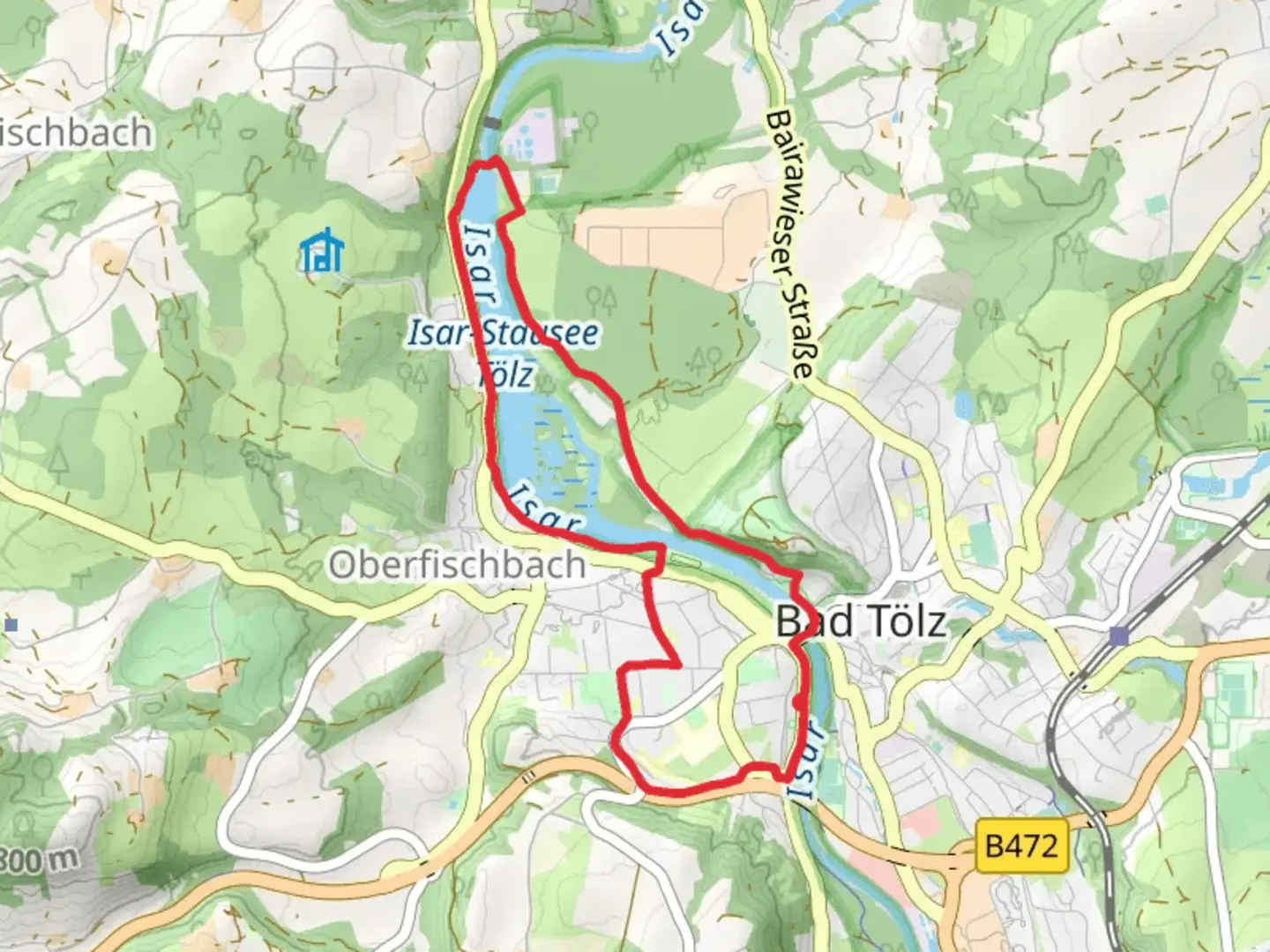
7.7 km
~1 hrs 45 min
124 m
Loop
“Explore the Bavarian landscape on a scenic hike with river views, wildlife, and historical charm.”
Nestled in the picturesque region of Bad Tölz-Wolfratshausen, Germany, this loop trail offers a delightful journey through the Bavarian landscape. Spanning approximately 8 kilometers (around 5 miles) with an elevation gain of about 100 meters (328 feet), this trail is rated as medium difficulty, making it accessible for most hikers with a moderate level of fitness.### Getting ThereTo reach the trailhead, you can opt for public transport or drive. If you're using public transport, take a train to Bad Tölz station, which is well-connected to Munich. From there, local buses or a short taxi ride will bring you to the starting point near the Isar River. For those driving, ample parking is available near the trailhead, with clear signage guiding you to the start of the loop.### Trail HighlightsAs you embark on this scenic loop, you'll be greeted by the serene beauty of the Isar River, which accompanies you for a significant portion of the hike. The trail meanders through lush forests and open meadows, offering a diverse range of landscapes. Keep an eye out for the vibrant wildflowers that dot the path, especially during spring and summer months.#### Historical SignificanceThe region around Bad Tölz is steeped in history, with roots tracing back to the Roman era. As you hike, you'll pass near the town of Bad Tölz, known for its charming old town and traditional Bavarian architecture. The town itself has a rich history as a spa destination, with its mineral springs attracting visitors for centuries.### Nature and WildlifeThe trail is a haven for nature enthusiasts. The Isar River is home to a variety of bird species, so birdwatchers should bring their binoculars. You might spot kingfishers darting along the riverbanks or hear the melodic calls of songbirds echoing through the trees. The surrounding forest is also home to deer and other small mammals, so tread quietly to increase your chances of wildlife encounters.### Navigation and SafetyWhile the trail is well-marked, it's always wise to have a reliable navigation tool. The HiiKER app is an excellent choice for this trail, providing detailed maps and real-time location tracking to ensure you stay on course. Be prepared for some uneven terrain, particularly in forested areas, and wear sturdy hiking boots for added support.### Final StretchAs you near the end of the loop, the trail gently descends back towards the Isar River, offering a peaceful conclusion to your hike. Take a moment to relax by the riverbank, perhaps enjoying a picnic or simply soaking in the tranquil surroundings before heading back to your starting point.

What to expect?
Activity types
Comments and Reviews
User comments, reviews and discussions about the Isar via Traumpfad Muenchen Venedig, Germany.
average rating out of 5
0 rating(s)