Download
Preview
Add to list
More
7.6 km
~2 hrs 38 min
668 m
Loop
“Explore a scenic 8 km loop near Bad Tölz-Wolfratshausen with lush forests, wildlife, and historical landmarks.”
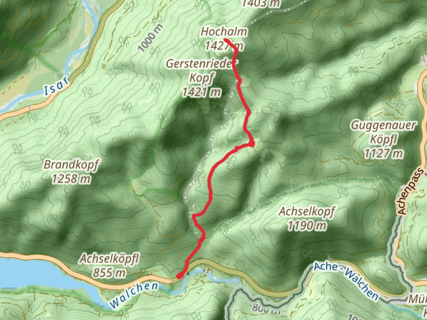
Starting near Bad Tölz-Wolfratshausen in Germany, this 8 km (approximately 5 miles) loop trail offers a moderate challenge with an elevation gain of around 600 meters (about 1,970 feet). The trailhead is conveniently accessible by both public transport and car. If you're using public transport, you can take a train to Bad Tölz and then a local bus to the nearest stop, which is a short walk from the trailhead. For those driving, there is parking available near the starting point.
Trail Overview
The trail begins with a gentle ascent through lush, mixed forests, providing a serene start to your hike. As you progress, the path becomes steeper, and you'll encounter a series of switchbacks that help manage the elevation gain. The forested area is home to a variety of wildlife, including deer and numerous bird species, so keep your eyes and ears open.
Significant Landmarks and Points of Interest
At approximately 2 km (1.2 miles) into the hike, you'll reach a scenic viewpoint that offers panoramic views of the surrounding Bavarian countryside. This is a great spot to take a break and enjoy the landscape. Continuing on, the trail leads you to Hochalm, a picturesque alpine meadow that is particularly beautiful in the spring and summer when wildflowers are in full bloom.
Around the 4 km (2.5 miles) mark, you'll come across a small, rustic hut that serves as a historical landmark. This hut was once used by shepherds and offers a glimpse into the traditional pastoral lifestyle of the region. It's a great spot to rest and perhaps enjoy a packed lunch.
Flora and Fauna
The trail is rich in biodiversity. In addition to the aforementioned wildlife, you might also spot foxes and various small mammals. The flora is equally diverse, with towering beech and spruce trees dominating the forested sections, and a variety of alpine flowers adorning the meadows.
Final Stretch and Descent
As you begin your descent, the trail winds through more open terrain, offering unobstructed views of the valley below. The path here is less steep but can be rocky, so watch your footing. The final 2 km (1.2 miles) of the trail take you back through the forest, eventually looping back to the trailhead.
Navigation and Safety
For navigation, it's highly recommended to use the HiiKER app, which provides detailed maps and real-time updates. The trail is well-marked, but having a reliable navigation tool can enhance your hiking experience and ensure you stay on track.
Historical Significance
The region around Bad Tölz-Wolfratshausen has a rich history dating back to medieval times. The town of Bad Tölz itself is known for its historic architecture and traditional Bavarian culture. The trail passes through areas that have been used for centuries for grazing and forestry, adding a layer of historical depth to your hike.
Whether you're a seasoned hiker or someone looking to enjoy a moderately challenging trail with beautiful scenery and historical significance, this loop near Bad Tölz-Wolfratshausen offers a rewarding experience.

What to expect?
Activity types
Comments and Reviews
User comments, reviews and discussions about the Hochalm, Germany.
4.33
average rating out of 5
6 rating(s)