Grasleitenstein Grasleitenkopf and Seekarkreuz via Aplina Purple
Download
Preview
Add to list
More
13.4 km
~4 hrs 19 min
991 m
Loop
“Experience a challenging 13 km loop hike near Bad Tölz-Wolfratshausen, blending alpine beauty and rich history.”
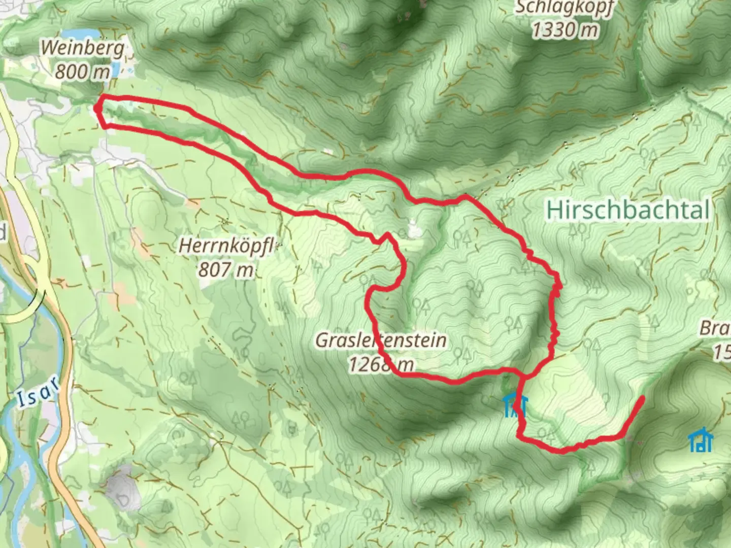
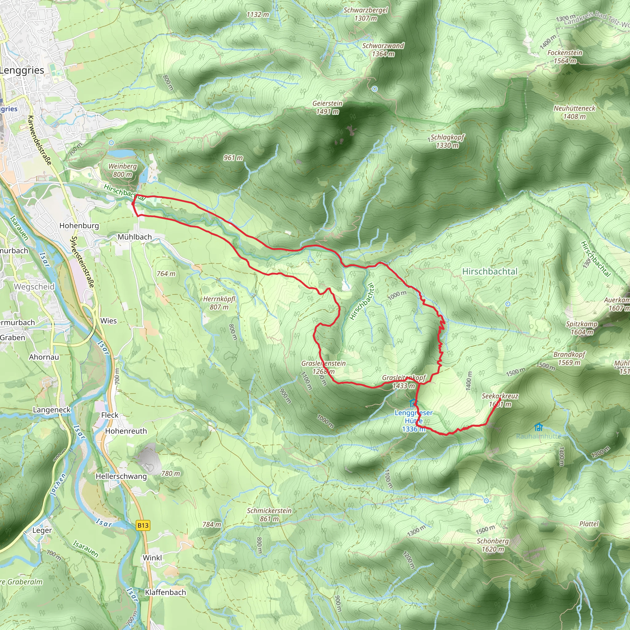
Starting your adventure near Bad Tölz-Wolfratshausen, Germany, this 13 km (8 miles) loop trail offers a medium difficulty hike with an elevation gain of approximately 900 meters (2,950 feet). The trailhead is conveniently accessible by both public transport and car. If you're taking public transport, you can reach Bad Tölz by train from Munich, and then take a local bus to the trailhead area. For those driving, there are parking facilities available near the starting point.
Initial Ascent and Grasleitenstein The hike begins with a steady ascent through dense forest, providing a serene and shaded environment. After about 3 km (1.9 miles) and an elevation gain of 300 meters (985 feet), you will reach Grasleitenstein. This section is characterized by its lush greenery and occasional wildlife sightings, including deer and various bird species. The trail here is well-marked, but it's advisable to use HiiKER for navigation to ensure you stay on track.
Grasleitenkopf Continuing from Grasleitenstein, the trail becomes steeper as you approach Grasleitenkopf. This segment covers another 4 km (2.5 miles) and an additional 400 meters (1,310 feet) in elevation gain. The terrain is more rugged, with rocky outcrops and narrow paths. Hikers should be cautious of loose rocks and ensure they have sturdy footwear. Upon reaching Grasleitenkopf, you'll be rewarded with panoramic views of the Bavarian Alps and the surrounding valleys. This is an excellent spot for a rest and some photography.
Seekarkreuz The next part of the trail leads you to Seekarkreuz, which is about 2 km (1.2 miles) from Grasleitenkopf with a moderate elevation gain of 200 meters (655 feet). This section is less strenuous, allowing you to enjoy the alpine meadows and wildflowers that are abundant in the area. Seekarkreuz is a popular destination for hikers and offers a 360-degree view of the region. On clear days, you can see as far as the Karwendel and Wetterstein mountain ranges.
Descent and Return From Seekarkreuz, the trail loops back towards the starting point. The descent is gradual and spans approximately 4 km (2.5 miles). This part of the hike takes you through mixed forests and open fields, providing a diverse landscape to enjoy. Keep an eye out for historical markers and information boards that detail the region's history, including its significance during World War II as a strategic lookout point.
Historical Significance The Bad Tölz-Wolfratshausen region has a rich history, with evidence of settlements dating back to the Roman era. The area was also significant during World War II, serving as a strategic location for both German and Allied forces. Historical markers along the trail provide insights into these events, making the hike not only a physical challenge but also an educational experience.
Wildlife and Flora Throughout the hike, you'll encounter a variety of flora and fauna. The lower elevations are dominated by beech and oak forests, while higher altitudes feature pine and spruce. Wildlife is abundant, with chances to see deer, foxes, and a variety of bird species. In the spring and summer months, the meadows are filled with wildflowers, adding a splash of color to the landscape.
Navigation and Safety While the trail is well-marked, it's always a good idea to use HiiKER for real-time navigation and updates. Ensure you have adequate water, snacks, and appropriate clothing for changing weather conditions. The trail can be slippery after rain, so take extra caution during wet conditions.
This hike offers a perfect blend of natural beauty, historical significance, and physical challenge, making it a must-do for any hiking enthusiast visiting the Bavarian Alps.
What to expect?
Activity types
Comments and Reviews
User comments, reviews and discussions about the Grasleitenstein Grasleitenkopf and Seekarkreuz via Aplina Purple, Germany.
4.57
average rating out of 5
7 rating(s)
