Download
Preview
Add to list
More
134.2 km
~8 days
2944 m
Multi-Day
“Embark on a historical hike through Germany's enchanting Taubertal, filled with medieval charm and panoramic vistas.”
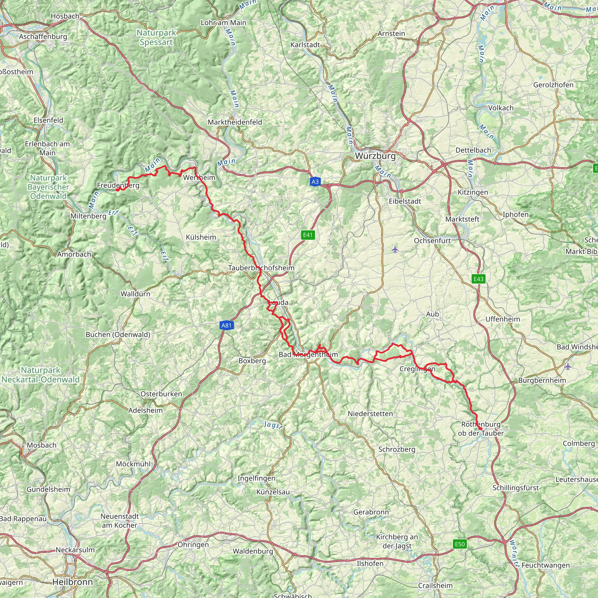
The Panoramawanderweg Taubertal is a scenic journey that unfolds over approximately 134 kilometers (83 miles), with an elevation gain of around 2900 meters (9514 feet), offering hikers a medium difficulty level experience. This point-to-point trail is nestled in the picturesque region near Ansbach, Germany, and is renowned for its captivating landscapes and historical richness.
Getting to the Trailhead
To embark on this adventure, hikers can reach the trailhead near Ansbach by public transportation or by car. If traveling by train, the Ansbach railway station serves as a convenient starting point, with the trailhead being a short taxi ride or bus trip away. For those driving, parking is available in the vicinity of the trailhead, which is typically marked by signage indicating the start of the Panoramawanderweg Taubertal.
Navigating the Trail
As you set out on the trail, it's advisable to use a reliable navigation tool like HiiKER to keep track of your progress and ensure you're following the correct path. The trail is well-marked, but having a digital map can be invaluable, especially at trail junctions or during less clear sections.
Landmarks and Scenery
The trail meanders through the Tauber valley, offering panoramic views of rolling hills, lush forests, and the serene Tauber River. Along the way, hikers will encounter charming vineyards and quaint villages that are perfect for rest stops and cultural immersion.
One of the significant landmarks on the trail is the medieval town of Rothenburg ob der Tauber, which is located roughly at the halfway point. This town is a historical gem, with well-preserved architecture and a rich history dating back to the Middle Ages. Walking through its cobblestone streets, you'll feel transported back in time.
Flora and Fauna
The Taubertal region is home to a diverse array of wildlife and plant species. As you hike, keep an eye out for deer, foxes, and a variety of bird species that inhabit the area. The trail also passes through several nature reserves, where the conservation of local flora and fauna is a priority.
Historical Significance
The Taubertal has a storied past, with numerous castles and ruins dotting the landscape, each telling a tale of the region's feudal history. The trail itself is a journey through time, as it often follows ancient trade routes that have been used for centuries.
Preparation and Planning
Before setting out, hikers should prepare for varying weather conditions and pack accordingly. The trail can be completed in sections or as a multi-day hike, with accommodations ranging from campgrounds to guesthouses available along the route. It's recommended to book these in advance, especially during peak hiking seasons.
Elevation and Distance
The trail's elevation gain of 2900 meters is spread out over its length, with some days being more challenging than others. Hikers should pace themselves and be prepared for both steep ascents and descents. The total distance of 134 kilometers can be broken down into manageable daily hikes, allowing for a comfortable pace and time to explore.
Conclusion
The Panoramawanderweg Taubertal is a trail that offers not only natural beauty but also a deep dive into the cultural and historical heart of Germany. With proper planning and a spirit of adventure, hikers will find this trail to be a rewarding experience that showcases the best of the Taubertal region.
Comments and Reviews
User comments, reviews and discussions about the Panoramawanderweg Taubertal, Germany.
4.2
average rating out of 5
5 rating(s)

