Download
Preview
Add to list
More
13.3 km
~3 hrs 22 min
434 m
Loop
“Explore diverse landscapes, rich biodiversity, and historical sites on this challenging, rewarding Ahrweiler hike.”
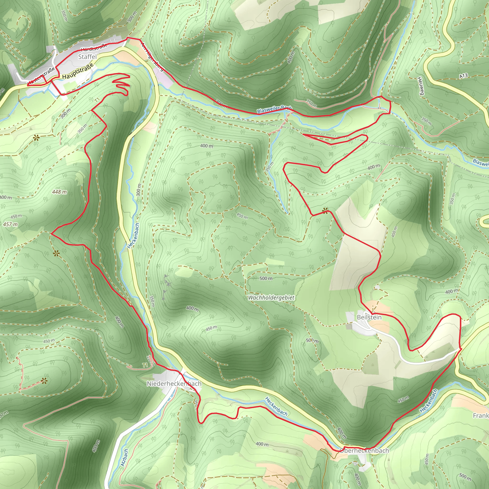
Nestled in the picturesque landscapes of the Ahrweiler region in Germany, the Kesseling Rundwanderweg and Wacholder Weg offer a challenging yet rewarding hiking experience. This loop trail spans approximately 13 kilometers (about 8 miles) with an elevation gain of around 400 meters (approximately 1,312 feet), making it a demanding trek suitable for experienced hikers.
Getting There
The trailhead is conveniently located near Ahrweiler, a charming town known for its medieval architecture and vineyards. If you're traveling by car, you can reach Ahrweiler via the A61 motorway, taking the Bad Neuenahr-Ahrweiler exit. For those relying on public transport, Ahrweiler is accessible by train from major cities like Bonn and Koblenz. From the Ahrweiler train station, local buses or a short taxi ride will take you to the trailhead.
Trail Highlights
As you embark on this loop, you'll traverse through a diverse landscape that includes dense forests, open meadows, and rocky outcrops. The trail is well-marked, but it's advisable to use the HiiKER app for navigation to ensure you stay on track.
#### Nature and Wildlife
The trail is renowned for its rich biodiversity. As you hike, keep an eye out for the juniper heathlands, which are a rare sight in this region. These heathlands are home to a variety of bird species, including the European stonechat and the red-backed shrike. The forested sections of the trail are inhabited by deer and wild boar, so be sure to maintain a respectful distance if you encounter any wildlife.
#### Historical Significance
The Ahrweiler region is steeped in history, and this trail offers glimpses into its past. As you hike, you'll come across remnants of ancient Roman settlements, particularly near the village of Kesseling. These archaeological sites provide a fascinating insight into the area's historical significance as a Roman frontier.
Notable Landmarks
Around the halfway point, approximately 6.5 kilometers (4 miles) into the hike, you'll reach the Kesseling village. This quaint village is an ideal spot to take a break and explore its traditional German architecture. Another highlight is the panoramic viewpoint near the trail's highest elevation, offering sweeping views of the Ahr Valley and the surrounding Eifel mountains.
Trail Conditions and Preparation
The trail's difficulty is rated as challenging due to its steep ascents and descents, particularly in the forested sections. Hikers should be prepared for uneven terrain and potentially slippery conditions, especially after rain. Sturdy hiking boots with good grip are essential, and trekking poles can be beneficial for stability.
Weather in this region can be unpredictable, so it's wise to check the forecast before setting out and pack accordingly. Layers are recommended, as temperatures can vary significantly throughout the day.
Final Tips
Ensure you carry enough water and snacks, as there are limited facilities along the trail. While the trail is accessible year-round, the best time to hike is during the spring and autumn months when the weather is mild, and the landscape is at its most vibrant.
Comments and Reviews
User comments, reviews and discussions about the Kesseling Rundwanderweg and Wacholder Weg, Germany.
4.0
average rating out of 5
1 rating(s)

