Download
Preview
Add to list
More
8.0 km
~2 hrs 15 min
397 m
Loop
“Explore Ahrweiler's scenic vineyards, historic ruins, and diverse wildlife on this 8 km moderate loop trail.”
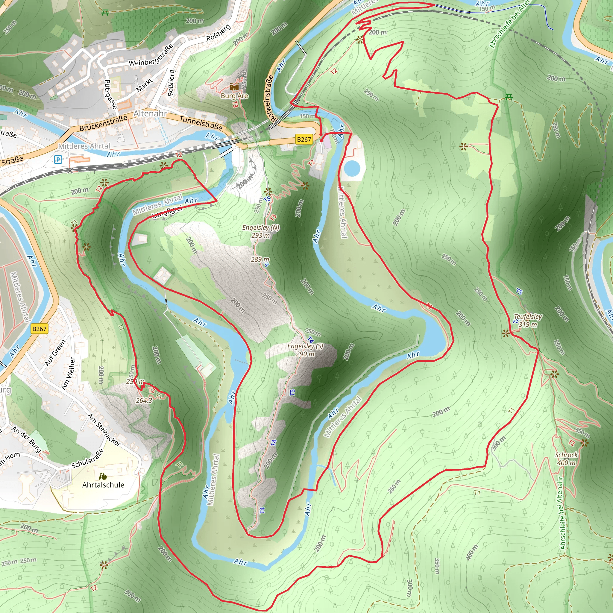
Starting near the picturesque town of Ahrweiler in Germany, this 8 km (approximately 5 miles) loop trail offers a delightful mix of natural beauty and historical intrigue. With an elevation gain of around 300 meters (approximately 984 feet), the trail is rated as medium difficulty, making it accessible for most hikers with a moderate level of fitness.
Getting There To reach the trailhead, you can either drive or use public transport. If driving, set your GPS to Ahrweiler, a charming town known for its medieval walls and half-timbered houses. There are several parking options available in the town. For those using public transport, Ahrweiler is well-connected by train. The nearest train station is Ahrweiler Station, which is a short walk from the trailhead.
Trail Highlights #### Ahrschleife bei Altenahr Starting from Ahrweiler, the trail initially takes you through lush vineyards that are characteristic of the Ahr Valley. The Ahrschleife bei Altenahr section is particularly scenic, offering panoramic views of the meandering Ahr River. As you ascend, you'll gain approximately 150 meters (492 feet) in elevation over the first 2 km (1.2 miles). This part of the trail is well-marked and relatively easy to navigate, but it's always a good idea to have the HiiKER app handy for real-time navigation.
#### Ahrtalweg As you continue, the trail merges with the Ahrtalweg, a well-known path that runs along the Ahr River. This section is more forested, providing a cool respite from the sun. Keep an eye out for local wildlife such as deer and various bird species. The trail here is relatively flat, making it a good opportunity to catch your breath and enjoy the serene surroundings.
Historical Significance The Ahr Valley has a rich history dating back to Roman times. Along the trail, you'll come across remnants of ancient Roman walls and medieval fortifications. One notable landmark is the Saffenburg Castle ruins, located about 4 km (2.5 miles) into the hike. The castle dates back to the 11th century and offers a glimpse into the region's feudal past. The ruins are perched on a hill, providing a perfect vantage point to take in the sweeping views of the valley below.
Practical Tips - **Footwear:** Given the mixed terrain, sturdy hiking boots are recommended. - **Weather:** The trail can be muddy after rain, so check the weather forecast before heading out. - **Water and Snacks:** There are no facilities along the trail, so bring enough water and snacks to last the entire hike. - **Navigation:** While the trail is well-marked, using the HiiKER app will ensure you stay on track and can explore additional points of interest.
Flora and Fauna The Ahr Valley is known for its biodiversity. In spring and summer, the trail is adorned with wildflowers, while autumn brings a burst of color to the vineyards. The forested sections are home to a variety of trees, including oak and beech. Birdwatchers will be delighted by the presence of species such as the European robin and the black woodpecker.
This trail offers a perfect blend of natural beauty, historical landmarks, and moderate physical challenge, making it a rewarding experience for any hiker.
What to expect?
Activity types
Comments and Reviews
User comments, reviews and discussions about the Ahrschleife bei Altenahr and Ahr via Ahrtalweg, Germany.
4.43
average rating out of 5
7 rating(s)

