Download
Preview
Add to list
More
41.6 km
~2 day
1606 m
Out and Back
“Embark on a breathtaking Appalachian adventure through lush forests and historic trails to Rabun Bald's panoramic summit.”
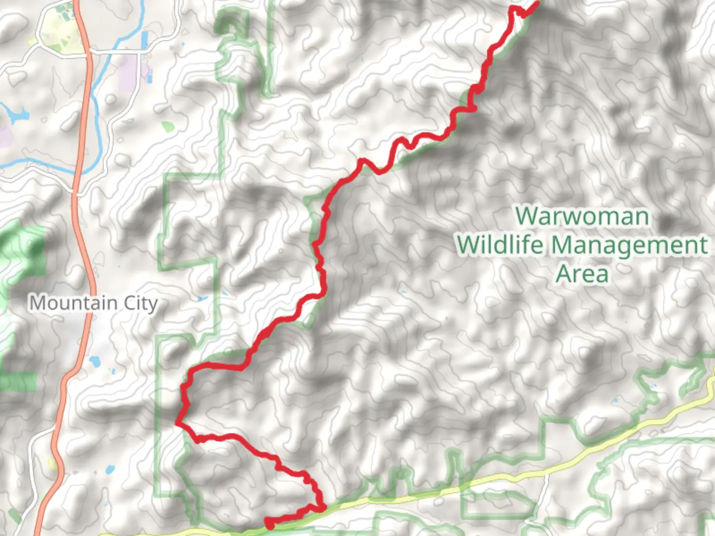
The Rabun Bald and Bartram Trail, starting near Rabun County, Georgia, offers a challenging yet rewarding experience for hikers looking to explore the Southern Appalachian Mountains. Spanning approximately 42 kilometers (26 miles) and featuring an elevation gain of around 1600 meters (5250 feet), this out-and-back trail is rated as medium difficulty, making it accessible to hikers with a reasonable level of fitness.
Getting to the Trailhead
To reach the trailhead, you can drive to the base near Warwoman Road, which is the most common starting point for this hike. If you're coming from Clayton, Georgia, take Warwoman Road east for about 14.5 kilometers (9 miles) until you reach the trailhead parking area on the right. There is no direct public transportation to the trailhead, so a personal vehicle or a taxi service is necessary.
Navigating the Trail
As you embark on your hike, it's advisable to use a reliable navigation tool like HiiKER to stay on track. The trail is well-marked, but having a digital map can help ensure you don't miss any turns or landmarks along the way.
The Ascent to Rabun Bald
The journey begins with a steady climb through a lush forest, leading you to the summit of Rabun Bald, Georgia's second-highest peak at 1,696 meters (5,564 feet). The ascent covers roughly 8 kilometers (5 miles) and offers a series of switchbacks that moderate the steepness of the climb. Upon reaching the top, you'll be rewarded with a 360-degree view from the observation tower, which is one of the trail's highlights. On a clear day, you can see the surrounding Blue Ridge Mountains in all their splendor.
Bartram Trail to Warwoman Dell
Continuing on the Bartram Trail, you'll encounter a diverse range of flora and fauna, including hardwood forests, rhododendron thickets, and possibly wildlife such as deer and birds of prey. The trail meanders through a series of moderate ascents and descents, with the terrain becoming more rugged as you progress.
Historical Significance
The trail is named after William Bartram, an 18th-century naturalist who explored the region. As you hike, you're following in the footsteps of Bartram's travels, which were instrumental in documenting the natural history of the Southern Appalachians. The area is steeped in history, with the trail itself being part of the larger Bartram Trail system that extends through several states.
Warwoman Dell and Beyond
Approximately 21 kilometers (13 miles) from the start, you'll reach Warwoman Dell, an area known for its scenic waterfalls and rich history. It's a great spot to rest and enjoy the serene environment before turning back or continuing further if you're planning a multi-day hike.
Preparation and Safety
Before setting out, ensure you have adequate water, food, and clothing for the hike. Weather conditions can change rapidly in the mountains, so be prepared for rain or cooler temperatures, especially at higher elevations. It's also wise to inform someone of your hiking plans and expected return time.
Remember, this trail can be strenuous, so pace yourself and take breaks as needed. With proper preparation and a sense of adventure, the Rabun Bald and Bartram Trail offers an unforgettable hiking experience through some of Georgia's most beautiful landscapes.

What to expect?
Activity types
Comments and Reviews
User comments, reviews and discussions about the Rabun Bald and Bartram Trail - Warwoman Road, Georgia.
average rating out of 5
0 rating(s)