Download
Preview
Add to list
More
469.9 km
~30 days
14708 m
Multi-Day
“Embark on the Benton Mackaye Trail for a challenging yet scenic 292-mile journey through Georgia's wilderness.”
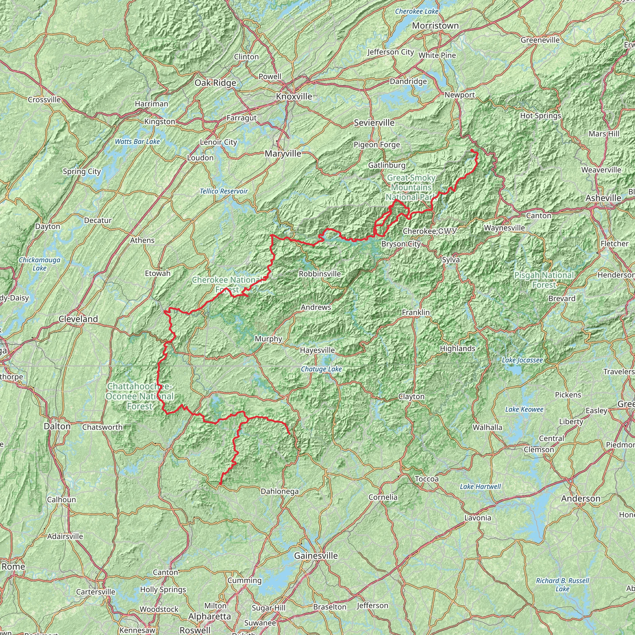
The Benton Mackaye Trail stretches approximately 470 kilometers (around 292 miles) and boasts a significant elevation gain of roughly 14,700 meters (about 48,228 feet), presenting a challenging adventure for even seasoned hikers. The trailhead is conveniently located near Dawson County, Georgia, and is accessible by car. For those relying on public transportation, options may be limited, but regional shuttles or ride-sharing services can be used to reach the starting point.
Getting to the Trailhead
To begin your journey on the Benton Mackaye Trail, you'll want to make your way to the southern terminus, which is situated close to Springer Mountain. If driving, you can navigate to the parking area near the trailhead by following Forest Service roads from the nearest towns such as Ellijay or Dahlonega. Be sure to check road conditions and access restrictions, especially during winter months or after heavy rainfall.
Navigating the Trail
As you embark on the trail, you'll traverse a diverse landscape that includes lush forests, rolling mountains, and serene rivers. The path is marked with white diamond blazes, ensuring a clear route. For additional navigation support, the HiiKER app provides detailed maps and trail information that can be invaluable for planning your hike and staying on course.
Landmarks and Scenery
The Benton Mackaye Trail is named after the visionary behind the Appalachian Trail, and it honors his legacy by providing a similarly immersive wilderness experience. Along the route, you'll encounter the Toccoa River Swinging Bridge, a notable landmark that offers a unique crossing over the picturesque river. The trail also winds through the Cohutta Wilderness, where the Jacks River Falls provides a breathtaking natural spectacle.
Wildlife and Nature
The trail is a haven for wildlife enthusiasts, with opportunities to spot white-tailed deer, black bears, and a variety of bird species. The flora is equally impressive, with wildflowers in spring and a kaleidoscope of autumn colors in the fall. Hikers should be prepared for encounters with wildlife and knowledgeable about how to safely observe and interact with the natural inhabitants.
Historical Significance
The region through which the Benton Mackaye Trail passes is steeped in history, from the indigenous peoples who originally inhabited the land to the early European settlers. The trail itself serves as a living tribute to Benton MacKaye's vision for a network of trails that promote conservation and connection with nature.
Preparation and Planning
Given the trail's difficulty rating and length, thorough preparation is essential. Hikers should plan for multiple days of trekking, with appropriate gear for overnight camping and variable weather conditions. Water sources are available along the trail, but purification methods should be employed. Resupply points and exit strategies should be mapped out in advance, especially for those attempting a thru-hike.
Seasonal Considerations
The best times to hike the Benton Mackaye Trail are during the spring and fall when temperatures are moderate, and the natural beauty is at its peak. Summer hikes are possible but can be hot and humid, while winter brings its own challenges with cold temperatures and potential snowfall.
Leave No Trace
As with any wilderness hike, the principles of Leave No Trace should be followed to minimize impact on the environment. This includes packing out all trash, respecting wildlife, and being considerate of other hikers.
By preparing adequately and respecting the natural and historical significance of the Benton Mackaye Trail, hikers can look forward to an unforgettable journey through some of the most scenic landscapes in the Eastern United States.
What to expect?
Activity types
Comments and Reviews
User comments, reviews and discussions about the Benton Mackaye Trail, Georgia.
4.6
average rating out of 5
15 rating(s)

