Download
Preview
Add to list
More
624.5 km
~44 days
25906 m
Multi-Day
“Trek the GR 5, a scenic alpine odyssey from Lake Geneva's shores to Nice's Mediterranean coast.”
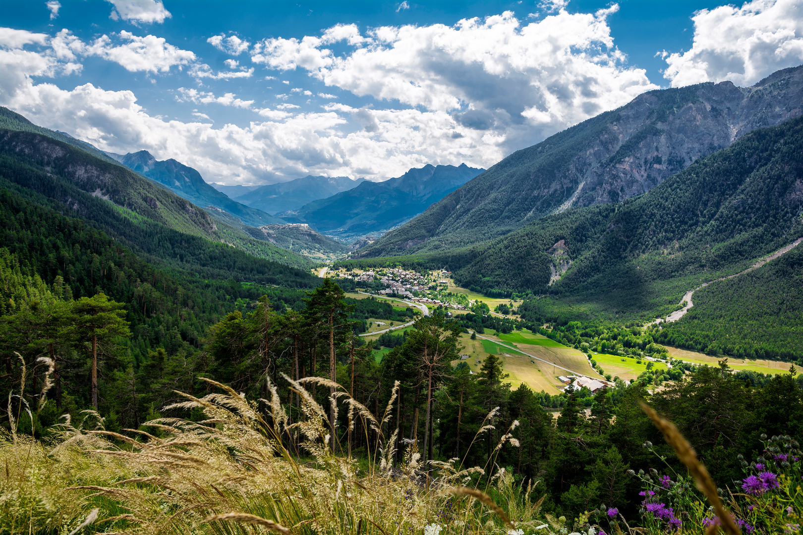
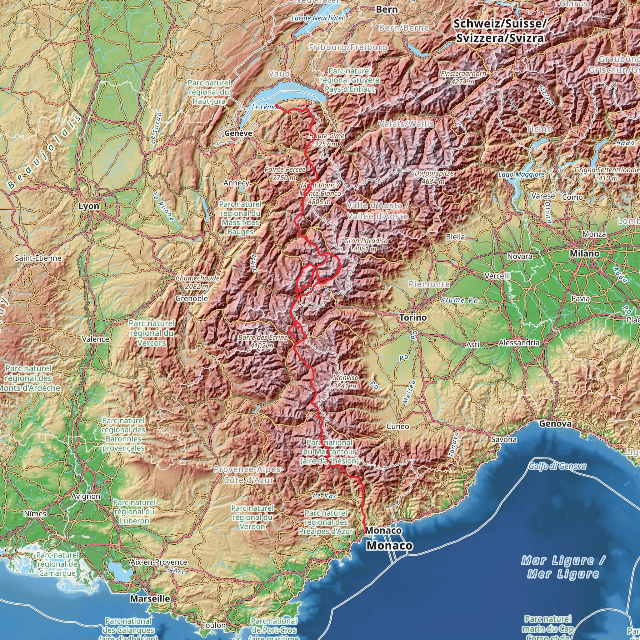
Embarking on the GR 5 trail, you'll traverse a stunning and diverse landscape stretching from the shores of Lake Geneva near Thonon-les-Bains, France, to the Mediterranean Sea at Nice. This long-distance trek, also known as the Grande Randonnée 5, spans approximately 624 kilometers (about 388 miles) and encompasses an elevation gain of roughly 25,900 meters (around 85,000 feet), presenting a challenging yet rewarding experience for seasoned hikers. Getting to the Trailhead To reach the starting point near Thonon-les-Bains, you can take a train or bus from major French cities to the Thonon-les-Bains station. If you're driving, the town is accessible via the A40 motorway, and you'll find parking options in the vicinity of the trailhead. The Journey Through the Alps As you set out from Thonon-les-Bains, the trail immediately immerses you in the picturesque landscapes of the French Alps. You'll encounter a mix of steep ascents, alpine meadows, and dense forests as you make your way south. The path leads you through the renowned Chablais and Faucigny regions, offering views of Mont Blanc, Europe's highest peak. Vanoise National Park One of the highlights is the Vanoise National Park, France's first national park, where the trail meanders through an area rich in flora and fauna. Keep an eye out for ibex, chamois, and marmots, and admire the diverse array of alpine flowers. The park is also home to historical sites, including remnants of the region's mining past. Crossing the French Riviera As you approach the end of the trail, the landscape transitions from rugged mountains to the gentle hills of the French Riviera. The Mediterranean climate brings a change in vegetation, with olive groves and vineyards dotting the countryside. The trail concludes in the vibrant city of Nice, where the azure waters of the Mediterranean provide a soothing finale to the arduous journey. Navigation and Planning Throughout the trek, it's essential to have reliable navigation tools. HiiKER is an excellent resource for planning your hike, offering detailed maps and information on the GR 5. Be sure to download the necessary maps for offline use, as some sections of the trail may have limited connectivity. Historical Significance The regions traversed by the GR 5 are steeped in history, from ancient Roman roads to sites significant to the World Wars. The trail offers a unique opportunity to connect with the past, as many paths follow routes that have been used for centuries for trade and migration. Preparation and Safety Given the trail's difficulty and length, thorough preparation is crucial. Ensure you have appropriate gear for varying weather conditions and terrain. It's advisable to plan your trip between June and September when the weather is most favorable. Always inform someone of your itinerary and check in regularly. Accommodation and Resupply Points Along the GR 5, you'll find a range of accommodations, from mountain huts to guesthouses. Resupply points are available in the towns and villages you'll pass through, allowing you to stock up on food and supplies. It's wise to book accommodations in advance, especially during peak hiking season. Environmental Considerations As you journey through these natural landscapes, it's important to practice Leave No Trace principles. Respect wildlife, stay on designated trails, and carry out all trash to preserve the environment for future hikers. The GR 5 is a trail of contrasts, offering an immersive experience through some of France's most breathtaking scenery. With careful planning and respect for the natural surroundings, hikers can embark on a memorable adventure across the heart of the Alps to the sun-kissed shores of the Mediterranean.
Comments and Reviews
User comments, reviews and discussions about the GR 5, France.
4.96
average rating out of 5
47 rating(s)

