Download
Preview
Add to list
More
1373.0 km
~69 days
20776 m
Multi-Day
“Embark on a historic 1373km pilgrimage through France's diverse landscapes, from rolling hills to the majestic Pyrenees.”
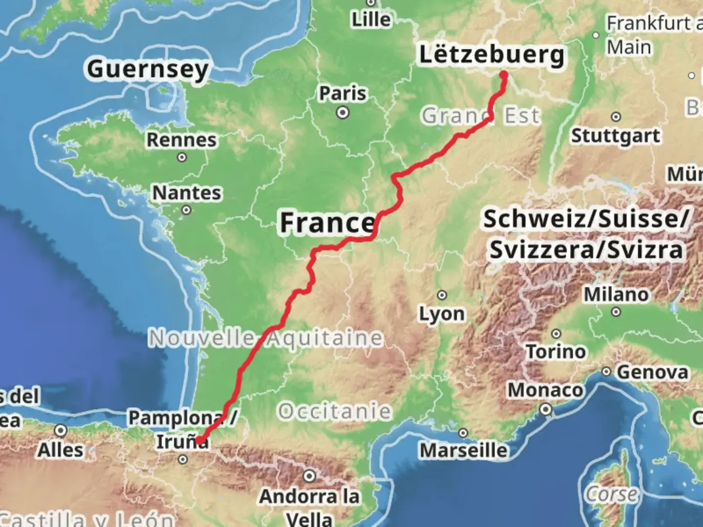
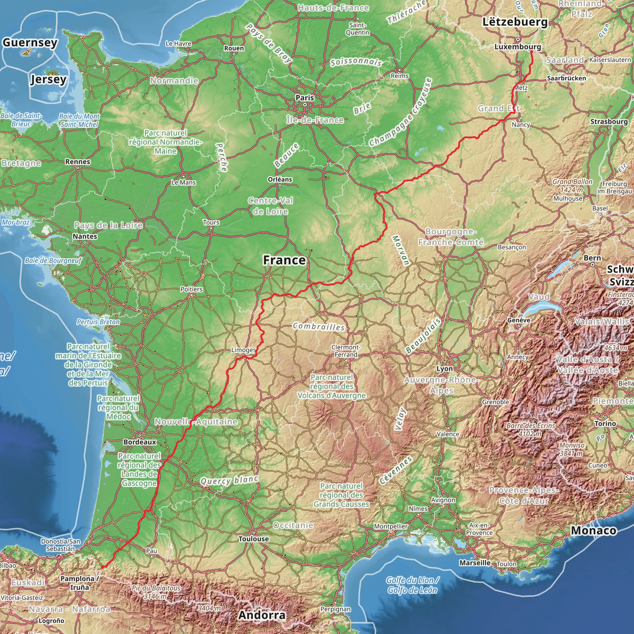
Embarking on the Camino Perl-Saint Jean Pied de Port via Vézelay, hikers will traverse approximately 1373 kilometers (853 miles) of varied landscapes, with an elevation gain of around 20700 meters (67913 feet). This long-distance pilgrimage route, part of the network of Camino de Santiago trails, begins near Thionville, France, and is a journey steeped in history and natural beauty.
Getting to the Trailhead The starting point of the trail is accessible from Thionville, which is well-connected by public transport. Travelers can take a train to Thionville station from major French cities such as Paris or Lyon. From the station, local buses or taxis can take you to the trailhead. If arriving by car, Thionville is near the A31 motorway, and parking is available in the town.
The Journey through France The trail kicks off in the Lorraine region, where hikers will meander through the rolling hills and quaint villages of northeastern France. The path then leads to the historic town of Vézelay, a UNESCO World Heritage Site, known for the Vézelay Abbey and its hilltop views. This segment alone covers roughly 400 kilometers (249 miles) and includes an elevation gain of about 5000 meters (16404 feet).
Crossing the Massif Central As the trail progresses, hikers will encounter the Massif Central, a highland region that presents a more challenging terrain with steeper ascents and descents. This section is characterized by volcanic plateaus, deep valleys, and is rich in biodiversity. The Massif Central stretch spans approximately 500 kilometers (311 miles) and accounts for a significant portion of the total elevation gain.
The Path to the Pyrenees Approaching the final stages of the hike, the trail winds through the wine country of Bordeaux and the verdant landscapes of Gascony. The Pyrenees loom in the distance, signaling the approach to Saint Jean Pied de Port. This medieval town marks the end of the journey and is a crossroads for pilgrims from various routes of the Camino de Santiago.
Wildlife and Nature Throughout the hike, travelers will encounter diverse ecosystems, from the deciduous forests of Burgundy to the rugged terrain of the Pyrenees. The trail offers opportunities to spot wildlife such as deer, wild boar, and various bird species, including birds of prey.
Historical Significance The Camino de Santiago, also known as the Way of St. James, has been a pilgrimage route since the Middle Ages, leading to the shrine of the apostle Saint James the Great in the cathedral of Santiago de Compostela in Galicia, Spain. The route via Vézelay has been traveled by pilgrims for centuries and is rich in historical landmarks, including ancient churches, abbeys, and castles.
Navigation and Planning For navigation along the trail, HiiKER is an invaluable tool, providing detailed maps and waypoints to ensure hikers stay on the correct path. It's advisable to plan accommodations in advance, especially during peak pilgrimage seasons, and to carry a basic French phrasebook for communication in the more remote villages.
Preparation Given the trail's length and varied terrain, hikers should be in good physical condition and prepared for long walking days. Packing essentials include a reliable pair of hiking boots, weather-appropriate clothing, a first-aid kit, and a water filtration system. It's also important to carry enough cash, as some smaller villages may not accept credit cards.
This trail offers a profound journey through the heart of France, connecting hikers not only to the natural world but also to the rich tapestry of European history and culture.
Comments and Reviews
User comments, reviews and discussions about the Camino Perl-Saint Jean Pied de Port via Vézelay, France.
average rating out of 5
0 rating(s)
