Download
Preview
Add to list
More
382.0 km
~21 days
5909 m
Multi-Day
“Embark on the Via Aurelia, a historic and scenic journey through time-honored landscapes and Roman legacies.”
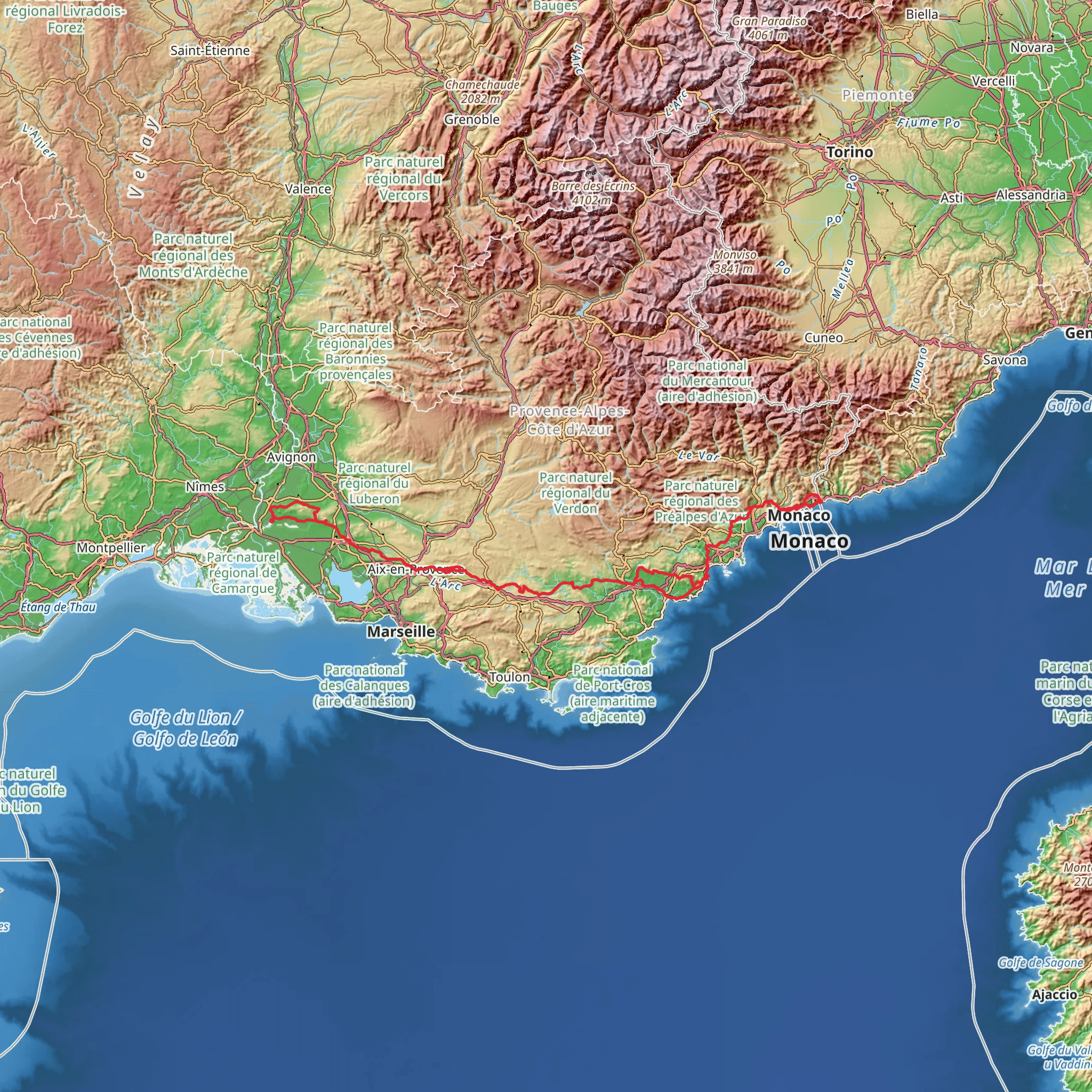
The Via Aurelia is an ancient road that stretches approximately 382 kilometers (237 miles) with an elevation gain of around 5900 meters (19,356 feet), beginning near Menton, France, and winding its way through the picturesque landscapes of the French Riviera and into Italy. This point-to-point trail is steeped in history, originally constructed in the 3rd century BC, and offers a medium difficulty rating, making it accessible to hikers with a moderate level of experience.
Getting to the Trailhead
To reach the starting point of the Via Aurelia, hikers can fly into Nice Côte d'Azur Airport and take public transportation or drive to Menton. From the airport, one can catch a train or bus to Menton, which is the last French town before the Italian border. The trailhead is conveniently located near the town center, which is well-signposted and easy to find.
Historical Significance and Landmarks
As you embark on the Via Aurelia, you'll be following in the footsteps of Roman legions that once marched between Rome and the French Riviera. The trail offers a unique blend of natural beauty and historical landmarks. Notable sites include the Balzi Rossi caves, with prehistoric human remains and cave paintings, and the remnants of Roman architecture scattered along the route.
Navigating the Trail
Hikers can utilize the HiiKER app for detailed maps and navigation assistance, ensuring they stay on the correct path. The trail is marked, but due to its historical nature, some sections may be less defined, making a reliable navigation tool essential.
Terrain and Elevation
The Via Aurelia traverses a diverse range of terrains, from coastal paths with stunning sea views to forested tracks and rolling hills. The elevation gain is gradual, with the most significant ascents occurring as the trail moves inland, away from the coast.
Flora and Fauna
The trail offers an opportunity to witness the rich biodiversity of the region. Hikers will pass through areas of Mediterranean maquis, a dense shrubland home to aromatic herbs like rosemary and thyme. The coastal sections provide a habitat for seabirds, while inland areas may offer sightings of wild boar, foxes, and various bird species.
Climate and Best Time to Hike
The climate along the Via Aurelia is typically Mediterranean, with mild winters and hot summers. The best time to hike the trail is during spring or autumn when the temperatures are more moderate, and the landscape is either blooming with wildflowers or rich with autumnal hues.
Accommodation and Supplies
The trail passes through numerous towns and villages where hikers can find accommodation ranging from hotels to guesthouses. It is advisable to book in advance, especially during peak tourist seasons. These settlements also provide opportunities to resupply, dine on local cuisine, and experience the regional culture.
Safety and Preparation
While the Via Aurelia is not considered a high-risk trail, it's important to prepare adequately. Hikers should carry enough water, especially during the summer months, and be prepared for sudden weather changes. A basic first-aid kit, sun protection, and appropriate hiking footwear are essential.
By following these guidelines and preparing accordingly, hikers can fully enjoy the rich historical tapestry and natural beauty of the Via Aurelia, a trail that not only challenges the body but also enriches the mind with its deep historical roots and cultural significance.
Comments and Reviews
User comments, reviews and discussions about the Via Aurelia, France.
5.0
average rating out of 5
4 rating(s)

