Download
Preview
Add to list
More
747.6 km
~53 days
35665 m
Multi-Day
“Embark on the Haute Randonnée Pyrénéenne, a majestic but demanding trek through the heart of the Pyrenees.”
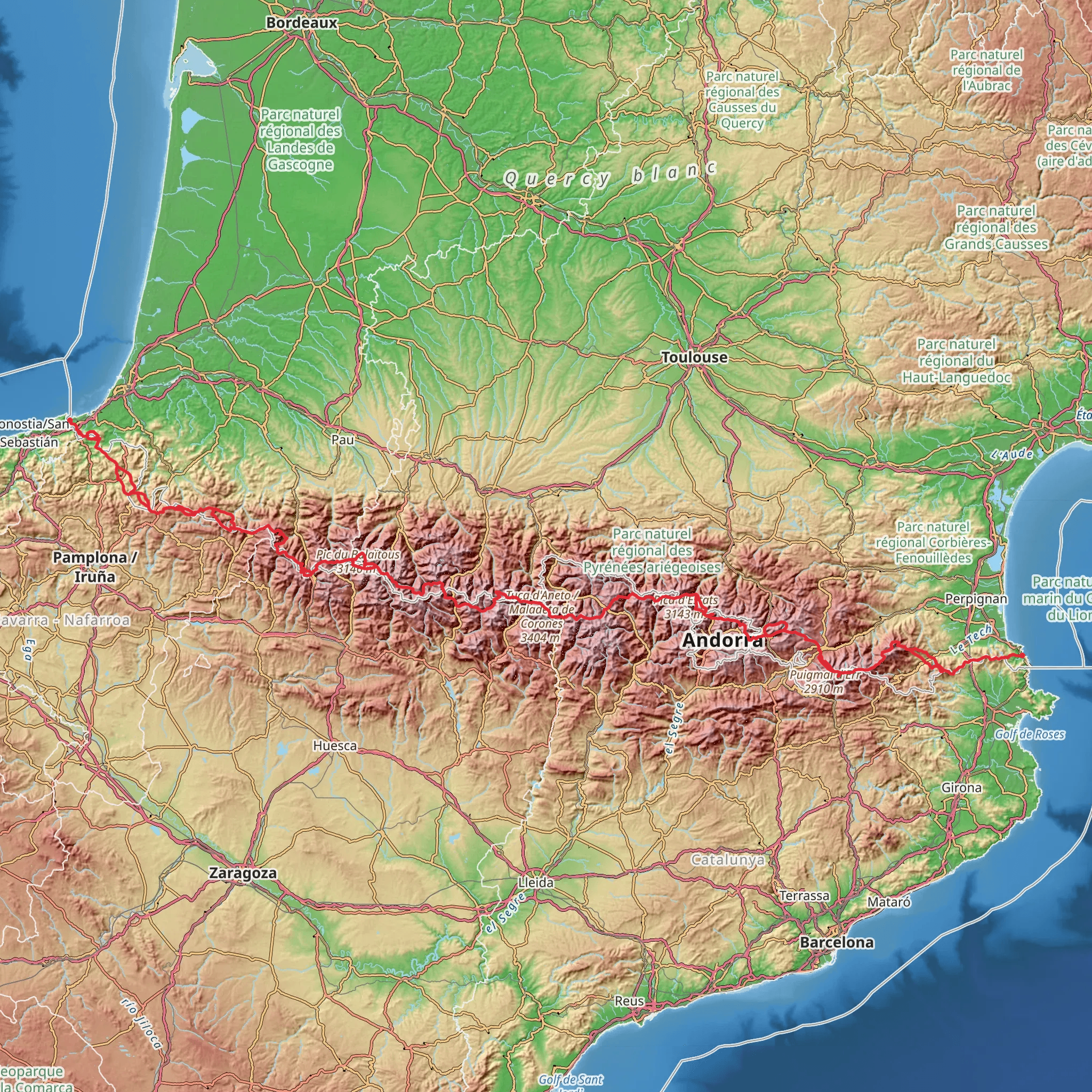
Spanning approximately 748 kilometers (465 miles) and with an elevation gain of around 35,600 meters (116,800 feet), the Haute Randonnée Pyrénéenne (HRP) is a high-level, long-distance footpath that traverses the Pyrenees mountain range, offering a challenging yet rewarding experience for seasoned hikers. This point-to-point trail begins near Hendaye, France, and winds its way through rugged terrain, crossing the border between France and Spain multiple times before reaching its end near Banyuls-sur-Mer.
Getting to the Trailhead
The starting point of the HRP is accessible from the coastal town of Hendaye, which can be reached by train or bus from major French cities such as Paris or Bordeaux. For those driving, Hendaye is well-connected by road, and parking is available in the town. From Hendaye, the trailhead is located near the beach, where the Atlantic Ocean meets the Pyrenees.
Navigating the Trail
Hikers can use the HiiKER app to navigate the trail, as it provides detailed maps and waypoints that are crucial for a trek of this magnitude. The HRP is not a single marked trail but rather a network of existing paths, and it requires good navigation skills to follow. The route often stays close to the French-Spanish border, traversing national parks and protected areas, and it is common for hikers to alternate between the GR10 in France and the GR11 in Spain, with detours into the higher mountains.
Landmarks and Terrain
The HRP takes hikers through some of the most stunning landscapes of the Pyrenees. Notable landmarks include the Pic du Midi d'Ossau, a distinctive mountain known for its shape, and the Vignemale, the highest peak in the French Pyrenees. The trail also passes by the breathtaking Cirque de Gavarnie, a natural amphitheater and UNESCO World Heritage Site.
Wildlife and Nature
The Pyrenees are home to a rich variety of flora and fauna. Hikers may encounter species such as the Pyrenean chamois, marmots, and birds of prey like the bearded vulture. The diverse ecosystems range from lush forests to high alpine meadows, with an abundance of wildflowers in the spring and summer months.
Historical Significance
The region is steeped in history, with the Pyrenees playing a significant role as a natural border and a crossroads for various cultures over the centuries. Along the HRP, hikers will find remnants of past inhabitants, from ancient dolmens and Romanesque chapels to abandoned shepherd huts and fortifications from the Carlist Wars.
Climate and Best Time to Hike
The best time to hike the HRP is from July to September when the snow has mostly melted, and the weather is more stable. However, weather in the mountains can be unpredictable, and hikers should be prepared for sudden changes in conditions.
Preparation and Logistics
Given the trail's difficulty, hikers should be in excellent physical condition and have experience with multi-day treks in mountainous terrain. It is essential to carry appropriate gear, including a tent, sleeping bag, stove, and sufficient food, as resupply points are limited. Water sources are generally plentiful, but purification is recommended.
Safety and Regulations
Hikers should be aware of the regulations in the various national parks and reserves the HRP passes through, including camping restrictions. It is also important to inform someone of your itinerary and check in regularly, as the remote nature of the trail can complicate rescue efforts in case of an emergency.
In conclusion, the Haute Randonnée Pyrénéenne offers an epic adventure for the well-prepared hiker, with its combination of natural beauty, cultural heritage, and physical challenge. With careful planning and respect for the environment, it can be an unforgettable journey through one of Europe's most iconic mountain ranges.
Comments and Reviews
User comments, reviews and discussions about the Haute Randonnée Pyrénéenne, France.
4.83
average rating out of 5
6 rating(s)

