Download
Preview
Add to list
More
1511.4 km
~83 days
24088 m
Multi-Day
“Embark on the GR 4 for a historic, scenic trek across France's diverse landscapes and storied past.”
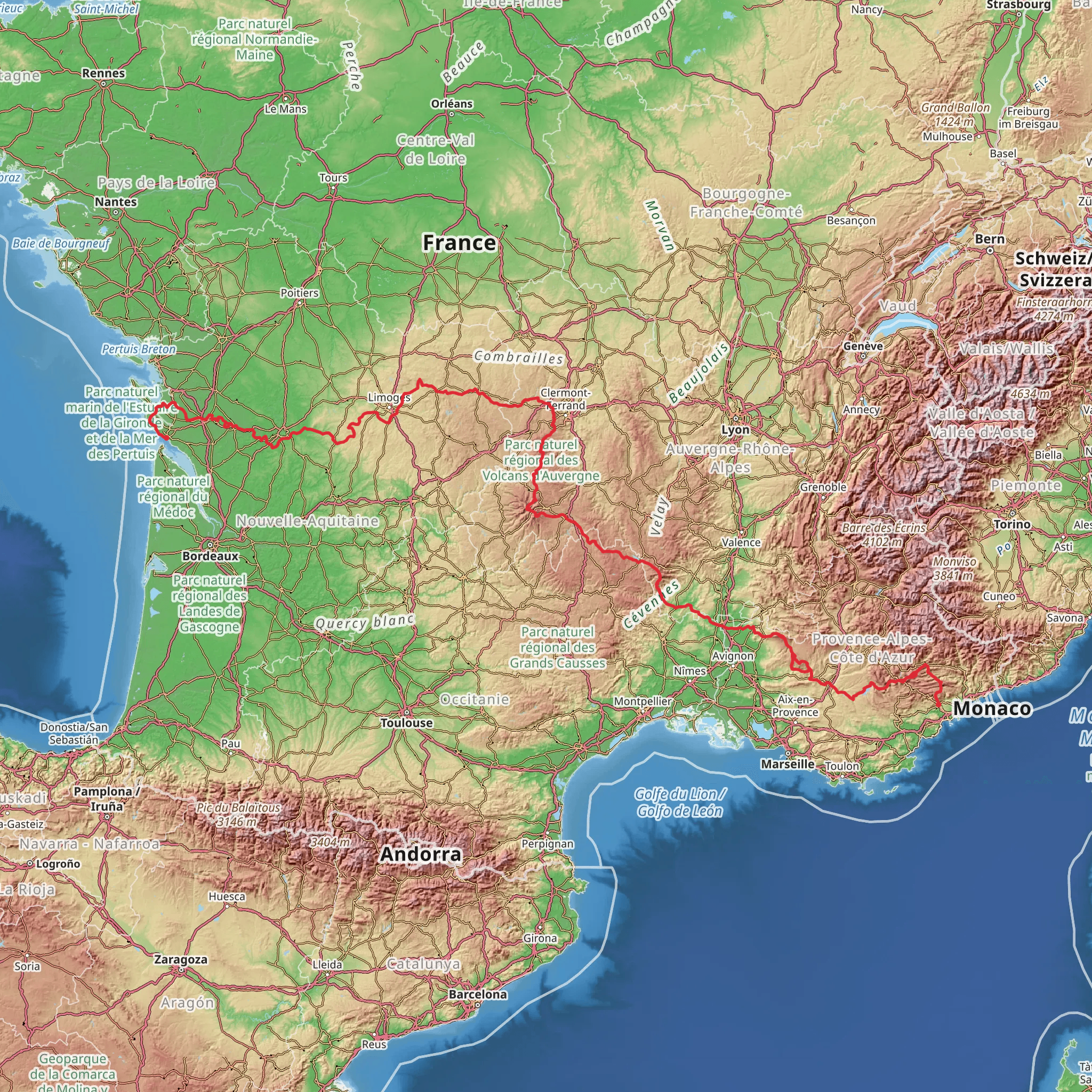
The GR 4 is a long-distance hiking trail that spans approximately 1511 kilometers (939 miles), with an elevation gain of around 24,000 meters (78,740 feet). This point-to-point trail begins near the town of Grasse, France, known for its perfume industry and situated in the picturesque region of Provence-Alpes-Côte d'Azur.
Getting to the Trailhead
To reach the starting point of the GR 4, hikers can fly into Nice Côte d'Azur Airport and take a bus or train to Grasse. If driving, Grasse is accessible via the A8 motorway. Parking is available in the town for those who wish to leave their vehicle before embarking on their hike.
Trail Overview
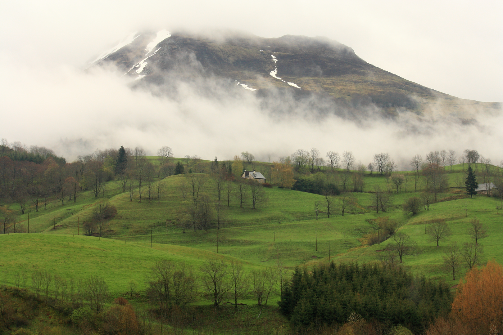
The GR 4 trail offers a diverse hiking experience, traversing through the heart of France and connecting the Mediterranean Sea to the Atlantic Ocean. The trail leads hikers through a variety of landscapes, including the pre-Alps, volcanic plateaus, and the Massif Central. Along the way, hikers will encounter a mix of terrains, from rocky paths and lush forests to open fields and river valleys.
Historical Significance
The regions crossed by the GR 4 are steeped in history. Hikers will pass through areas that have been inhabited since prehistoric times, with numerous opportunities to explore medieval villages, ancient ruins, and historical landmarks. The trail itself follows paths that have been used for centuries, including old shepherd routes and trade paths.
Landmarks and Nature
One of the significant landmarks along the GR 4 is the Verdon Gorge, known for its stunning turquoise waters and dramatic cliffs. The trail also passes through the Cévennes National Park, a UNESCO World Heritage site, where hikers can enjoy the rich biodiversity and possibly spot rare species like the Griffon vulture.
Wildlife
The diverse ecosystems along the GR 4 support a wide range of wildlife. Hikers should keep an eye out for red deer, wild boar, and various bird species. The trail also crosses through the Parc Naturel Régional des Volcans d'Auvergne, home to the largest natural volcanic lake in France, Lac Pavin.
Navigation
Given the length and complexity of the trail, hikers should be well-prepared with detailed maps and a reliable navigation tool. HiiKER is an excellent resource for planning and navigating the GR 4, providing up-to-date trail information and GPS tracking.
Preparation and Planning
Due to the trail's difficulty rating and length, hikers should be in good physical condition and have experience with multi-day treks. It's essential to carry appropriate gear for varying weather conditions and have a solid plan for resupply points and overnight accommodations. The trail is well-marked with the characteristic red and white stripes of GR routes, but hikers should always have a backup navigation plan.
Accommodation and Resupply
The GR 4 passes through numerous towns and villages where hikers can find accommodation ranging from campsites to guesthouses. Resupply options are available in larger towns, but it's advisable to carry enough food and water between these points, especially in the more remote sections of the trail.
Conclusion
Embarking on the GR 4 is a commitment to a remarkable adventure through the heart of France. With proper preparation, hikers will be rewarded with breathtaking landscapes, rich cultural experiences, and the satisfaction of completing one of Europe's great long-distance trails.
Comments and Reviews
User comments, reviews and discussions about the GR 4, France.
4.6
average rating out of 5
5 rating(s)

