5.0 (7)
·
Medium
Clent Hill the Four Stones, Adams Hill, Deep Wood and Walton Hill via North Worcestershire Path
Download
Preview
Add to list
More
Trail length
8.9 km
Time
~2 hrs 15 min
Elevation Gain
290 m
Hike Type
Loop
“Explore Worcestershire's Clent Hills on a scenic 9 km loop with stunning views and historical landmarks.”
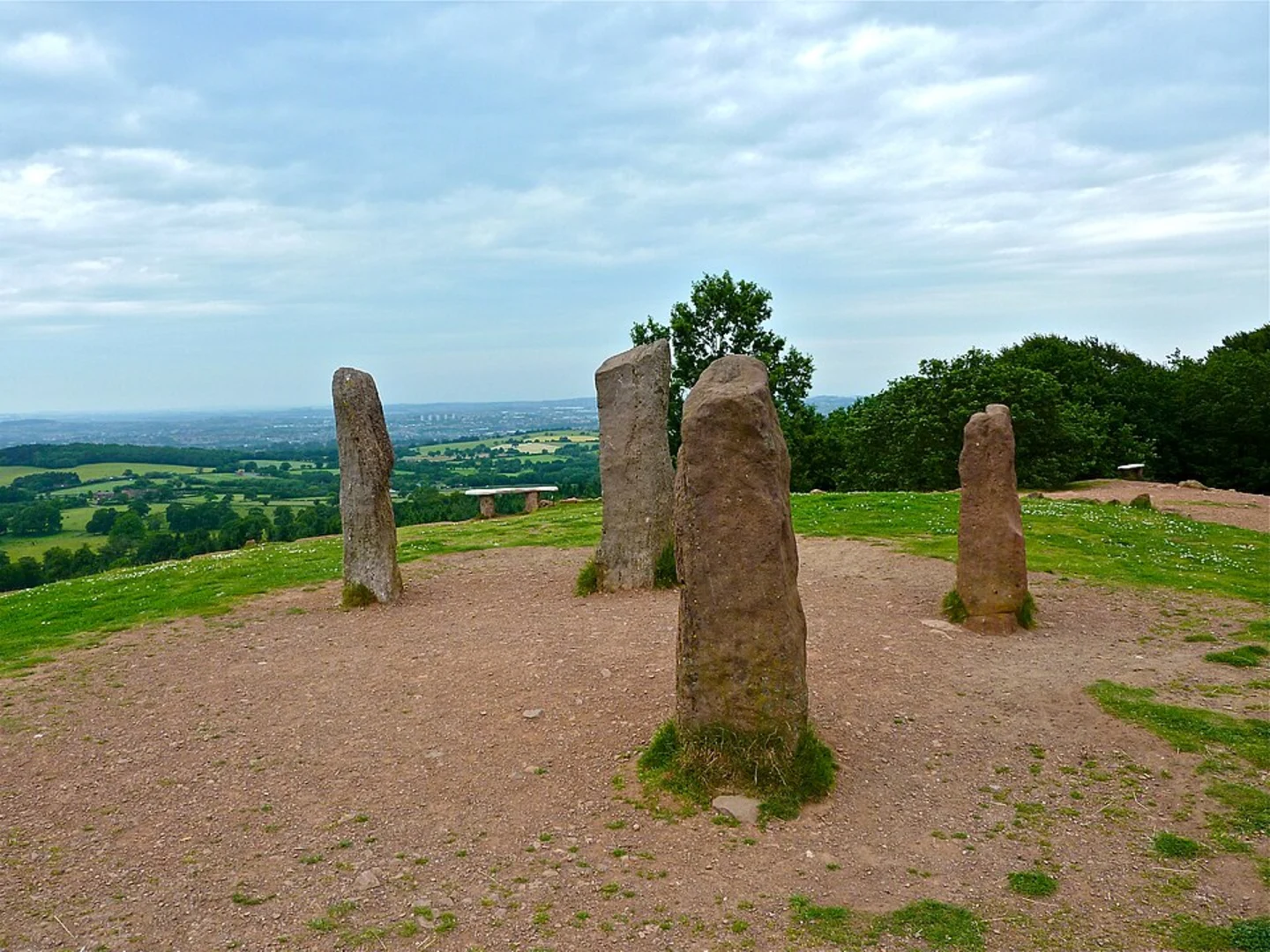
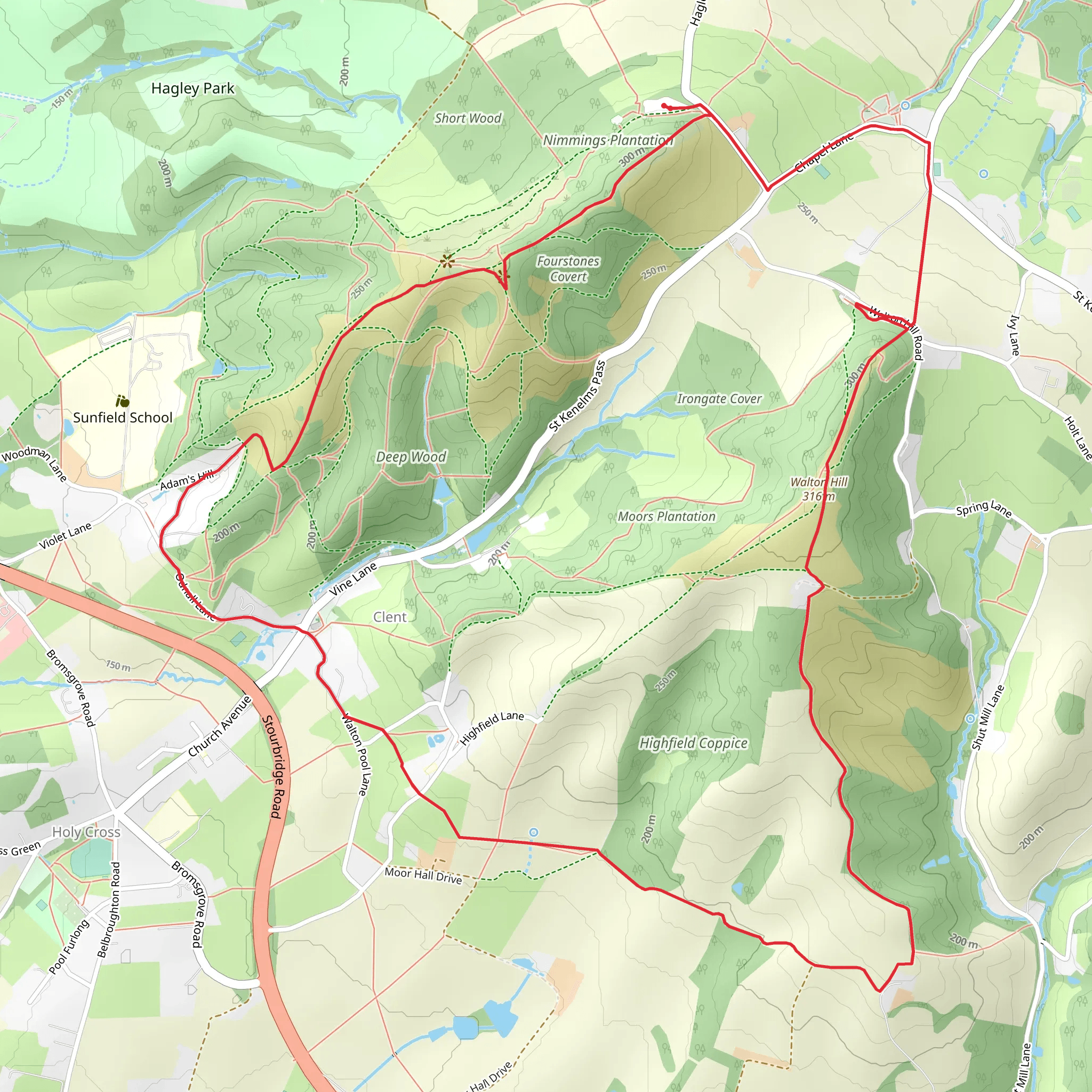
Starting near Worcestershire, England, this 9 km (approximately 5.6 miles) loop trail offers a delightful mix of natural beauty, historical landmarks, and moderate physical challenge. With an elevation gain of around 200 meters (656 feet), hikers can expect a moderately challenging experience suitable for those with a reasonable level of fitness. Getting There To reach the trailhead, you can drive and park near the Clent Hills Visitor Centre, located at Nimmings Wood Car Park, Hagley Wood Lane, Stourbridge DY9 9JR. If you prefer public transport, the nearest train station is Hagley, which is about 3 miles (4.8 km) away. From Hagley Station, you can take a taxi or a local bus to the visitor centre. ### Trail Overview The trail begins at the Clent Hills Visitor Centre and quickly immerses you in the serene beauty of the Worcestershire countryside. The path is well-marked and maintained, making navigation straightforward. For those who prefer digital navigation tools, HiiKER is an excellent resource to use. ### Clent Hill and the Four Stones The first significant landmark you'll encounter is Clent Hill, which offers panoramic views of the surrounding landscape. At the summit, you'll find the Four Stones, a set of standing stones that were erected in the 18th century. These stones are not ancient but were placed to enhance the picturesque quality of the landscape, a common practice during that period. ### Adams Hill and Deep Wood Continuing along the trail, you'll descend towards Adams Hill. This section is relatively easy, with gentle slopes and well-trodden paths. As you enter Deep Wood, the trail becomes more shaded and cooler, offering a refreshing change of scenery. Deep Wood is home to a variety of wildlife, including deer, foxes, and numerous bird species. Keep an eye out for the ancient oak and beech trees that dominate this area. ### Walton Hill The final significant ascent is Walton Hill, the highest point in the Clent Hills at 316 meters (1,037 feet) above sea level. The climb is steep but short, and the effort is rewarded with stunning views that stretch as far as the Cotswolds and the Black Mountains on a clear day. This is an excellent spot for a rest and a picnic. ### Historical Significance The Clent Hills have a rich history, with evidence of human activity dating back to the Bronze Age. The area was also significant during the Roman period, and remnants of Roman roads can still be found. In more recent history, the hills were a popular destination for Victorian day-trippers from Birmingham, and many of the paths and viewpoints were developed during this time. ### Final Stretch After descending from Walton Hill, the trail loops back towards the starting point at the Clent Hills Visitor Centre. This final section is relatively flat and easy, allowing you to cool down and reflect on the diverse landscapes and historical landmarks you've encountered. ### Tips for Hikers - Wear sturdy hiking boots, as some sections can be muddy, especially after rain. - Bring plenty of water and snacks, as there are limited facilities along the trail. - Check the weather forecast before you go, as the exposed sections can be windy and cold. - Use HiiKER for real-time navigation and updates on trail conditions. This trail offers a perfect blend of natural beauty, historical intrigue, and moderate physical challenge, making it a rewarding experience for any hiker.
What to expect?
forest
rivers
scenic-views
historic-landmarks
Activity types
running
walking
Comments and Reviews
User comments, reviews and discussions about the Clent Hill the Four Stones, Adams Hill, Deep Wood and Walton Hill via North Worcestershire Path, England.
5.0
average rating out of 5
7 rating(s)
