Download
Preview
Add to list
More
44.1 km
~3 days
746 m
Multi-Day
“Embark on the historic Clarendon Way, a picturesque trek through England's storied landscapes and charming villages.”
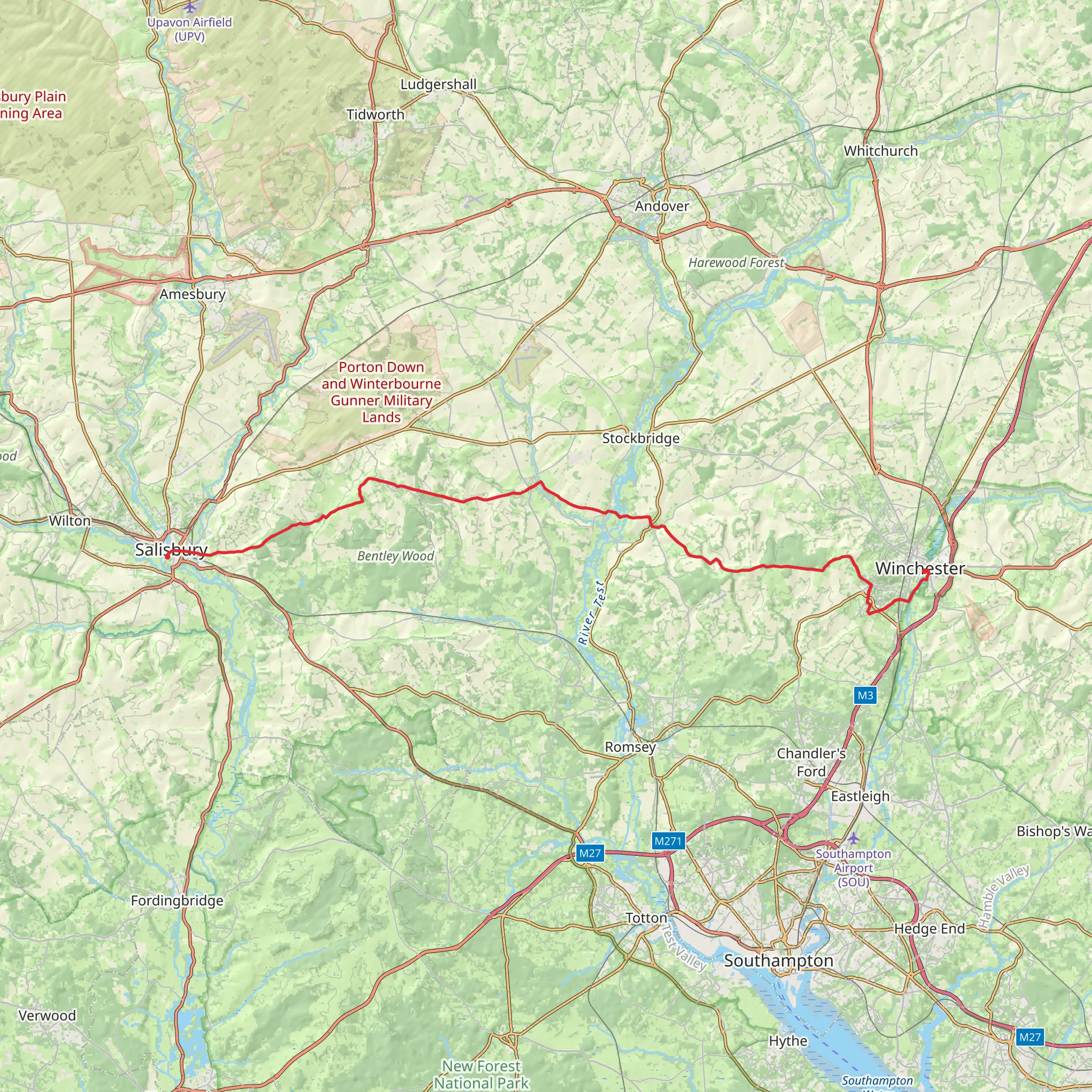
The Clarendon Way is a scenic and historic footpath that stretches approximately 44 kilometers (about 27 miles) with an elevation gain of around 700 meters (about 2300 feet), connecting the cathedral cities of Winchester and Salisbury across the rolling countryside of Wiltshire, England. This point-to-point trail offers a medium difficulty rating, making it accessible to hikers with a reasonable level of fitness.
Getting to the Trailhead
To begin your journey on the Clarendon Way, you'll want to make your way to the trailhead near Winchester. If you're arriving by public transport, Winchester is well-served by trains from London and other major cities. From Winchester railway station, the trailhead is just a short walk away. For those driving, parking is available in the city, and from there, you can follow the signposts leading to the start of the trail.
Historical Significance
As you embark on the Clarendon Way, you're not just stepping onto a path but also into history. The trail is named after Clarendon Park, near Salisbury, where the Clarendon Palace once stood. The palace was a royal residence and administrative center in the Middle Ages, and its ruins can still be visited near the end of the trail.
Navigating the Trail
The Clarendon Way is well-marked, but it's always wise to carry a reliable navigation tool like HiiKER to ensure you stay on the right path. The trail meanders through picturesque villages, woodlands, and across chalk downlands, offering a variety of landscapes.
Key Landmarks and Sections
- Winchester to Farley Mount: Starting in the historic city of Winchester, with its magnificent cathedral, the trail heads west. You'll pass through the village of Kings Worthy before reaching the Farley Mount Country Park, a perfect spot for panoramic views of the surrounding countryside.
- Farley Mount to Broughton: As you continue, the path takes you through the small hamlet of Sarum Road and on to the village of Houghton. This stretch is characterized by its charming river meadows and the opportunity to spot local wildlife.
- Broughton to Middle Winterslow: After Broughton, the trail rises to the rural village of Middle Winterslow. Here, you'll find yourself on the historic Roman Road, which offers a gentle climb and descent through quintessentially English landscapes.
- Middle Winterslow to Clarendon Palace: The final leg of the trail takes you towards the ruins of Clarendon Palace. It's worth taking a moment to explore the site and reflect on the area's rich history before completing the last few kilometers to Salisbury.
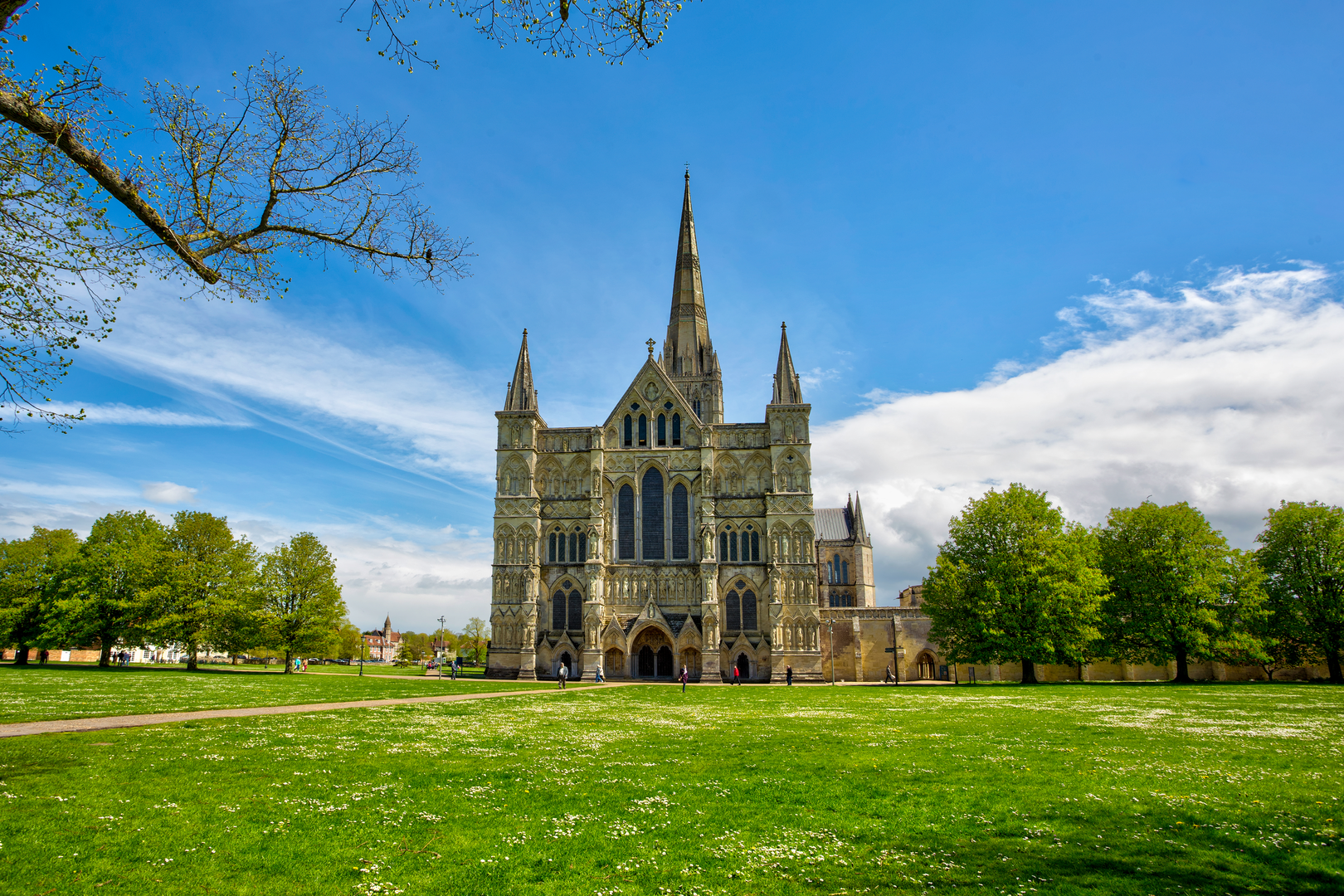
- Arrival in Salisbury: The trail concludes in the medieval city of Salisbury, where the spire of Salisbury Cathedral, the tallest in England, welcomes weary hikers. Take time to explore the city's historic streets and relax after your journey.
Wildlife and Nature
Throughout the Clarendon Way, hikers can enjoy a rich tapestry of British flora and fauna. The trail's diverse habitats are home to a variety of bird species, and with some luck, you may spot deer grazing in the fields or hares bounding across the path. The changing seasons bring different highlights, from the vibrant wildflowers of spring to the golden hues of autumn.
Preparation and Planning
Before setting out, ensure you have appropriate gear for the weather and terrain, including waterproof clothing and sturdy hiking boots. It's also advisable to carry sufficient water and snacks, as well as a first-aid kit for emergencies. Given the trail's length, some may choose to complete it over two days, staying overnight in one of the villages along the route.
The Clarendon Way offers a delightful blend of natural beauty, wildlife, and a glimpse into England's storied past, making it a rewarding experience for any hiker looking to explore the English countryside.
What to expect?
Activity types
Comments and Reviews
User comments, reviews and discussions about the Clarendon Way, England.
4.8
average rating out of 5
5 rating(s)

