Download
Preview
Add to list
More
13.6 km
~4 hrs 12 min
903 m
Point-to-Point
“This 14 km trail near Threlkeld offers breathtaking views, historical intrigue, and a rewarding physical challenge.”
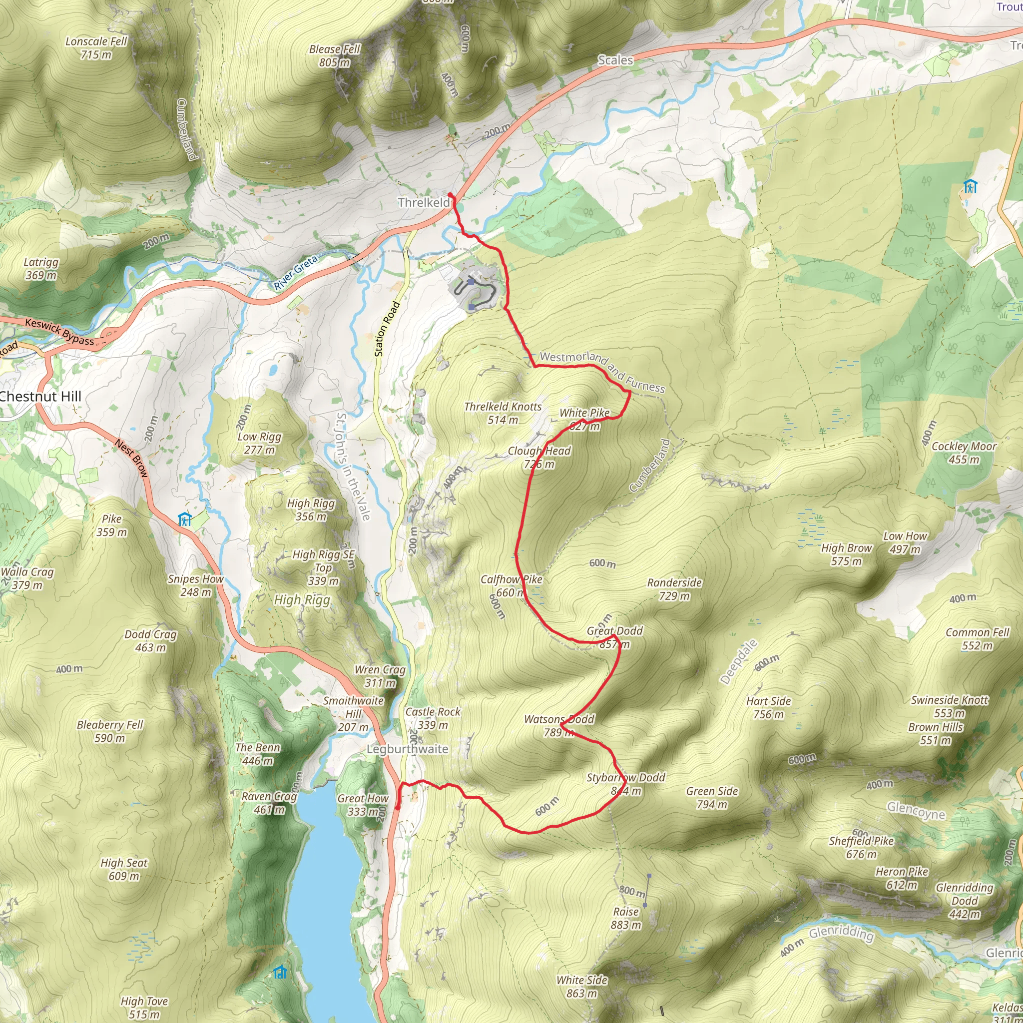
Starting near Westmorland and Furness, England, this 14 km (approximately 8.7 miles) point-to-point trail offers a rewarding hike with an elevation gain of around 900 meters (approximately 2,950 feet). The trailhead is accessible by car or public transport, with the nearest significant landmark being the village of Threlkeld. If you're driving, parking is available in Threlkeld, and from there, you can begin your journey.
Initial Ascent and Clough Head
The hike begins with a steady ascent towards Clough Head. This initial section is a good warm-up, with the path gradually climbing through open fields and past stone walls typical of the English countryside. As you ascend, you'll gain about 300 meters (984 feet) over the first 3 km (1.86 miles). The terrain here is grassy and can be boggy in places, so waterproof boots are recommended.
White Pike
After reaching Clough Head, the trail continues towards White Pike. This section is relatively straightforward, with a gentle incline and well-defined paths. White Pike offers stunning panoramic views of the surrounding fells and valleys. At this point, you will have covered approximately 5 km (3.1 miles) and gained around 500 meters (1,640 feet) in elevation. The landscape here is characterized by heather moorland and scattered rocky outcrops.
Great Dodd
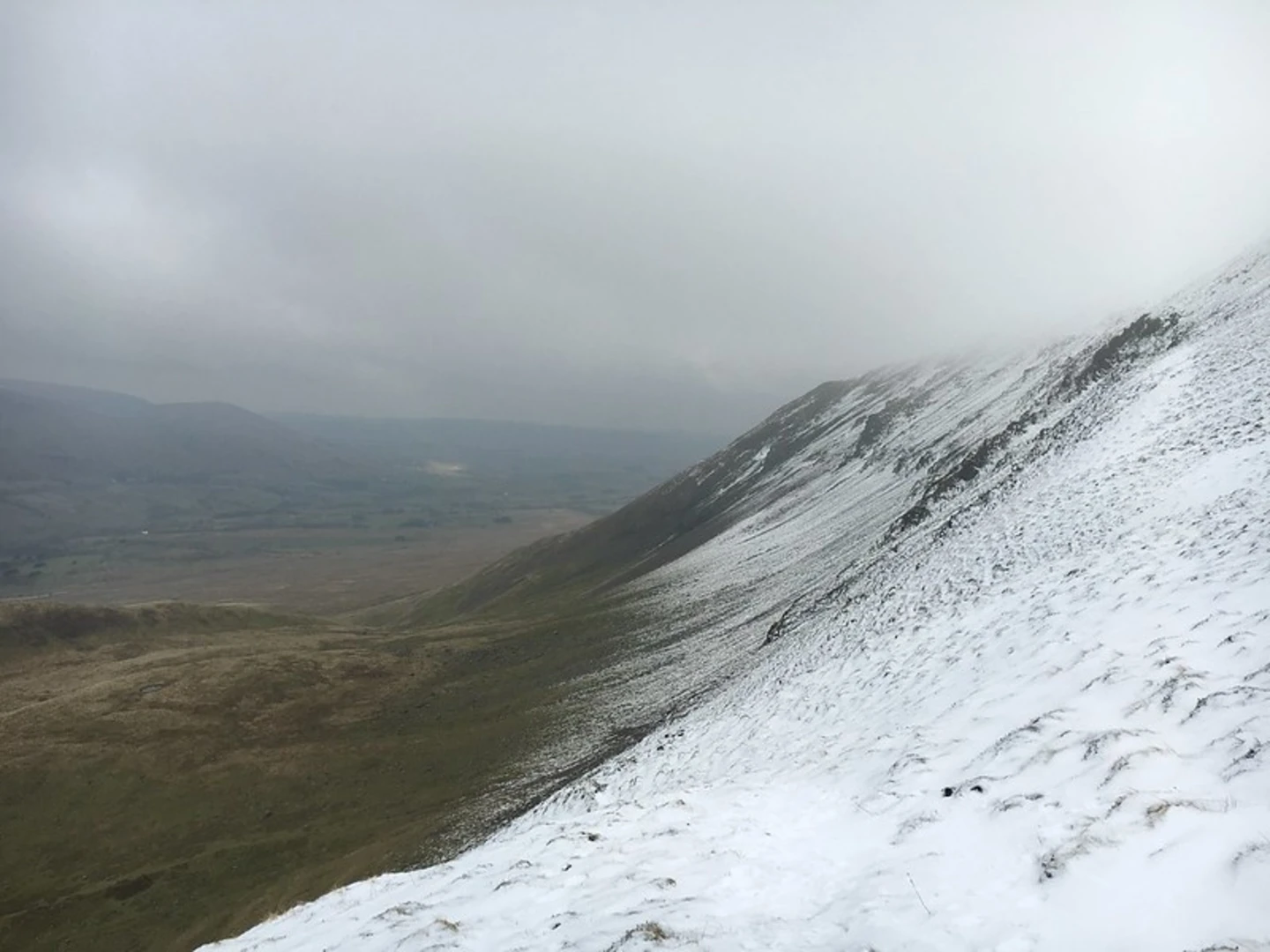
From White Pike, the trail leads you to Great Dodd, one of the highest points on this hike. The ascent to Great Dodd is more challenging, with steeper sections and rocky terrain. You'll gain an additional 200 meters (656 feet) in elevation over the next 2 km (1.24 miles). The summit of Great Dodd offers breathtaking views of the Lake District, including Blencathra and Skiddaw to the north. This is a great spot for a rest and some photos.
Stybarrow Dodd
The final major peak on this hike is Stybarrow Dodd. The trail from Great Dodd to Stybarrow Dodd is less strenuous, with a gradual incline and well-trodden paths. This section is about 3 km (1.86 miles) long and involves a modest elevation gain of 100 meters (328 feet). The summit of Stybarrow Dodd provides expansive views of Ullswater and the surrounding fells.
Descent and Finish
The descent from Stybarrow Dodd takes you down towards the village of Glenridding. This section is about 4 km (2.48 miles) long and involves a steep descent, so trekking poles can be helpful. The path here is rocky and can be slippery, especially after rain. As you descend, you'll pass through a mix of heathland and woodland, with the occasional stream crossing.
Historical Significance
The region around this trail is steeped in history. The Lake District has been inhabited since prehistoric times, and you may come across ancient stone circles and remnants of old settlements. The area was also a significant site during the Roman occupation of Britain, with several Roman roads and forts nearby.
Wildlife and Nature
The trail offers a chance to see a variety of wildlife, including red deer, foxes, and a range of bird species such as peregrine falcons and red grouse. The flora is equally diverse, with heather, bilberry, and various wildflowers adding color to the landscape.
Navigation
For navigation, it's advisable to use HiiKER, which provides detailed maps and real-time updates. This will help you stay on track and ensure you don't miss any of the key landmarks along the way.
Whether you're an experienced hiker or someone looking to challenge themselves, this trail offers a mix of natural beauty, historical intrigue, and physical challenge that makes it a memorable adventure.
What to expect?
Activity types
Comments and Reviews
User comments, reviews and discussions about the White Pike, Clough Head, Great Dodd and Stybarrow Dodd Walk, England.
5.0
average rating out of 5
2 rating(s)

