Download
Preview
Add to list
More
9.7 km
~2 hrs 33 min
376 m
Loop
“Experience stunning views, historical intrigue, and diverse landscapes on this rewarding 10 km loop near Coniston.”
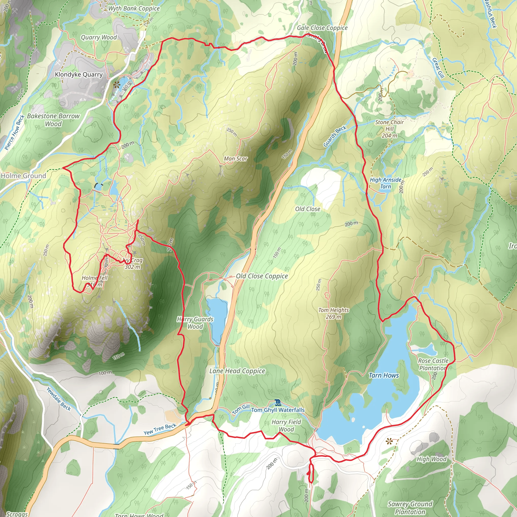
Starting near Westmorland and Furness in England, this 10 km (6.2 miles) loop trail offers a delightful mix of scenic beauty, moderate challenge, and historical intrigue. With an elevation gain of around 300 meters (984 feet), it’s a rewarding hike that provides stunning views and a variety of natural landscapes.
Getting There To reach the trailhead, you can drive or use public transport. If driving, head towards the village of Coniston, where parking is available near the Cumbria Way. For those using public transport, the nearest train station is Windermere. From Windermere, you can take a bus to Coniston, which is well-connected and offers regular services.
Trail Overview The trail begins near the Cumbria Way, a historic route that has been used for centuries. As you start your hike, you’ll be greeted by the serene waters of Tarn Hows, a picturesque tarn surrounded by lush woodlands. This area is managed by the National Trust and is renowned for its beauty, making it a popular spot for photographers and nature lovers alike.
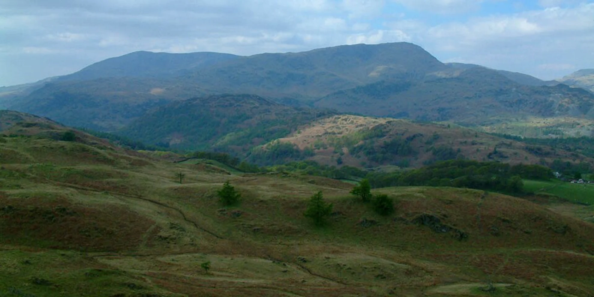
Tarn Hows to Holme Fell From Tarn Hows, the trail ascends gradually towards Holme Fell. This section covers approximately 3 km (1.9 miles) and includes an elevation gain of about 150 meters (492 feet). The path is well-marked but can be rocky in places, so sturdy footwear is recommended. As you climb, you’ll be treated to panoramic views of the surrounding fells and valleys. Keep an eye out for local wildlife, including red squirrels and various bird species.
Holme Fell to Ivy Crag Continuing from Holme Fell, the trail leads you towards Ivy Crag. This segment is around 2 km (1.2 miles) and involves a mix of gentle slopes and steeper sections. Ivy Crag offers a fantastic vantage point, with sweeping views of Coniston Water and the distant peaks of the Lake District. The crag itself is a great spot for a rest and a snack, allowing you to soak in the scenery.
Return to Tarn Hows The final leg of the loop brings you back to Tarn Hows, covering the remaining 5 km (3.1 miles). This part of the trail is relatively easy, with a gentle descent and well-maintained paths. Along the way, you’ll pass through ancient woodlands and open meadows, offering a diverse range of flora and fauna. The return route also provides an opportunity to explore some of the historical aspects of the area, including old mining sites that date back to the 19th century.
Navigation and Safety For navigation, it’s highly recommended to use the HiiKER app, which provides detailed maps and real-time GPS tracking. This will ensure you stay on the right path and can easily find points of interest along the way. Always check the weather forecast before setting out, as conditions can change rapidly in the Lake District. Carry sufficient water, snacks, and a basic first aid kit.
Historical Significance The region around Tarn Hows and Holme Fell is steeped in history. The Cumbria Way itself is an ancient route that has been used for trade and travel for centuries. The old mining sites you’ll encounter are remnants of the area’s industrial past, providing a glimpse into the lives of those who worked here in the 19th century. The landscape has been shaped by both natural forces and human activity, creating a unique environment that tells a rich story of the region’s heritage.
This trail offers a perfect blend of natural beauty, moderate challenge, and historical interest, making it a must-visit for any hiking enthusiast.
What to expect?
Activity types
Comments and Reviews
User comments, reviews and discussions about the Tarn Hows, Holme Fell and Ivy Crag via Cumbria Way, England.
4.0
average rating out of 5
1 rating(s)

