Download
Preview
Add to list
More
14.6 km
~4 hrs 19 min
843 m
Loop
“The Scales Tarn and Blencathra Loop offers stunning views, rich history, and a moderate hiking challenge.”
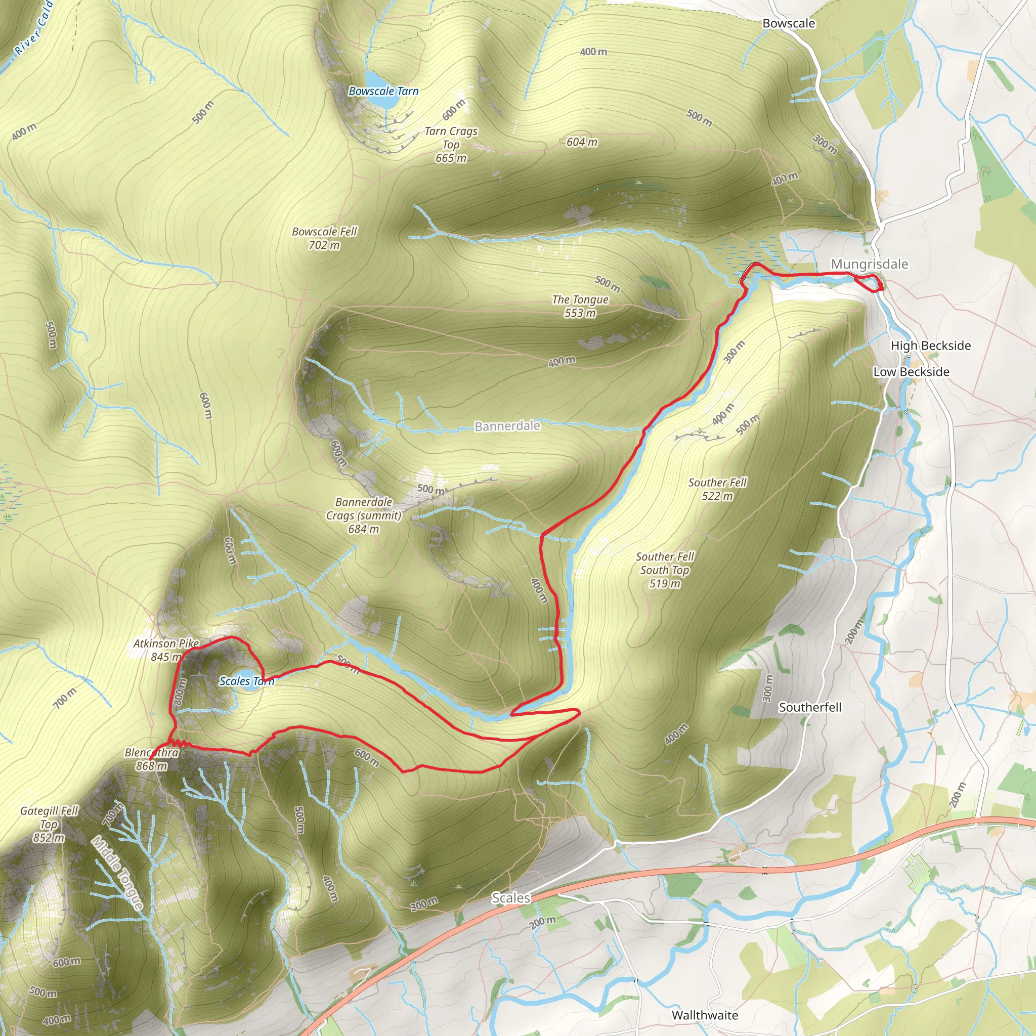
Starting near Westmorland and Furness, England, the Scales Tarn and Blencathra Loop is a captivating 15 km (approximately 9.3 miles) trail with an elevation gain of around 800 meters (2,625 feet). This loop trail is rated as medium difficulty, making it suitable for hikers with a moderate level of fitness and some experience in hill walking.
Getting There
To reach the trailhead, you can drive or use public transport. If driving, head towards the village of Mungrisdale, where parking is available. For those using public transport, the nearest significant landmark is Penrith Railway Station. From Penrith, you can take a local bus or taxi to Mungrisdale, which is about 12 miles (19 km) away.
Trail Overview
The trail begins near Mungrisdale and quickly ascends towards Scales Tarn, a serene mountain lake nestled beneath the imposing Blencathra. The initial part of the hike involves a steady climb, gaining approximately 300 meters (984 feet) in the first 3 km (1.9 miles). The path is well-trodden but can be rocky and uneven, so sturdy hiking boots are recommended.
Scales Tarn
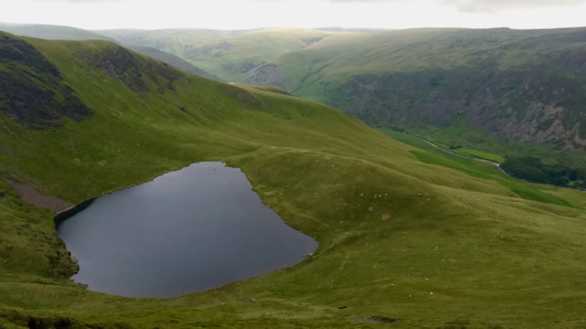
At around the 4 km (2.5 miles) mark, you'll reach Scales Tarn, a picturesque spot perfect for a short rest. The tarn is surrounded by rugged terrain and offers stunning views of the surrounding fells. This area is also rich in wildlife; keep an eye out for red deer and various bird species such as peregrine falcons and red grouse.
Ascent to Blencathra
From Scales Tarn, the trail becomes steeper as you make your way up to Blencathra, also known as Saddleback. This section involves an elevation gain of about 400 meters (1,312 feet) over 2 km (1.2 miles). The path can be narrow and exposed in places, so caution is advised, especially in wet or windy conditions. The summit of Blencathra offers panoramic views of the Lake District, including Derwentwater and the distant peaks of Skiddaw and Helvellyn.
Historical Significance
Blencathra has a rich history, with its name derived from the Old Norse "Blenk" meaning "top" and "Cathra" meaning "seat." The mountain has been a significant landmark for centuries and is often mentioned in local folklore and literature. The area around Mungrisdale also has historical significance, with remnants of ancient settlements and Roman roads.
Descent and Return
The descent from Blencathra takes you along a ridge known as Halls Fell, which offers spectacular views but requires careful navigation. The path here is rocky and can be slippery, so take your time. After descending Halls Fell, the trail levels out as you make your way back towards Mungrisdale, completing the loop. This final section is about 6 km (3.7 miles) and involves a gentle descent of approximately 100 meters (328 feet).
Navigation and Safety
Given the varied terrain and potential for rapidly changing weather conditions, it's advisable to use a reliable navigation tool like HiiKER to stay on track. Ensure you have a map, compass, and sufficient supplies, including water, snacks, and a first aid kit. Mobile phone reception can be patchy, so inform someone of your plans before setting out.
Flora and Fauna
The trail passes through diverse habitats, from lowland meadows to high-altitude heathlands. In spring and summer, the area is adorned with wildflowers such as heather, bilberry, and various grasses. Wildlife enthusiasts may spot red squirrels, badgers, and a variety of bird species, making this hike a rewarding experience for nature lovers.
This loop trail offers a blend of natural beauty, historical intrigue, and physical challenge, making it a must-do for hikers exploring the Lake District.
What to expect?
Activity types
Comments and Reviews
User comments, reviews and discussions about the Scales Tarn and Blencathra Loop - Mungrisdale, England.
4.5
average rating out of 5
4 rating(s)

