Buck Pike, Dow Crag, Old Man of Coniston, Brim Fell and Levers Water Loop
Download
Preview
Add to list
More
12.9 km
~4 hrs 3 min
888 m
Loop
“The Buck Pike to Levers Water Loop offers stunning vistas, rugged terrain, and rich historical significance.”
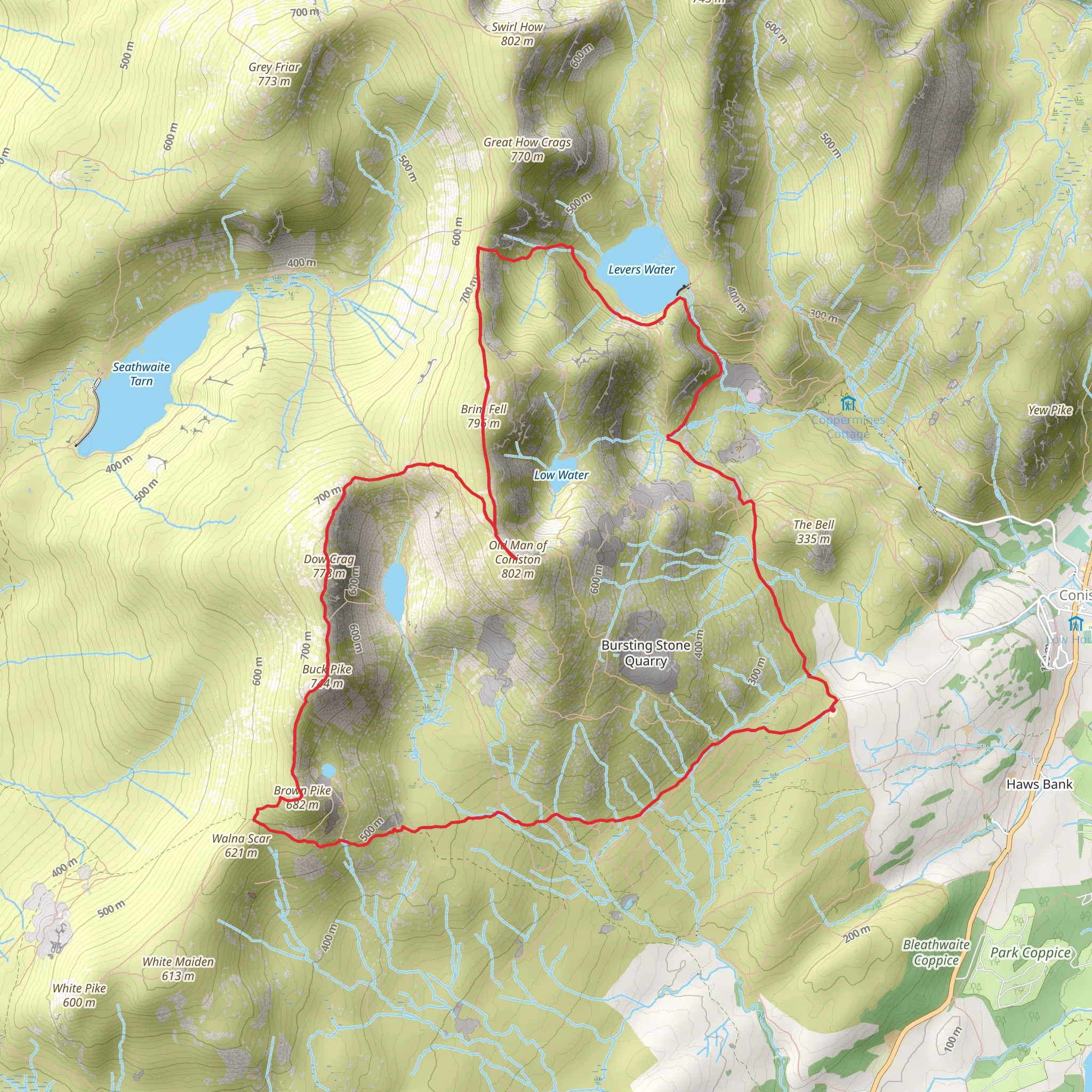
Starting your adventure near Westmorland and Furness, England, the Buck Pike, Dow Crag, Old Man of Coniston, Brim Fell, and Levers Water Loop is a captivating 13 km (8 miles) loop trail with an elevation gain of approximately 800 meters (2,625 feet). This medium-difficulty hike offers a blend of rugged terrain, stunning vistas, and historical significance, making it a must-experience for avid hikers.
Getting There To reach the trailhead, you can drive or use public transport. If driving, aim for the village of Coniston, where parking is available near the Coniston Sports and Social Centre. For public transport, take a train to Windermere and then a bus to Coniston. The bus stop is conveniently located near the trailhead.
Trail Overview The loop begins with a gradual ascent towards Buck Pike. The initial stretch is relatively gentle, allowing you to warm up before the more challenging sections. As you climb, you'll be treated to panoramic views of the Coniston Water and the surrounding fells.
#### Buck Pike to Dow Crag At around 3 km (1.9 miles) into the hike, you'll reach Buck Pike. The terrain here becomes rockier, so watch your footing. The path then leads you to Dow Crag, a prominent feature known for its steep cliffs and dramatic scenery. This section is particularly popular with rock climbers, so you might see some in action.
#### Dow Crag to Old Man of Coniston Continuing from Dow Crag, the trail ascends towards the Old Man of Coniston, one of the most iconic peaks in the Lake District. At approximately 5 km (3.1 miles) into the hike, you'll reach the summit, standing at 803 meters (2,635 feet). The views from here are breathtaking, offering a 360-degree panorama of the Lake District, including Coniston Water, Morecambe Bay, and even the Isle of Man on a clear day.
#### Old Man of Coniston to Brim Fell From the Old Man of Coniston, the trail descends slightly before climbing again towards Brim Fell. This section is less steep but still requires careful navigation. Brim Fell, at 796 meters (2,612 feet), offers another excellent vantage point. The terrain here is grassy and less rocky, providing a bit of a respite.
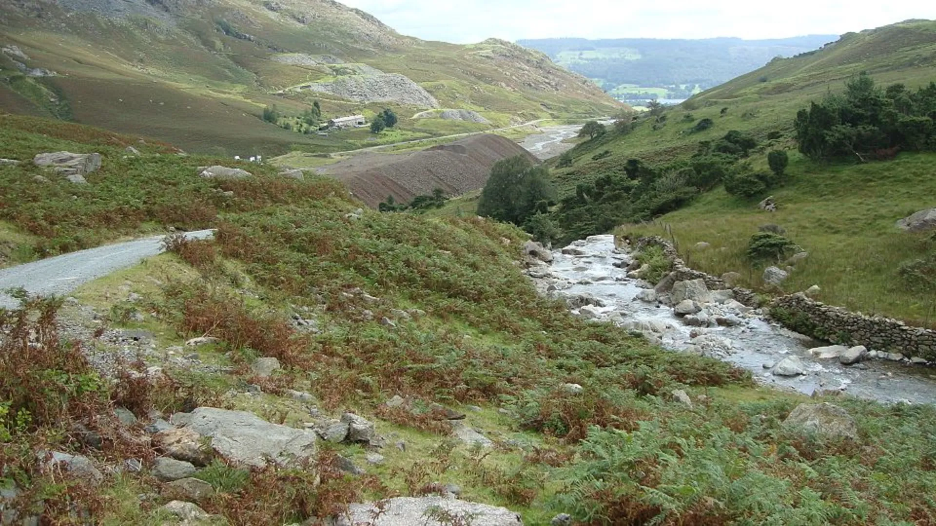
#### Brim Fell to Levers Water The descent from Brim Fell towards Levers Water is gradual and scenic. Levers Water is a serene tarn surrounded by rugged hills, making it a perfect spot for a break. The area is rich in mining history, with remnants of old copper mines visible along the path. This section is about 9 km (5.6 miles) into the hike.
Wildlife and Flora The trail is home to a variety of wildlife, including red deer, foxes, and numerous bird species like the peregrine falcon and the golden eagle. The flora is equally diverse, with heather, bilberry, and various wildflowers adding splashes of color to the landscape.
Navigation and Safety Given the varied terrain and potential for sudden weather changes, it's crucial to have reliable navigation tools. HiiKER is an excellent app for this trail, providing detailed maps and real-time updates. Ensure you have appropriate gear, including sturdy hiking boots, weather-appropriate clothing, and sufficient water and snacks.
Historical Significance The Coniston area is steeped in history, particularly related to its mining past. The Old Man of Coniston was once a hub for copper mining, and you can still see the remnants of old mine shafts and buildings. The trail also passes by the ruins of old slate quarries, offering a glimpse into the region's industrial heritage.
This loop trail offers a perfect blend of natural beauty, challenging terrain, and historical intrigue, making it an unforgettable hiking experience.
What to expect?
Activity types
Comments and Reviews
User comments, reviews and discussions about the Buck Pike, Dow Crag, Old Man of Coniston, Brim Fell and Levers Water Loop, England.
4.5
average rating out of 5
4 rating(s)
