Bowscale Tarn, Bowscale Fell and Bannerdale Crags Loop from Mungrisdale
Download
Preview
Add to list
More
12.1 km
~3 hrs 25 min
602 m
Loop
“Explore lush fields, serene tarns, and dramatic crags on this 12 km Westmorland and Furness loop trail.”
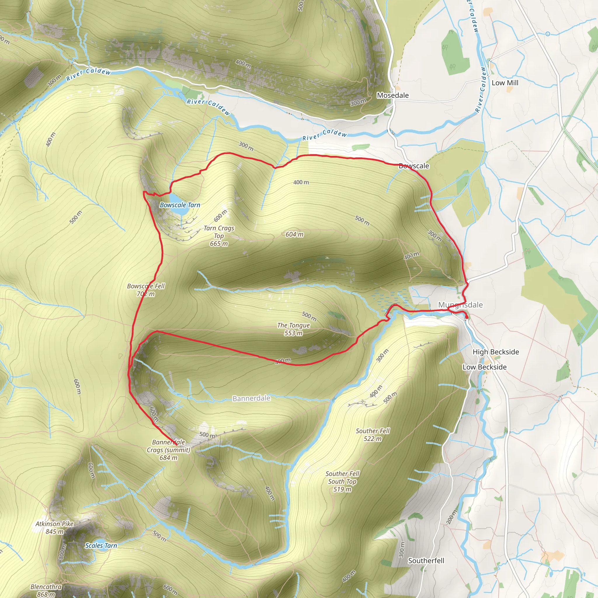
Starting near the quaint village of Mungrisdale in Westmorland and Furness, England, this 12 km (7.5 miles) loop trail offers a moderately challenging hike with an elevation gain of approximately 600 meters (1,970 feet). The trailhead is easily accessible by car, with parking available in Mungrisdale. For those using public transport, the nearest significant town with bus services is Penrith, from where you can take a taxi or local bus to Mungrisdale.
Initial Ascent and Bowscale Tarn The hike begins with a gentle ascent through lush green fields and past traditional stone walls, typical of the English countryside. After about 2 km (1.2 miles), you will reach Bowscale Tarn, a serene glacial lake nestled in a natural amphitheater. The tarn is a great spot for a short break, offering picturesque views and a chance to spot local wildlife such as red squirrels and various bird species.
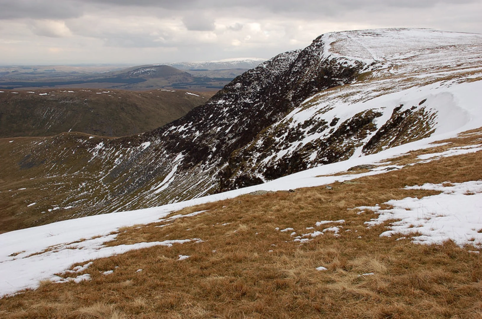
Climbing Bowscale Fell From Bowscale Tarn, the trail becomes steeper as you ascend Bowscale Fell. This section covers approximately 3 km (1.9 miles) and gains around 300 meters (985 feet) in elevation. The path is well-trodden but can be rocky and uneven in places, so sturdy hiking boots are recommended. As you climb, you'll be rewarded with expansive views of the surrounding fells and valleys. On a clear day, you can see as far as the Pennines to the east.
Bannerdale Crags After reaching the summit of Bowscale Fell, the trail continues along a ridge towards Bannerdale Crags. This section is about 2 km (1.2 miles) long and relatively flat, making it a pleasant walk with panoramic views. Bannerdale Crags is known for its dramatic cliffs and unique geological formations. The crags are also a popular spot for birdwatching, with species such as peregrine falcons and kestrels often seen soaring above.
Descent and Return to Mungrisdale The descent from Bannerdale Crags back to Mungrisdale is approximately 5 km (3.1 miles) and involves a gradual downhill walk through open moorland and grassy paths. This section offers a different perspective of the landscape, with views of the River Glenderamackin winding through the valley below. Keep an eye out for grazing sheep and the occasional deer.
Historical Significance The area around Mungrisdale has a rich history, with evidence of ancient settlements and Roman roads. The village itself dates back to medieval times and features traditional Cumbrian architecture. The landscape has been shaped by centuries of farming and mining, adding a layer of historical intrigue to your hike.
Navigation and Safety Given the varied terrain and potential for rapidly changing weather conditions, it's advisable to use a reliable navigation tool like HiiKER to stay on track. Ensure you carry a map, compass, and sufficient water and snacks. Weather in the Lake District can be unpredictable, so pack layers and waterproof gear.
This loop trail offers a blend of natural beauty, wildlife, and historical significance, making it a rewarding experience for hikers of all levels.
What to expect?
Activity types
Comments and Reviews
User comments, reviews and discussions about the Bowscale Tarn, Bowscale Fell and Bannerdale Crags Loop from Mungrisdale, England.
4.57
average rating out of 5
7 rating(s)
