Download
Preview
Add to list
More
9.7 km
~2 hrs 55 min
595 m
Loop
“Embark on a scenic, moderately challenging 10 km hike from Mungrisdale to Bowscale Tarn and Fell, enriched with folklore and breathtaking views.”
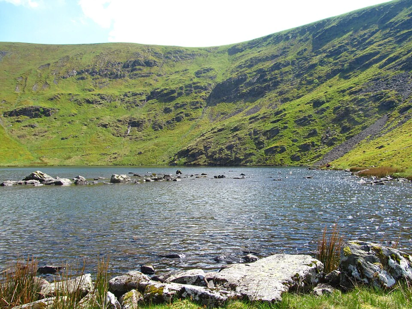
Starting near the quaint village of Mungrisdale in Westmorland and Furness, England, the Bowscale Tarn and Bowscale Fell Loop is a captivating 10 km (6.2 miles) journey with an elevation gain of approximately 500 meters (1,640 feet). This loop trail offers a medium difficulty rating, making it suitable for moderately experienced hikers.### Getting There To reach the trailhead, you can drive to Mungrisdale, where limited parking is available. If you prefer public transport, the nearest major town is Penrith, which is well-connected by train. From Penrith, you can take a local bus or taxi to Mungrisdale, which is about 12 miles (19 km) away.### Trail Overview The trail begins in Mungrisdale, a picturesque village that sets the tone for the scenic beauty ahead. As you start your hike, you'll follow a well-marked path that gradually ascends towards Bowscale Tarn. The initial 2 km (1.2 miles) of the trail are relatively gentle, allowing you to warm up as you take in the lush greenery and rolling hills.### Bowscale Tarn At around the 2 km (1.2 miles) mark, you'll reach Bowscale Tarn, a serene glacial lake nestled in a natural amphitheater. The tarn is a perfect spot for a short break, offering stunning reflections of the surrounding fells on a calm day. Legend has it that the tarn is home to two immortal fish, adding a touch of folklore to your visit.### Ascending Bowscale Fell From Bowscale Tarn, the trail becomes steeper as you ascend Bowscale Fell. This section covers approximately 3 km (1.9 miles) and involves an elevation gain of about 300 meters (984 feet). The path is well-trodden but can be rocky and uneven, so sturdy hiking boots are recommended. As you climb, you'll be rewarded with panoramic views of the Northern Fells and the Eden Valley.### Summit and Descent Reaching the summit of Bowscale Fell, at an elevation of 702 meters (2,303 feet), you'll find a cairn marking the highest point. Take a moment to enjoy the expansive views, which on a clear day, can stretch as far as the Scottish Borders. The descent begins from here, following a different path that loops back towards Mungrisdale. This section is about 5 km (3.1 miles) and gradually descends, offering a more relaxed pace as you make your way back.### Flora and Fauna Throughout the hike, keep an eye out for the diverse flora and fauna. The area is home to red squirrels, roe deer, and a variety of bird species, including skylarks and buzzards. The vegetation ranges from heather and bracken on the higher slopes to wildflowers and grasses in the lower areas.### Historical Significance The region around Bowscale Tarn and Bowscale Fell is steeped in history. The tarn itself has been a subject of local folklore for centuries. Additionally, the surrounding fells have been used for sheep farming for generations, and you may encounter traditional dry stone walls and ancient farmsteads along the way.### Navigation For navigation, it is highly recommended to use the HiiKER app, which provides detailed maps and real-time updates to ensure you stay on the right path. The trail is generally well-marked, but having a reliable navigation tool can enhance your hiking experience.This loop trail offers a blend of natural beauty, moderate challenge, and historical intrigue, making it a rewarding hike for those looking to explore the Northern Fells of the Lake District.

What to expect?
Activity types
Comments and Reviews
User comments, reviews and discussions about the Bowscale Tarn and Bowscale Fell Loop, England.
5.0
average rating out of 5
2 rating(s)