Download
Preview
Add to list
More
9.9 km
~2 hrs 34 min
365 m
Loop
“The Belle Grange Coppice and Blelham Tarn Loop offers a scenic 10 km hike rich in beauty and history.”
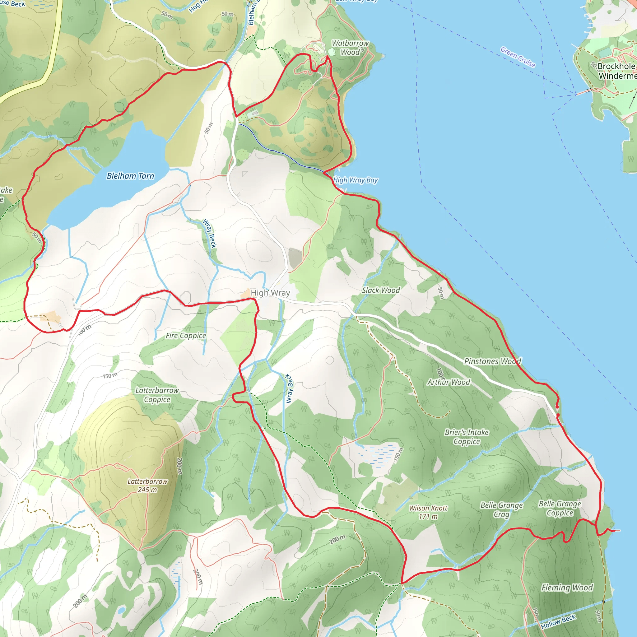
Starting near Westmorland and Furness in England, the Belle Grange Coppice and Blelham Tarn Loop is a captivating 10 km (6.2 miles) trail with an elevation gain of approximately 300 meters (984 feet). This loop trail is rated as medium difficulty, making it suitable for moderately experienced hikers.### Getting There To reach the trailhead, you can drive or use public transport. If driving, set your GPS to the vicinity of Belle Grange, near the western shore of Windermere. For those using public transport, the nearest significant landmark is the town of Ambleside. From Ambleside, you can take a local bus towards Hawkshead and alight at the stop closest to Belle Grange.### Trail Overview The trail begins with a gentle ascent through Belle Grange Coppice, a serene woodland area. As you navigate through the coppice, you'll be surrounded by a variety of native trees, including oak, ash, and birch. The forest floor is often carpeted with bluebells in the spring, creating a picturesque start to your hike.### Key Landmarks and Points of Interest
Belle Grange Coppice
Approximately 2 km (1.2 miles) into the hike, you'll reach the heart of Belle Grange Coppice. This area is known for its rich biodiversity. Keep an eye out for red squirrels and a variety of bird species, including woodpeckers and nuthatches.#### Blelham Tarn Continuing on, around the 5 km (3.1 miles) mark, you'll arrive at Blelham Tarn. This tranquil tarn is a perfect spot for a mid-hike break. The tarn is surrounded by reed beds and is a haven for waterfowl such as ducks and herons. The reflection of the surrounding hills on the water's surface is particularly stunning on a clear day.### Historical Significance The region around Belle Grange and Blelham Tarn is steeped in history. The area was once part of the extensive hunting grounds of the medieval lords of Furness Abbey. Remnants of ancient stone walls and boundary markers can still be seen along the trail, offering a glimpse into the past.### Navigation and Safety The trail is well-marked, but it's always wise to have a reliable navigation tool. HiiKER is an excellent app for this purpose, providing detailed maps and real-time location tracking. The terrain can be uneven and muddy, especially after rain, so sturdy hiking boots are recommended. ### Final Stretch As you loop back towards the starting point, the trail descends gently through open fields and pastures. The final 3 km (1.9 miles) offer panoramic views of the surrounding countryside and Windermere in the distance. This section is relatively easy, allowing you to enjoy the scenery as you make your way back to the trailhead.This loop trail offers a perfect blend of natural beauty, wildlife, and historical intrigue, making it a rewarding hike for those looking to explore the picturesque landscapes of Westmorland and Furness.
What to expect?
Activity types
Comments and Reviews
User comments, reviews and discussions about the Belle Grange Coppice and Blelham Tarn Loop, England.
4.25
average rating out of 5
4 rating(s)

