Download
Preview
Add to list
More
14.8 km
~3 hrs 31 min
345 m
Loop
“Experience the serene beauty and historical landmarks of the South Downs on the Keymer to Lower Standean Loop.”
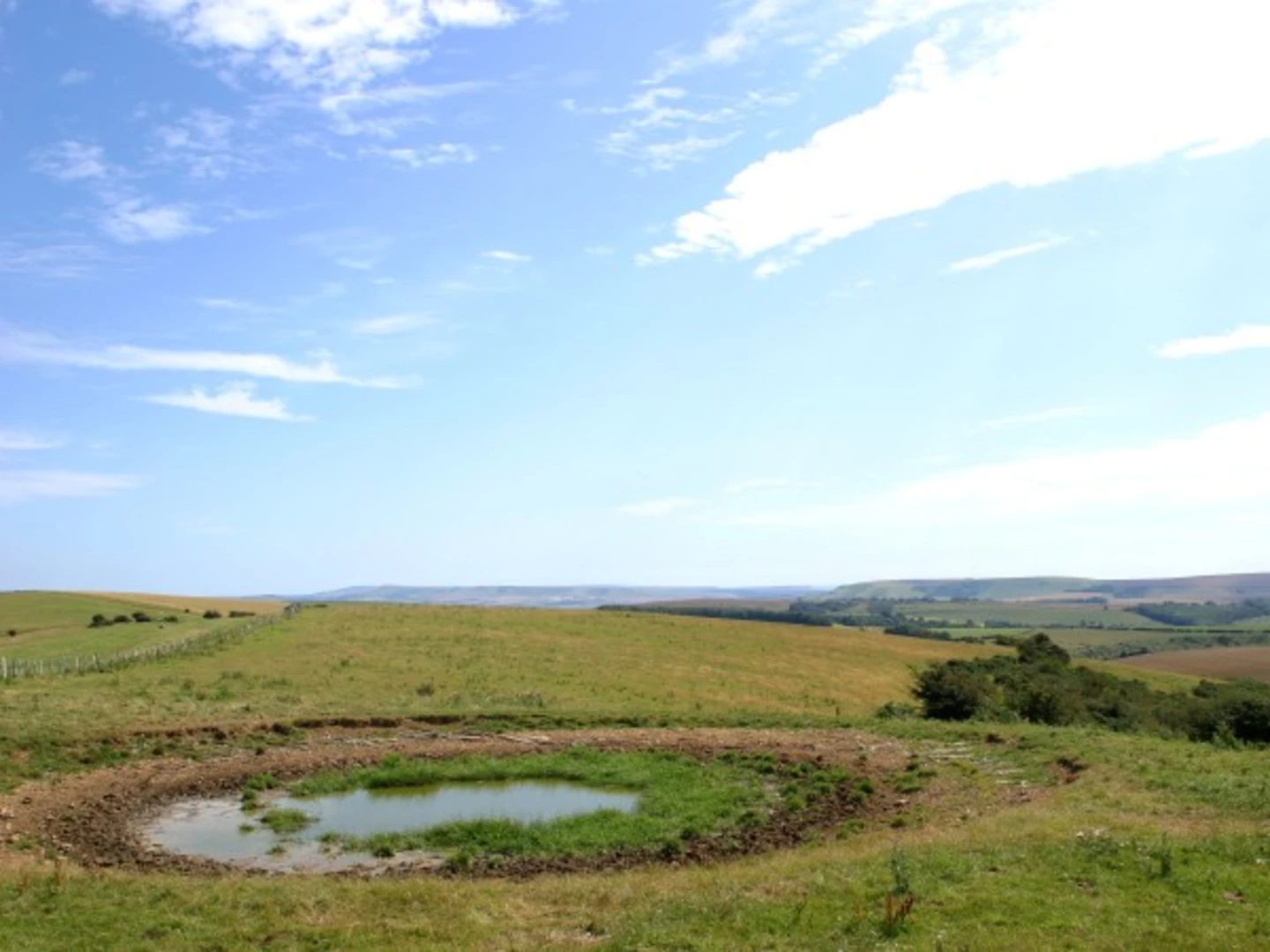
Starting near the charming village of Keymer in West Sussex, England, the Keymer to Lower Standean Loop is a delightful 15 km (approximately 9.3 miles) trail that offers a moderate challenge with an elevation gain of around 300 meters (about 984 feet). This loop trail is perfect for those looking to experience the serene beauty of the South Downs National Park.
Getting There To reach the trailhead, you can either drive or use public transport. If driving, you can park near Keymer, which is easily accessible from the A273. For those using public transport, the nearest train station is Hassocks, which is just a short walk from Keymer. From London, you can take a direct train to Hassocks, making it a convenient option for city dwellers looking for a countryside escape.
Trail Navigation For navigation, it is highly recommended to use HiiKER, which provides detailed maps and real-time updates to ensure you stay on track throughout your hike.
Trail Highlights
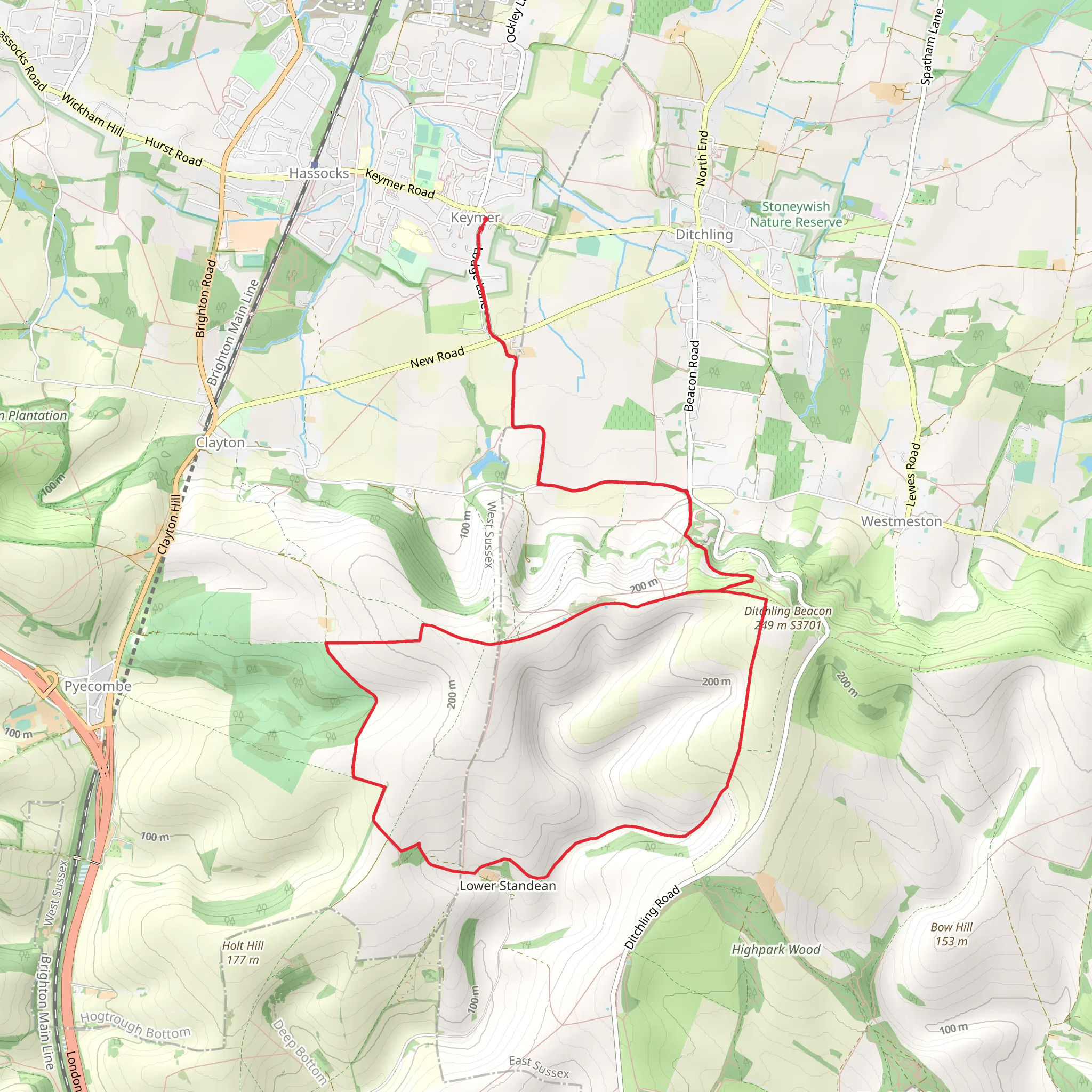
#### Keymer to Ditchling Beacon Starting from Keymer, the trail initially takes you through picturesque farmland and gently rolling hills. After about 3 km (1.9 miles), you will begin to ascend towards Ditchling Beacon, one of the highest points in the South Downs. The climb is gradual but steady, offering panoramic views of the surrounding countryside as you gain elevation. Ditchling Beacon stands at 248 meters (814 feet) and is a significant landmark with historical importance, having been used as a signaling point during the Spanish Armada in 1588.
#### Ditchling Beacon to Lower Standean From Ditchling Beacon, the trail continues along the South Downs Way, a historic route that has been used for centuries. This section is relatively flat and allows you to enjoy the expansive views of the rolling hills and valleys. After approximately 5 km (3.1 miles), you will reach the small hamlet of Lower Standean. This area is rich in wildlife, so keep an eye out for grazing sheep, skylarks, and the occasional red kite soaring overhead.
#### Lower Standean to Keymer The return leg of the loop takes you through a mix of open fields and wooded areas. The descent is gentle, allowing you to take in the lush greenery and the tranquil atmosphere. After about 4 km (2.5 miles), you will pass through the village of Clayton, where you can see the historic Clayton Windmills, also known as "Jack and Jill." These windmills date back to the 19th century and are a fascinating glimpse into the region's agricultural past.
Flora and Fauna The trail is abundant with diverse flora and fauna. In spring and summer, the meadows are awash with wildflowers such as cowslips, orchids, and buttercups. The woodlands are home to a variety of bird species, including woodpeckers, nuthatches, and warblers. If you're lucky, you might even spot a deer or two in the more secluded areas.
Practical Tips - Wear sturdy hiking boots, as some sections of the trail can be muddy, especially after rain. - Bring plenty of water and snacks, as there are limited facilities along the route. - Check the weather forecast before you go, as the South Downs can be quite exposed and windy. - Use HiiKER for real-time navigation and updates on trail conditions.
This loop trail offers a perfect blend of natural beauty, historical landmarks, and a moderate physical challenge, making it an ideal day hike for outdoor enthusiasts.
What to expect?
Activity types
Comments and Reviews
User comments, reviews and discussions about the Keymer to Lower Standean Loop, England.
4.5
average rating out of 5
2 rating(s)

