Download
Preview
Add to list
More
6.9 km
~1 hrs 26 min
29 m
Out and Back
“Explore the flat, tidal causeway to Hilbre Island near West Kirby for a unique, wildlife-rich adventure.”
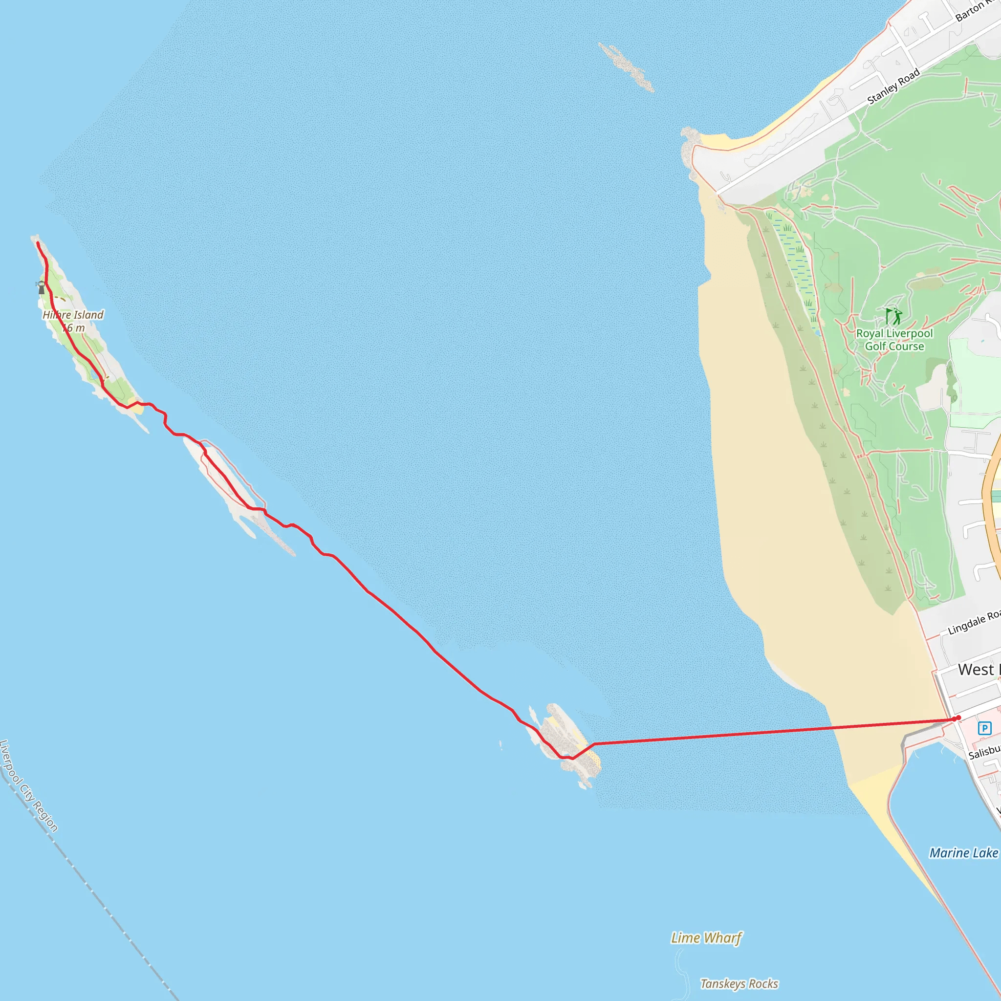
Starting near West Kirby, England, this 7 km (4.35 miles) out-and-back trail offers a unique hiking experience with no elevation gain, making it accessible for a wide range of hikers. The trailhead is conveniently located near the West Kirby Marine Lake, a popular spot for water sports and leisurely strolls.
Getting There
To reach the trailhead, you can take a train to West Kirby Station, which is well-connected via the Merseyrail network. From the station, it's a short 10-minute walk to the starting point near the Marine Lake. If you're driving, there are several parking options available near the lake, including a large car park adjacent to the West Kirby Sailing Club.
Trail Overview
The trail primarily follows a causeway that leads to Hilbre Island, a small island in the Dee Estuary. The causeway is only accessible during low tide, so it's crucial to check tide times before setting out. The entire hike is flat, making it suitable for families and those looking for a leisurely walk.
Points of Interest
#### Marine Lake
At the beginning of your hike, you'll pass by the West Kirby Marine Lake. This man-made lake is a hub for sailing, windsurfing, and kayaking. It's a great spot to take in some local activities or even try your hand at a water sport before or after your hike.
#### Little Eye and Middle Eye
As you make your way along the causeway, you'll first encounter Little Eye, a small rocky outcrop. This is a good spot to take a break and enjoy the views of the estuary. Continuing on, you'll reach Middle Eye, another small island that offers a closer look at the unique geology of the area.
#### Hilbre Island
The main attraction of this hike is Hilbre Island itself. The island is a designated Local Nature Reserve, home to a variety of bird species, including oystercatchers, curlews, and redshanks. Seals can often be spotted basking on the sandbanks around the island, so bring binoculars for a closer look.
Historical Significance
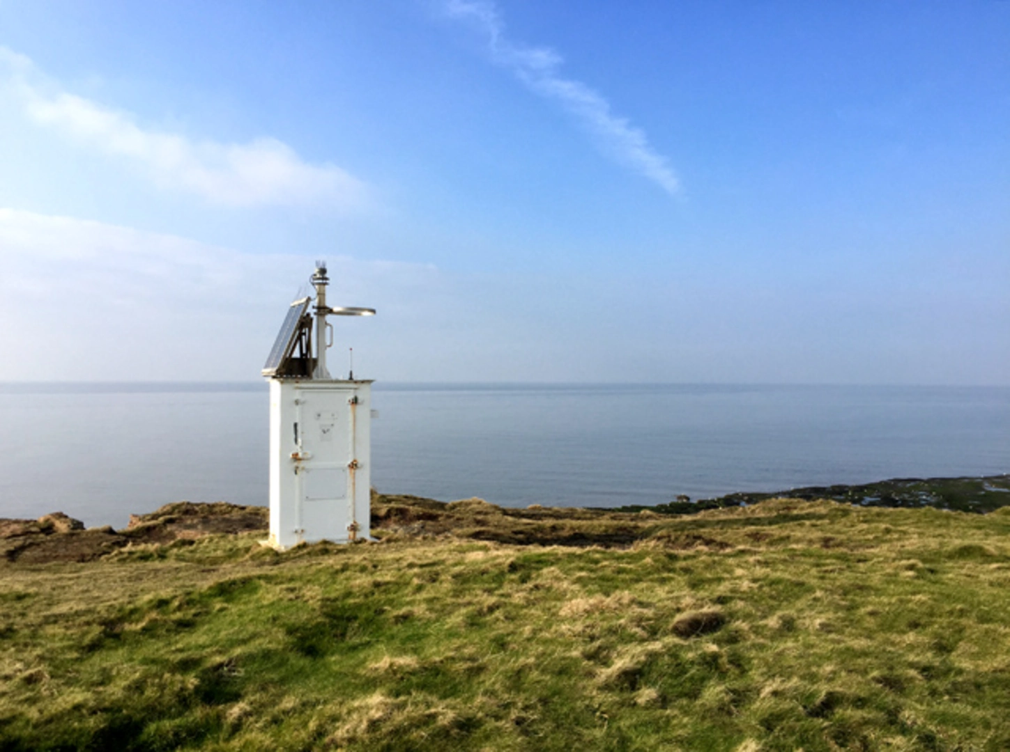
Hilbre Island has a rich history dating back to the Viking era. The name "Hilbre" is derived from the Old Norse words "hild" (battle) and "ey" (island), indicating its historical importance. The island also features the remains of a 19th-century telegraph station, which played a crucial role in maritime communication.
Navigation and Safety
Given the tidal nature of the causeway, it's essential to use a reliable navigation tool like HiiKER to monitor your progress and ensure you return before the tide comes in. The trail is well-marked, but the flat terrain can be deceptive, and it's easy to lose track of time.
Wildlife and Flora
The Dee Estuary is a haven for wildlife. In addition to the birdlife, the area is rich in marine flora, including various types of seaweed and salt-tolerant plants. The estuary's unique ecosystem supports a diverse range of species, making it a fascinating area for nature enthusiasts.
Final Tips
- Check tide times before you go. - Bring binoculars for bird and seal watching. - Wear waterproof footwear, as the causeway can be wet and slippery. - Pack a picnic to enjoy on Hilbre Island, but remember to take all your litter back with you.
This trail offers a blend of natural beauty, historical intrigue, and wildlife observation, making it a rewarding hike for those prepared to navigate its unique tidal challenges.
What to expect?
Activity types
Comments and Reviews
User comments, reviews and discussions about the Hibre Island, England.
4.4
average rating out of 5
5 rating(s)

