Download
Preview
Add to list
More
25.7 km
~1 day 0 hrs
227 m
Loop
“The Streatley to Wallingford Loop is a scenic, historical 26 km trek through England's charming countryside.”
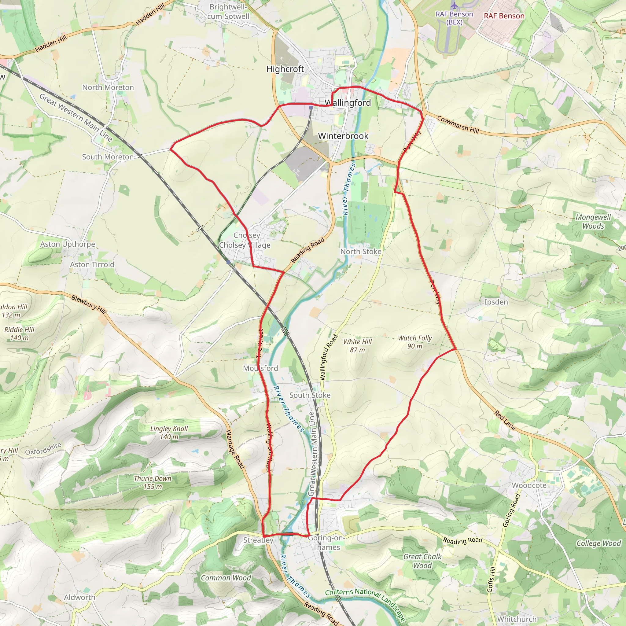
Starting near West Berkshire, England, the Streatley to Wallingford Loop via River Thames is a picturesque 26 km (16 miles) loop trail with an elevation gain of around 200 meters (656 feet). This medium-difficulty trail offers a blend of natural beauty, historical landmarks, and charming English countryside.
Getting There To reach the trailhead, you can drive to Streatley, where parking is available near the village center. For those using public transport, the nearest railway station is Goring & Streatley, which is well-connected to London Paddington. From the station, it's a short walk to the trailhead.
Trail Overview The trail begins in the quaint village of Streatley, nestled on the banks of the River Thames. As you set off, you'll immediately be greeted by the serene waters of the Thames, which will accompany you for a significant portion of the hike. The initial stretch is relatively flat, making it a gentle start.
Key Landmarks and Sections
#### Streatley to Moulsford Approximately 5 km (3 miles) into the hike, you'll reach the village of Moulsford. This section is characterized by lush riverside meadows and occasional glimpses of local wildlife, including swans and herons. Moulsford itself is a charming village with historical significance, featuring the Moulsford Railway Bridge, designed by Isambard Kingdom Brunel.
#### Moulsford to Wallingford Continuing along the Thames Path, you'll cover another 6 km (3.7 miles) to reach Wallingford. This historic market town is rich in history, with Wallingford Castle ruins offering a glimpse into the past. The castle, once a royal residence, played a significant role during the English Civil War. Wallingford also has several quaint cafes and pubs, perfect for a mid-hike refreshment.
#### Wallingford to South Stoke Leaving Wallingford, the trail heads south for about 7 km (4.3 miles) towards South Stoke. This section involves a gentle ascent, providing panoramic views of the surrounding countryside. South Stoke is a picturesque village with traditional thatched cottages and a beautiful church, St. Andrew's, dating back to the 13th century.
#### South Stoke to Streatley The final leg of the journey is a 8 km (5 miles) stretch back to Streatley. This part of the trail takes you through open fields and woodland areas, offering a variety of landscapes. The elevation gain is more noticeable here, but the effort is rewarded with stunning views of the Chiltern Hills.
Navigation and Safety For navigation, it's highly recommended to use HiiKER, which provides detailed maps and real-time updates. The trail is well-marked, but having a reliable navigation tool ensures you stay on track.
Flora and Fauna Throughout the hike, you'll encounter a diverse range of flora and fauna. The riverside sections are particularly rich in birdlife, while the woodland areas are home to deer and other small mammals. Seasonal wildflowers add a splash of color to the landscape, making it a visually rewarding experience.
Historical Significance The trail is steeped in history, from the ancient village of Streatley to the medieval market town of Wallingford. The presence of historical landmarks like Wallingford Castle and the Moulsford Railway Bridge adds a layer of intrigue to the hike, making it not just a physical journey but a historical exploration as well.
This trail offers a perfect blend of natural beauty, historical landmarks, and moderate physical challenge, making it an ideal choice for hikers looking to experience the best of the English countryside.
What to expect?
Activity types
Comments and Reviews
User comments, reviews and discussions about the Streatley to Wallingford Loop via River Thames, England.
4.0
average rating out of 5
1 rating(s)

