Download
Preview
Add to list
More
6.0 km
~1 hrs 15 min
33 m
Out and Back
“Explore the scenic and historic Calder and Hebble Navigation trail, perfect for all hiking levels.”
Starting near Wakefield, England, the Calder and Hebble Navigation from Horbury Bridge is an inviting 6 km (approximately 3.7 miles) out-and-back trail with no significant elevation gain, making it accessible for a wide range of hikers. The trailhead is conveniently located near Horbury Bridge, which can be reached by car or public transport. If you're driving, you can park near the Horbury Bridge area. For those using public transport, the nearest train station is Wakefield Westgate, from where you can take a local bus to Horbury Bridge.
Trail Overview
The trail follows the historic Calder and Hebble Navigation, a canal system that dates back to the 18th century. This waterway was crucial for transporting goods during the Industrial Revolution, and remnants of this era can still be seen along the route. As you walk, you'll encounter a series of locks and weirs, which are fascinating examples of early engineering.
Landmarks and Points of Interest
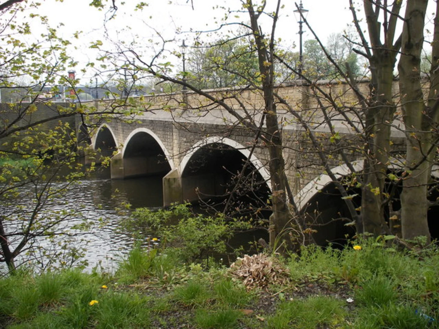
Approximately 1 km (0.6 miles) into the hike, you'll come across the Horbury Bridge itself, a charming stone structure that offers picturesque views of the canal. Continuing along the path, you'll pass through lush greenery and wooded areas, providing ample opportunities for birdwatching. Keep an eye out for kingfishers and herons, which are commonly spotted in this region.
At around the 3 km (1.8 miles) mark, you'll reach the turnaround point near the village of Thornhill Lees. Here, you can take a moment to explore the local area or simply enjoy a picnic by the water before heading back.
Navigation and Safety
The trail is well-marked and relatively flat, making navigation straightforward. However, it's always a good idea to have a reliable navigation tool like HiiKER to ensure you stay on track. The path can be muddy after rain, so waterproof footwear is recommended.
Historical Significance
The Calder and Hebble Navigation played a vital role in the development of the surrounding towns and industries. As you walk, you'll notice several historical plaques and information boards that provide insights into the canal's history and its impact on the region.
Getting There
To reach the trailhead, if you're driving, set your GPS to Horbury Bridge, Wakefield. For public transport users, take a train to Wakefield Westgate and then a local bus to Horbury Bridge. The trailhead is easily accessible from the bus stop, making it a convenient option for those without a car.
This trail offers a blend of natural beauty, historical intrigue, and easy accessibility, making it a rewarding experience for hikers of all levels.

What to expect?
Activity types
Comments and Reviews
User comments, reviews and discussions about the Calder and Hebble Navigation from Horbury Bridge, England.
4.0
average rating out of 5
2 rating(s)