Download
Preview
Add to list
More
4.4 km
~1 hrs 17 min
242 m
Out and Back
“Hike The Wrekin via Telford T50 for stunning views, historical sites, and diverse wildlife in Shropshire.”
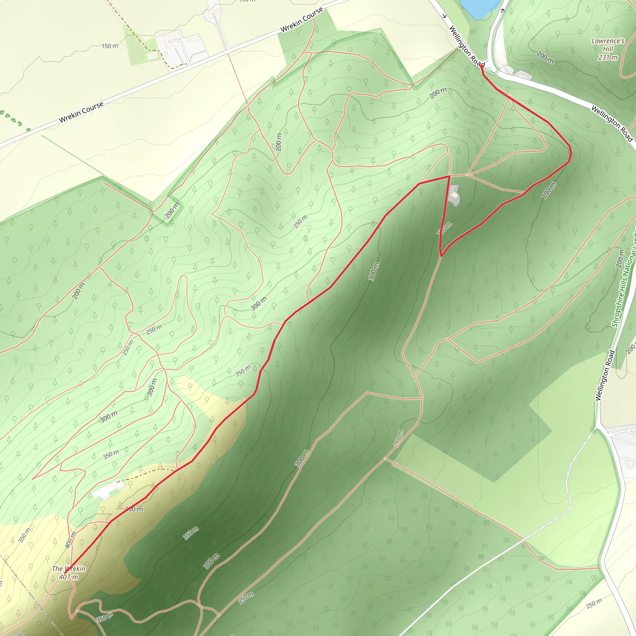
Starting your hike near Telford and Wrekin, England, the trailhead for this 4 km (2.5 miles) out-and-back journey is conveniently accessible by both car and public transport. If you're driving, you can park at the Ercall Wood Car Park, which is the nearest known address. For those using public transport, the Telford Central railway station is the closest major stop, and from there, you can take a local bus or taxi to the trailhead.
Trail Overview
The Wrekin via Telford T50 trail offers a moderate challenge with an elevation gain of approximately 200 meters (656 feet). The trail is well-marked and maintained, making it suitable for hikers with a moderate level of fitness. As you begin your ascent, you'll notice the path winding through a mix of deciduous woodland, providing ample shade and a serene atmosphere.
Significant Landmarks and Points of Interest
About 1 km (0.6 miles) into the hike, you'll encounter Halfway House, a small clearing that offers a brief respite and a chance to catch your breath. This spot is perfect for a quick snack or water break. Continuing on, the trail becomes steeper, and you'll start to notice the changing flora, with more coniferous trees appearing as you gain elevation.
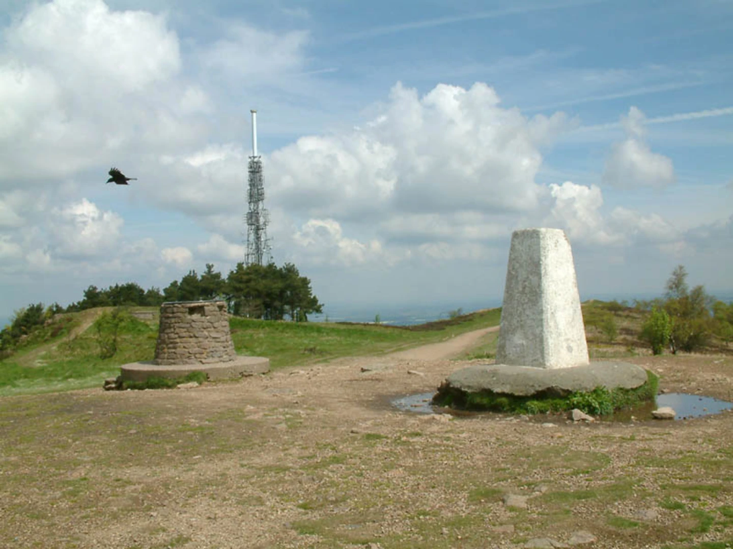
At approximately 2 km (1.2 miles), you'll reach the summit of The Wrekin. Here, you'll find the remnants of an Iron Age hill fort, known as The Wrekin Hillfort. This historical site offers a glimpse into the area's ancient past and provides a fascinating backdrop to your hike. The summit also features a trig point and a toposcope, which offers panoramic views of the surrounding Shropshire countryside. On a clear day, you can see as far as the Welsh mountains to the west and the Malvern Hills to the south.
Flora and Fauna
The Wrekin is home to a diverse range of wildlife. Keep an eye out for red kites soaring above and listen for the distinctive calls of woodpeckers echoing through the trees. The area is also rich in plant life, with bluebells carpeting the forest floor in spring and a variety of ferns and mosses adding to the lush, green landscape.
Navigation and Safety
To ensure you stay on track, it's recommended to use the HiiKER app, which provides detailed maps and real-time navigation. The trail is generally safe, but be cautious of uneven terrain and slippery sections, especially after rain. Proper hiking boots with good grip are advisable.
Getting Back
The return journey follows the same path, allowing you to enjoy the descent with a different perspective. The total round trip is around 4 km (2.5 miles), making it a manageable hike for a half-day outing.
Whether you're a history enthusiast, a nature lover, or simply looking for a rewarding hike with stunning views, The Wrekin via Telford T50 trail offers a little something for everyone.
What to expect?
Activity types
Comments and Reviews
User comments, reviews and discussions about the The Wrekin via Telford T50, England.
5.0
average rating out of 5
1 rating(s)

