Download
Preview
Add to list
More
5.5 km
~1 hrs 17 min
110 m
Point-to-Point
“The Holden Clough via Ashton to Oldham Greenway trail offers scenic views, historical landmarks, and moderate hiking challenges.”
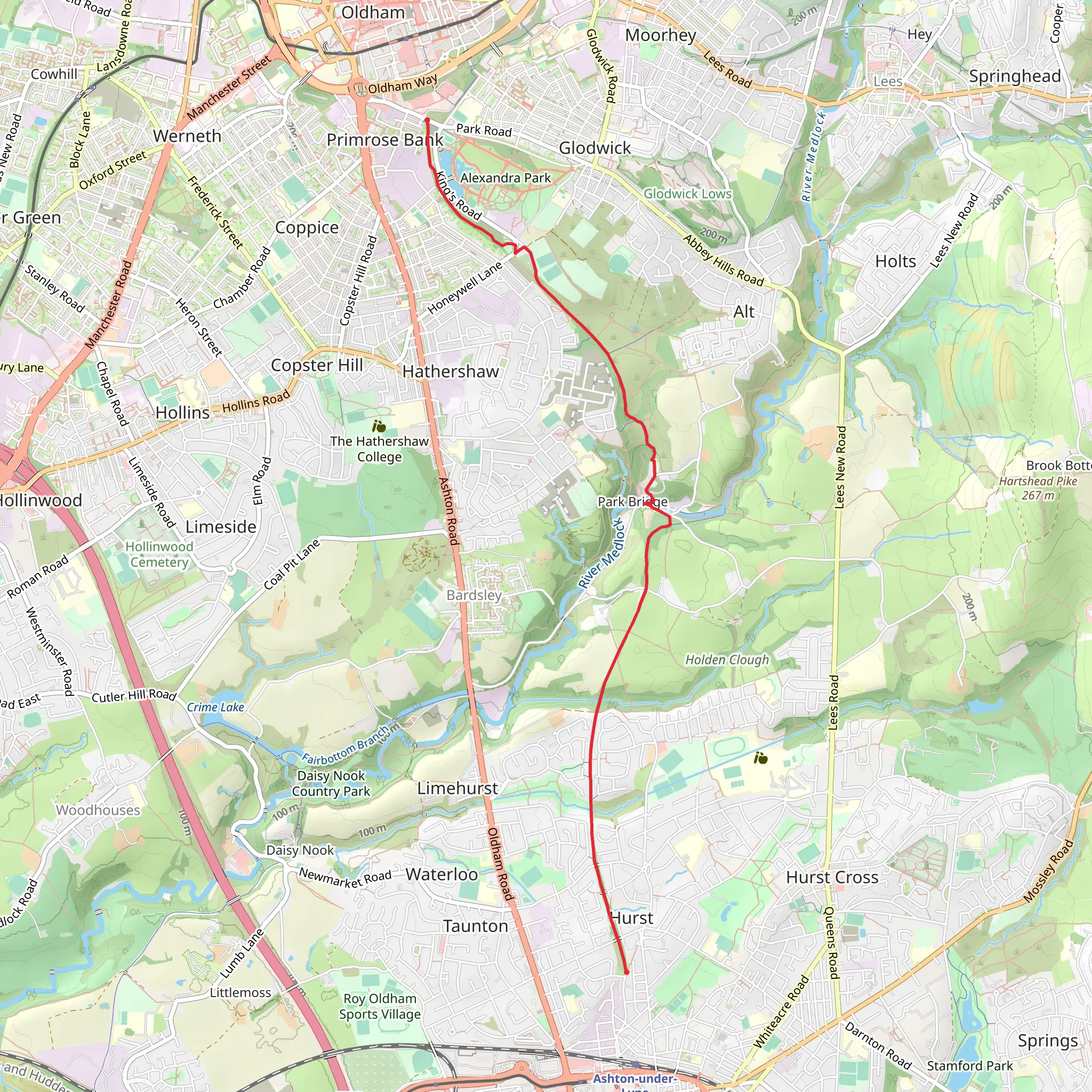
Starting near Tameside, England, the Holden Clough via Ashton to Oldham Greenway trail spans approximately 6 km (3.7 miles) with an elevation gain of around 100 meters (328 feet). This point-to-point trail is estimated to be of medium difficulty, making it suitable for moderately experienced hikers.### Getting There To reach the trailhead, you can either drive or use public transport. If driving, you can park near the Tameside area. For those using public transport, the nearest significant landmark is the Ashton-under-Lyne railway station, which is well-connected to Manchester and other nearby cities. From the station, you can take a local bus or a short taxi ride to the trailhead.### Trail Overview The trail begins near Tameside and quickly immerses you in the serene English countryside. As you start, you'll notice the gentle ascent, which gradually increases as you move along. The first kilometer (0.6 miles) is relatively easy, allowing you to warm up and enjoy the initial views.### Landmarks and Points of Interest Around the 2 km (1.2 miles) mark, you'll come across the historic Ashton Canal. This canal, constructed in the late 18th century, played a significant role in the industrial revolution, facilitating the transport of coal and other goods. Take a moment to appreciate the engineering marvel and perhaps snap a few photos.Continuing along the trail, you'll encounter a mix of woodland and open fields. The diversity in flora and fauna is remarkable, with common sightings of birds like robins and blackbirds, and if you're lucky, you might spot a deer or two. The trail is particularly beautiful in spring when wildflowers bloom, adding a splash of color to your hike.### Navigation and Safety The trail is well-marked, but it's always a good idea to have a reliable navigation tool. HiiKER is an excellent app for this purpose, providing detailed maps and real-time updates. Ensure you have downloaded the trail map before setting off, as mobile signal can be patchy in some areas.### Midway Point At approximately 3 km (1.9 miles), you'll reach the halfway point near Daisy Nook Country Park. This is a great spot to take a break, have a snack, and enjoy the picturesque surroundings. The park itself has a rich history, having been a popular leisure destination since the 19th century. There are also public restrooms and picnic areas available here.### Final Stretch As you continue towards Oldham, the trail becomes slightly more challenging with a few steeper sections. The elevation gain is more noticeable here, but the effort is rewarded with stunning views of the surrounding landscape. The final kilometer (0.6 miles) takes you through a beautiful stretch of woodland before emerging near Oldham Greenway.### Ending the Hike The trail concludes near Oldham, where you can easily access public transport options to return to your starting point or continue your journey. The Oldham Mumps Metrolink station is nearby, providing convenient connections to Manchester and other destinations.This trail offers a perfect blend of natural beauty, historical significance, and moderate physical challenge, making it a rewarding experience for any hiker.
What to expect?
Activity types
Comments and Reviews
User comments, reviews and discussions about the Holden Clough via Ashton to Oldham Greenway, England.
4.33
average rating out of 5
3 rating(s)

