Download
Preview
Add to list
More
8.5 km
~2 hrs 3 min
216 m
Point-to-Point
“Explore Surrey's stunning landscapes and historical landmarks on this rewarding 9 km trail from Hurst Green.”
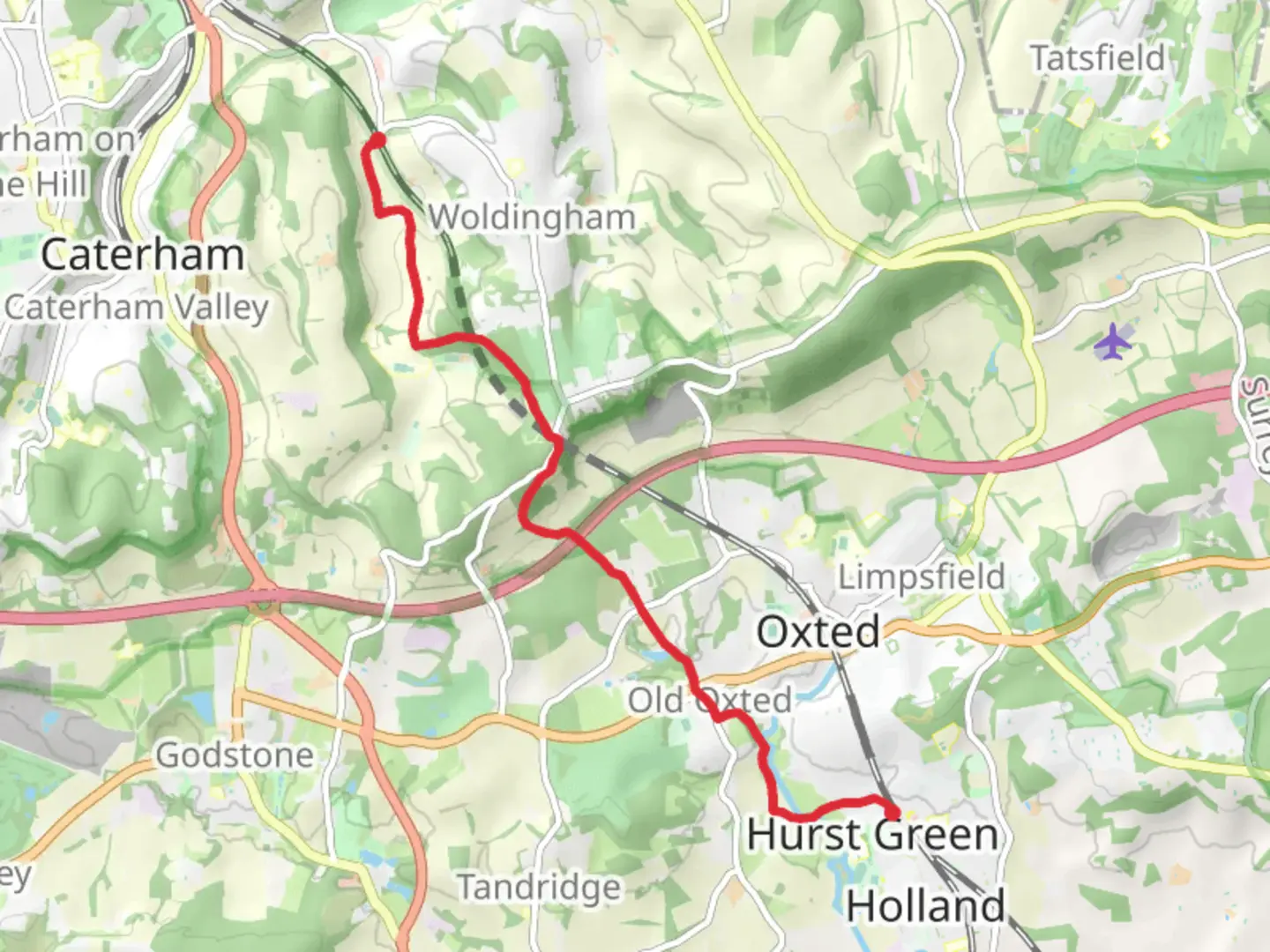
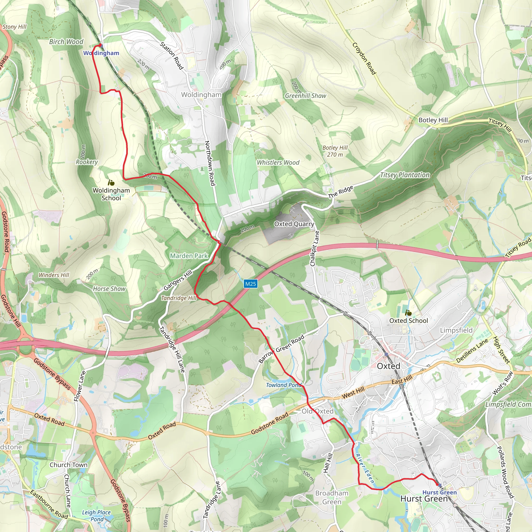
Starting near the picturesque village of Hurst Green in Surrey, England, this 9 km (approximately 5.6 miles) point-to-point trail offers a delightful mix of natural beauty and historical intrigue. With an elevation gain of around 200 meters (656 feet), the trail is rated as medium difficulty, making it suitable for moderately experienced hikers.
Getting There To reach the trailhead, you can take a train to Hurst Green Station, which is well-connected via the Southern Railway network. If you're driving, you can park near the station or in designated parking areas in the village. The nearest significant landmark to the trailhead is the Hurst Green Community Centre.
Trail Overview The trail begins in Hurst Green and meanders through the lush countryside of Surrey. Early on, you'll traverse through open fields and woodlands, offering a serene start to your hike. Keep an eye out for local wildlife such as deer, foxes, and a variety of bird species.
Landmarks and Points of Interest - **Oxted Downs**: About 3 km (1.9 miles) into the hike, you'll reach the Oxted Downs, part of the North Downs. This area is known for its chalk grassland, which supports a unique ecosystem. The views from here are particularly stunning, offering panoramic vistas of the surrounding countryside. - **Titsey Place and Gardens**: Approximately 5 km (3.1 miles) into the trail, you'll pass near Titsey Place, a historic manor house with beautifully maintained gardens. While the house itself is private, the gardens are open to the public on certain days, offering a perfect spot for a short detour. - **Botley Hill**: As you continue, you'll ascend Botley Hill, the highest point in Surrey at 267 meters (876 feet) above sea level. The climb is gradual but rewarding, with expansive views that make it a highlight of the hike.
Historical Significance The region is steeped in history, with several landmarks dating back to medieval times. The North Downs Way, which intersects with parts of this trail, has been used for centuries by pilgrims traveling to Canterbury. The area around Titsey Place has been inhabited since the Roman era, adding a layer of historical depth to your hike.
Navigation and Safety Given the varied terrain, it's advisable to use a reliable navigation tool like HiiKER to stay on track. The trail is well-marked, but having a digital map can be invaluable, especially in wooded areas where paths can be less distinct.
Final Stretch to Woldingham The final leg of the hike takes you through more wooded areas and open fields before descending into the village of Woldingham. The trail ends near Woldingham Station, making it convenient for those relying on public transport for their return journey. If you're driving, you can arrange for a pickup or use local taxi services.
This trail offers a balanced mix of natural beauty, historical landmarks, and moderate physical challenge, making it a rewarding experience for any hiker.
What to expect?
Activity types
Comments and Reviews
User comments, reviews and discussions about the Hurst Green to Woldingham Walk, England.
4.0
average rating out of 5
1 rating(s)
