Download
Preview
Add to list
More
215.4 km
~9 days
661 m
Multi-Day
“Embrace history and nature on a scenic 134-mile trek through Norfolk's heart and along its coastal charm.”
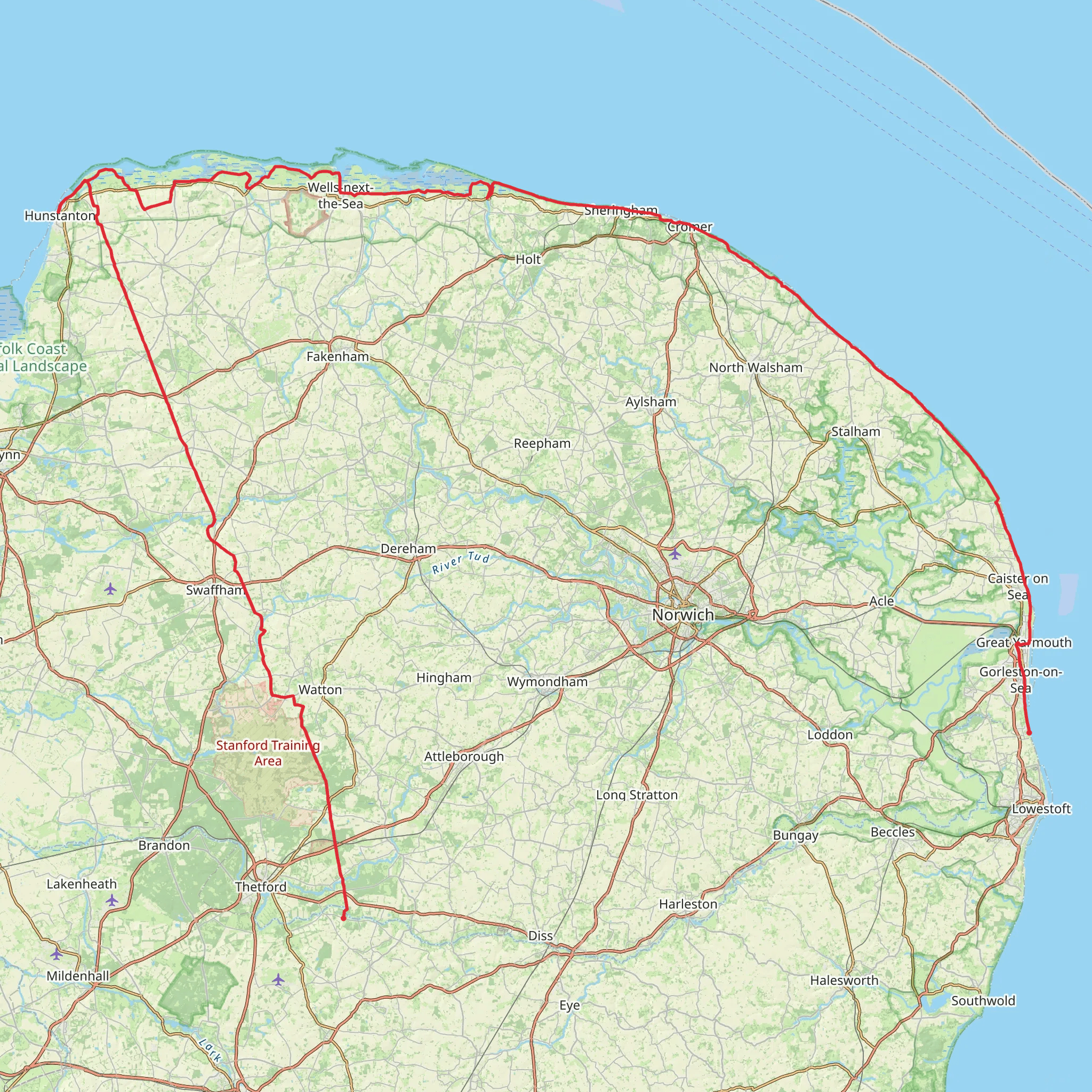
The Peddars Way and Norfolk Coast Path is a long-distance walking route that combines rich history with diverse landscapes, stretching approximately 215 kilometers (134 miles) with an elevation gain of around 600 meters (1968 feet). This point-to-point trail begins near Knettishall Heath Country Park, close to the border of Suffolk, and meanders northwards through the varied countryside of Norfolk before meeting the coastline and following it to the seaside town of Cromer.
Getting to the Trailhead
To reach the starting point of the trail near Knettishall Heath Country Park, hikers can drive and park at the country park itself. For those using public transport, the nearest train stations are Thetford and Diss, from which you can take a taxi or local bus services to the trailhead. HiiKER can be used to navigate to the start and throughout the hike, ensuring you stay on the correct path.
Historical Significance and Landmarks
The Peddars Way section of the trail follows the route of a Roman road built along the line of an even older trackway. The path is relatively straight in this section, characteristic of Roman road design. Hikers will pass through the remnants of ancient landscapes, including heathland, mixed woodland, and low river valleys. Notable historical landmarks include the Roman fort at North Pickenham, the Saxon Shore fort at Brancaster, and the magnificent Holkham Hall estate.
As the trail reaches the Norfolk Coast Path, the scenery transitions to salt marshes, sandy beaches, and cliffs. The coastal section offers an opportunity to see a variety of birdlife, especially at nature reserves like Titchwell Marsh and Cley Marshes. The trail also passes through traditional seaside towns such as Wells-next-the-Sea and Sheringham, where hikers can enjoy local seafood and explore the charming streets.
Trail Experience and Wildlife
The trail is well-marked and maintained, making it accessible for hikers with a moderate level of experience. The terrain is varied but not particularly challenging, with the majority of elevation gain occurring in the coastal section as the path ascends and descends the low cliffs.
Wildlife enthusiasts will appreciate the diversity of species along the route. Inland, you may spot deer, foxes, and a variety of birds. Along the coast, the trail is renowned for its birdwatching opportunities, with migratory birds, waders, and seabirds being common sights.
Preparation and Planning
When planning to hike the Peddars Way and Norfolk Coast Path, it's essential to consider the time of year, as the coastal weather can be unpredictable. Waterproof gear and layers are recommended. Accommodation options range from camping to bed and breakfasts, with plenty of choices along the route. It's advisable to book in advance during peak seasons.
For navigation, HiiKER offers detailed maps and information that can assist with route planning and in-trail navigation. Hikers should also carry a physical map and compass as a backup.
Access and Amenities
The trail is well-served by a number of small towns and villages where hikers can resupply, find accommodation, or enjoy a meal. Public transport options are available at various points along the trail for those who wish to hike sections rather than the entire route.
Conclusion
The Peddars Way and Norfolk Coast Path offers a unique combination of historical interest and natural beauty. Whether you're interested in the ancient history of the region, the diverse wildlife, or simply the joy of walking through some of England's most picturesque landscapes, this trail provides a memorable experience for all who walk it.
What to expect?
Activity types
Comments and Reviews
User comments, reviews and discussions about the Peddars Way and Norfolk Coast Path, England.
4.33
average rating out of 5
18 rating(s)

