Download
Preview
Add to list
More
13.2 km
~3 hrs 14 min
363 m
Loop
“Explore history, nature, and wildlife on the captivating 13 km Roman Lakes and Lower Cliffe loop trail.”
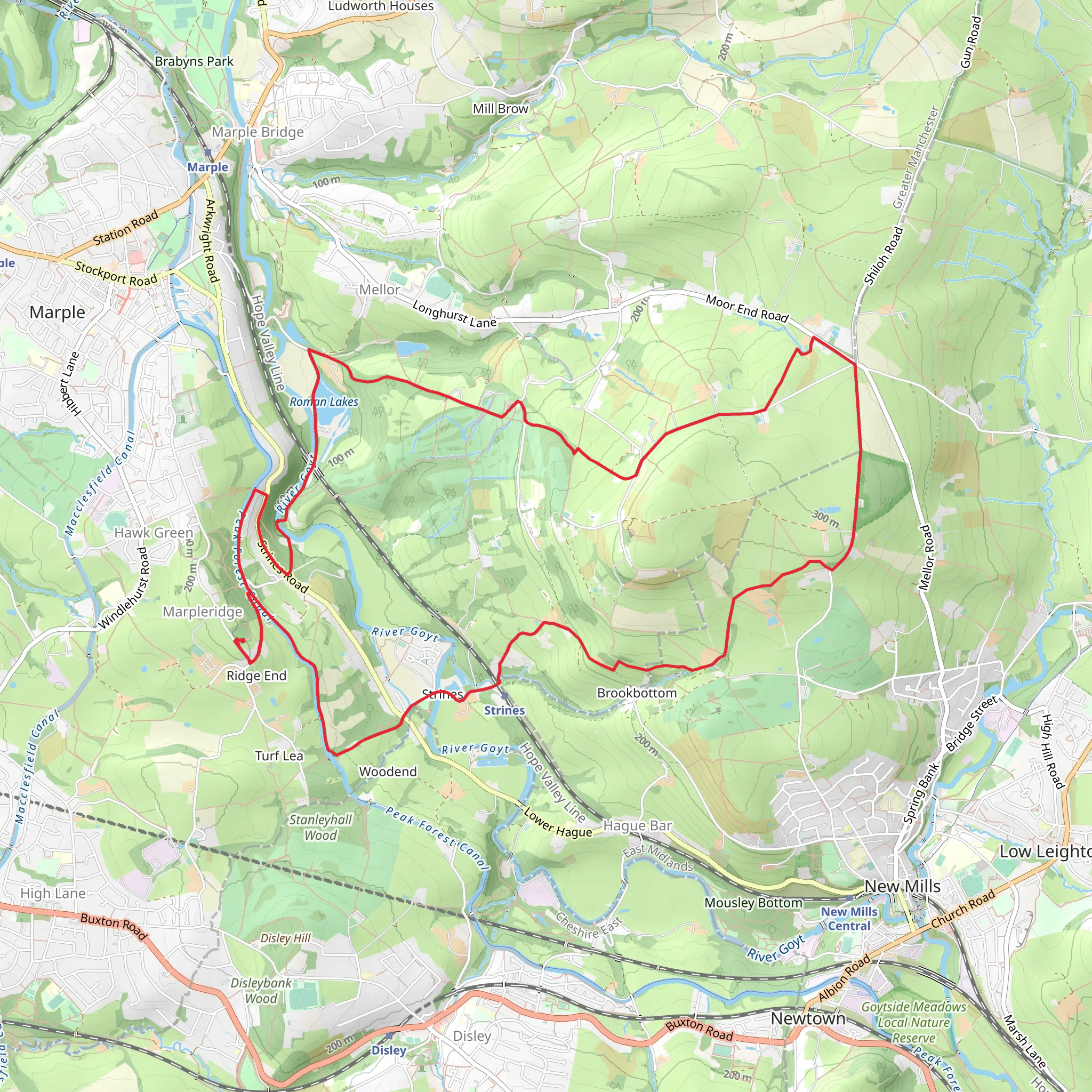
Starting near Stockport, England, the Roman Lakes and Lower Cliffe via Cown Edge Way is a captivating loop trail that spans approximately 13 km (8 miles) with an elevation gain of around 300 meters (984 feet). This medium-difficulty hike offers a blend of historical intrigue, natural beauty, and diverse wildlife, making it a rewarding experience for outdoor enthusiasts.
Getting There
To reach the trailhead, you can drive or use public transport. If driving, set your GPS to Roman Lakes Leisure Park, Marple, Stockport, SK6 7HB. For those using public transport, take a train to Marple Station, which is well-connected from Manchester Piccadilly. From Marple Station, it's a short walk to the trailhead.
Trail Overview
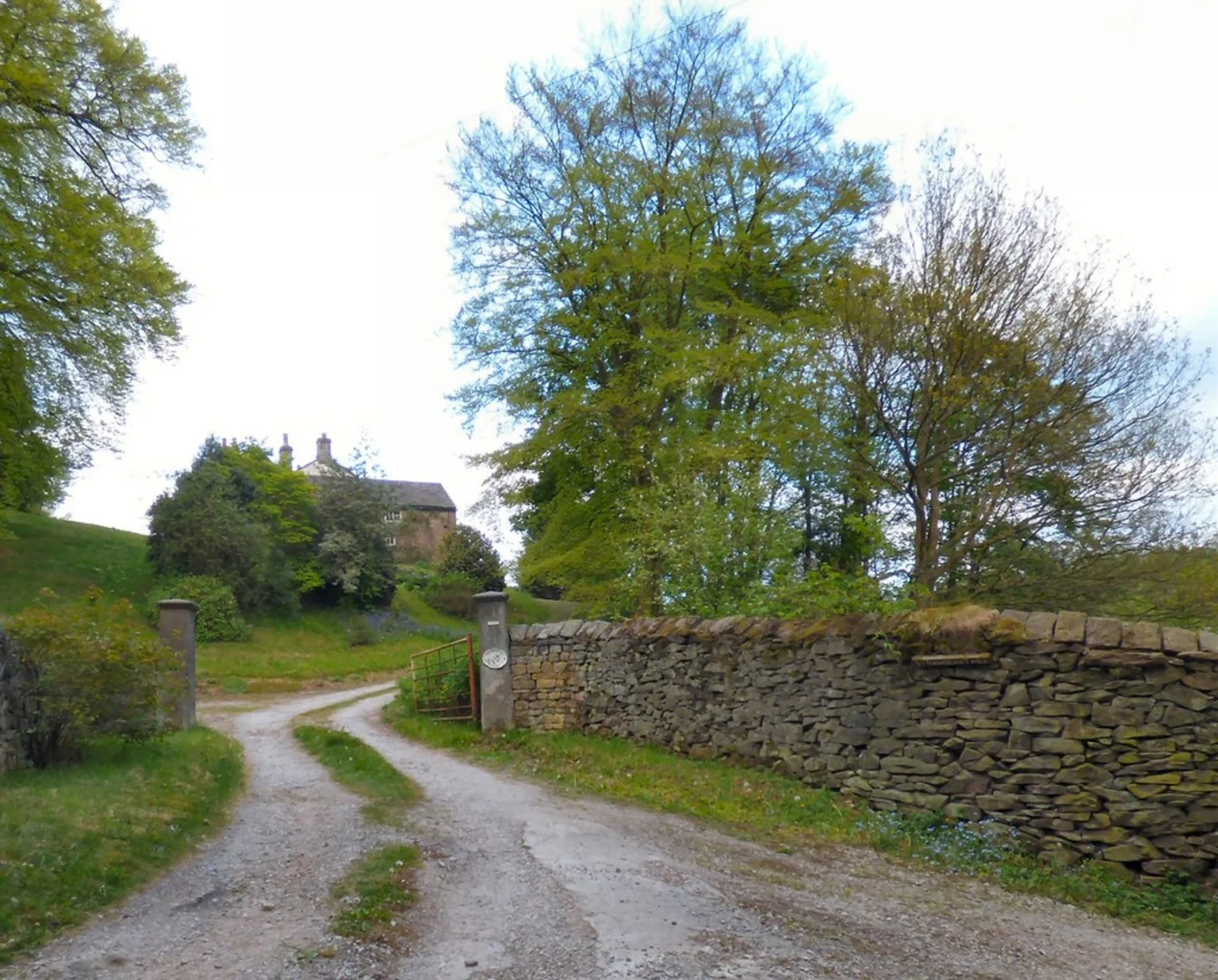
The trail begins at Roman Lakes Leisure Park, a historic site that dates back to the Roman era. The lakes were originally constructed as mill ponds during the Industrial Revolution, and today they offer a serene starting point for your hike. As you set off, you'll follow well-marked paths that guide you through lush woodlands and open fields.
Key Landmarks and Sections
#### Roman Lakes to Lower Cliffe
The initial section of the trail takes you around the Roman Lakes, where you can enjoy the tranquil waters and perhaps spot some local wildlife, including ducks and swans. After approximately 2 km (1.2 miles), you'll start to ascend towards Lower Cliffe. This part of the trail offers moderate elevation gain, providing panoramic views of the surrounding countryside.
#### Cown Edge Way
At around the 5 km (3.1 miles) mark, you'll join the Cown Edge Way. This ancient route is steeped in history, once serving as a boundary marker during medieval times. The path here is more rugged, with rocky outcrops and heather-clad moorlands. Keep an eye out for kestrels and other birds of prey that frequent this area.
#### Return Loop
After reaching the highest point of the trail, approximately 300 meters (984 feet) above sea level, you'll begin your descent. The return loop takes you through picturesque villages and past historic farmsteads, offering a glimpse into the rural life of the region. The final stretch brings you back to Roman Lakes, completing the loop.
Navigation and Safety
For navigation, it's highly recommended to use the HiiKER app, which provides detailed maps and real-time updates. The trail is generally well-marked, but having a reliable navigation tool ensures you stay on track.
Flora and Fauna
The trail is rich in biodiversity. In the woodlands, you'll find oak, ash, and birch trees, while the open fields are home to wildflowers like bluebells and foxgloves. Wildlife enthusiasts can look forward to spotting deer, rabbits, and a variety of bird species.
Historical Significance
The Roman Lakes area has a deep historical significance, with remnants of Roman roads and ancient mill structures. The Cown Edge Way itself is a historical route that has been used for centuries, adding a layer of historical context to your hike.
Practical Tips
- Wear sturdy hiking boots, as some sections can be rocky and uneven. - Bring sufficient water and snacks, especially if you plan to take breaks and enjoy the scenery. - Check the weather forecast before you go, as conditions can change rapidly in this region.
This trail offers a perfect blend of history, nature, and adventure, making it a must-visit for hikers of all levels.
What to expect?
Activity types
Comments and Reviews
User comments, reviews and discussions about the Roman Lakes and Lower Cliffe via Cown Edge Way, England.
4.4
average rating out of 5
5 rating(s)

