Download
Preview
Add to list
More
80.7 km
~5 days
2756 m
Multi-Day
“Embark on the literary and scenic Coleridge Way, a trek through Somerset's breathtaking countryside and poetic history.”
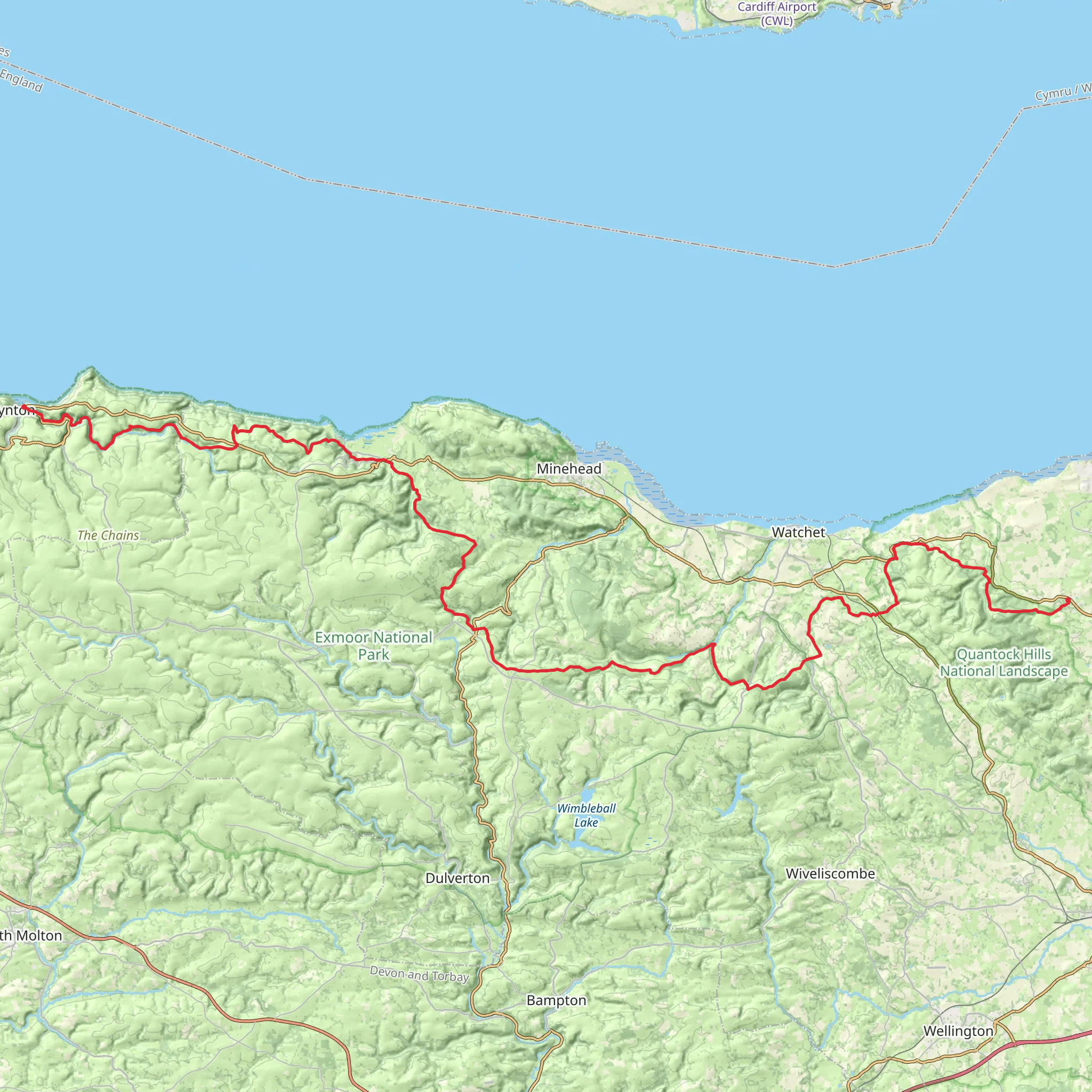
Spanning approximately 81 kilometers (around 50 miles) with an elevation gain of around 2700 meters (approximately 8858 feet), the Coleridge Way offers a medium-difficulty trek through the stunning landscapes of Somerset, England. This point-to-point trail begins near the quaint village of Nether Stowey, at the Coleridge Cottage, which is a significant landmark and the former home of the poet Samuel Taylor Coleridge.
Getting to the Trailhead
To reach the starting point of the Coleridge Way, hikers can drive to Nether Stowey, where parking is available near the Coleridge Cottage. For those using public transport, buses serve the area, and the nearest train stations are located in Bridgwater and Taunton, from where you can catch a bus or taxi to Nether Stowey.
Navigating the Trail
The trail is well-marked with distinct Coleridge Way signs, featuring the quill symbol. Hikers can also use the HiiKER app for detailed maps and navigation assistance, ensuring they stay on the correct path throughout their journey.
Landmarks and Scenery
As you set off from Nether Stowey, you'll be walking in the footsteps of Coleridge himself, with the path winding through the Quantock Hills, an Area of Outstanding Natural Beauty. The trail offers panoramic views of the surrounding countryside and the Bristol Channel, with the possibility of sighting the Welsh coast on clear days.
The route takes you through a variety of landscapes, including dense woodlands, open heathland, and traditional farmland. Approximately 16 kilometers (10 miles) into the hike, you'll reach the village of Holford, which sits at the foot of the Quantocks and offers a picturesque setting for a rest stop.
Continuing on, the trail crosses over to the Brendon Hills and into the Exmoor National Park, known for its diverse wildlife, including the native Exmoor ponies. The path meanders through the park's heather-clad moorland and wooded valleys, providing ample opportunities for wildlife spotting.
Historical Significance
The Coleridge Way not only celebrates the literary heritage of Samuel Taylor Coleridge but also traverses landscapes that have been shaped by centuries of human activity. The region's history is evident in the small villages and hamlets you'll pass, each with their own stories and historical buildings, such as the ancient churches and traditional thatched cottages.
End of the Trail
The trail concludes in the village of Lynmouth, on the rugged North Devon coast. Here, hikers can explore the Lynmouth and Lynton Cliff Railway, the highest and steepest water-powered railway in the world, or simply relax by the sea after their long journey.
Preparation and Planning
Before embarking on the Coleridge Way, hikers should ensure they are adequately prepared with suitable footwear, clothing for changeable weather, and sufficient food and water. It's also advisable to plan for overnight stays, as the trail typically takes 3-4 days to complete. There are various accommodation options along the route, including B&Bs, inns, and campsites.
Remember to respect the natural environment and follow the Countryside Code, leaving no trace of your visit and keeping to the marked paths to protect the local flora and fauna.
What to expect?
Activity types
Comments and Reviews
User comments, reviews and discussions about the Coleridge Way, England.
4.5
average rating out of 5
4 rating(s)

