Download
Preview
Add to list
More
12.6 km
~3 hrs 12 min
420 m
Loop
“Discover Shropshire's past and natural splendor on this scenic, moderately challenging 13 km hike.”
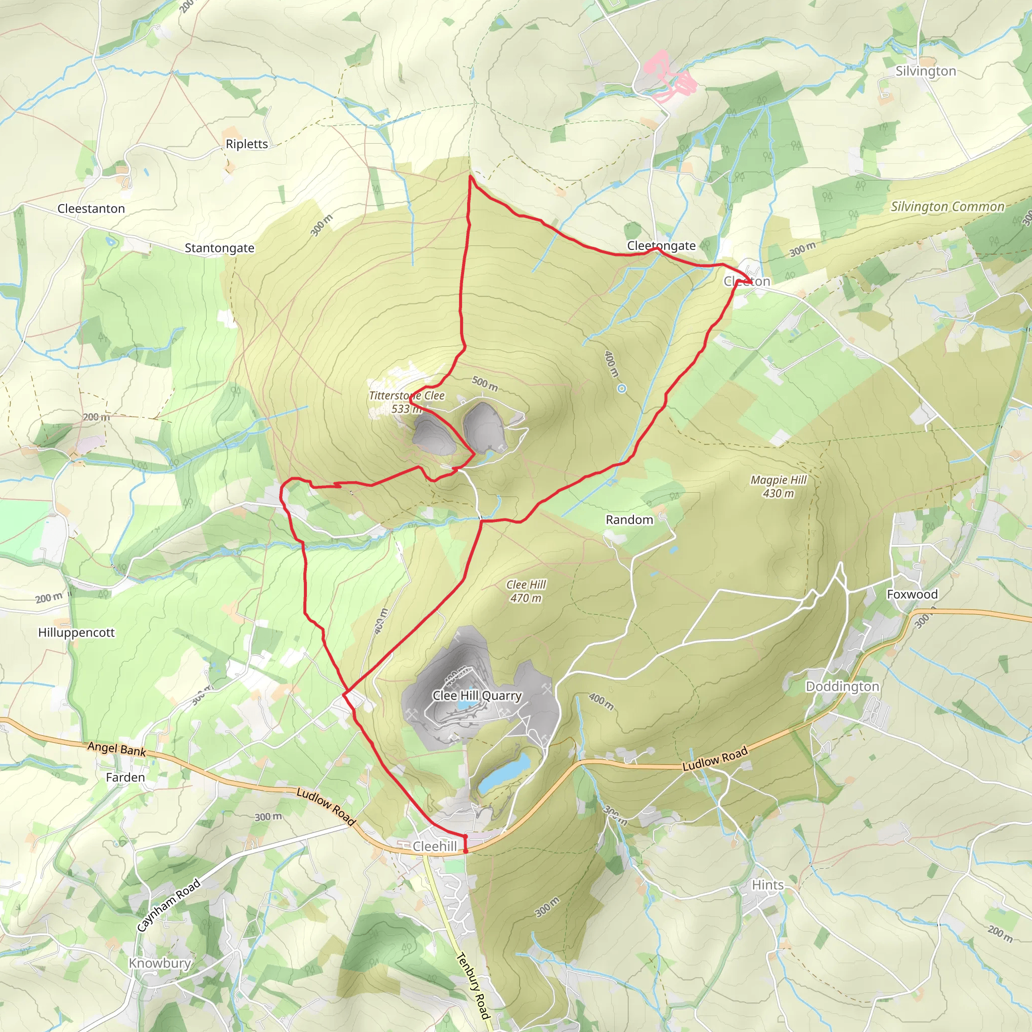
Embarking on the Titterstone Clee Hill and Cleeton St Mary hike from Cleehill, you'll traverse a loop of approximately 13 kilometers (about 8 miles) with an elevation gain of around 400 meters (roughly 1,300 feet). This trail, nestled near Shropshire, England, offers a medium difficulty rating and promises a blend of natural beauty, historical intrigue, and a chance to experience the English countryside.
Getting to the Trailhead
To reach the starting point of the hike, if you're coming by car, navigate towards the village of Cleehill, which is accessible via the B4364 or B4363, depending on your direction of travel. Parking is available in the village, from where you can easily locate the trailhead.
For those preferring public transport, buses serve the nearby towns and villages, though services may be infrequent. Check the latest schedules for the most up-to-date information. From your drop-off point, you may need to walk a short distance to the trailhead.
The Hike Itself
As you set off from the village of Cleehill, the trail will lead you through a mix of terrains, including pastoral landscapes, heathland, and the rugged upland moor of the Clee Hills. The initial ascent is gradual, allowing you to warm up as you take in the surrounding countryside.
Historical Significance and Landmarks
One of the most significant landmarks you'll encounter is the Titterstone Clee Hill itself, which is the third-highest hill in Shropshire and offers panoramic views of the surrounding area. The hill has a rich mining history, with remnants of its past, such as abandoned quarries and old mine buildings, still visible along the trail. These relics serve as a reminder of the area's industrial heritage, particularly in dhustone and coal extraction.
Flora and Fauna
The Clee Hills are a haven for wildlife enthusiasts. The area is known for its diverse bird population, including curlews, skylarks, and birds of prey. Keep an eye out for these species as you navigate the trail. The heathland and moorland also support a variety of plant life, with heather and bilberry bushes being particularly prevalent.
Navigating the Trail
As you continue your hike, the use of a navigation tool like HiiKER can be invaluable in ensuring you stay on the correct path, especially when visibility is poor due to weather conditions or when navigating the less distinct sections of the trail.
Elevation and Terrain
The trail includes some steep sections, particularly as you approach the summit of Titterstone Clee Hill. The elevation gain here can be challenging, but the views from the top are a worthy reward. Be prepared for uneven ground and potentially muddy conditions, especially after rain.
Preparing for the Hike
Before setting out, ensure you have appropriate footwear for the terrain, as well as layers of clothing to adapt to changing weather conditions. It's also advisable to bring water and snacks to maintain energy levels throughout the hike.
Conclusion
By the time you complete the loop and return to Cleehill, you'll have experienced a rich tapestry of Shropshire's natural beauty, wildlife, and history. This trail offers a rewarding challenge for hikers looking to immerse themselves in the English countryside.
What to expect?
Activity types
Comments and Reviews
User comments, reviews and discussions about the Titterstone Clee Hill and Cleeton St Mary from Cleehill, England.
4.67
average rating out of 5
6 rating(s)

