Download
Preview
Add to list
More
19.7 km
~4 hrs 40 min
435 m
Loop
“Explore the Ringinglow Western Loop for 20 km of stunning landscapes, history, and diverse wildlife near Sheffield.”
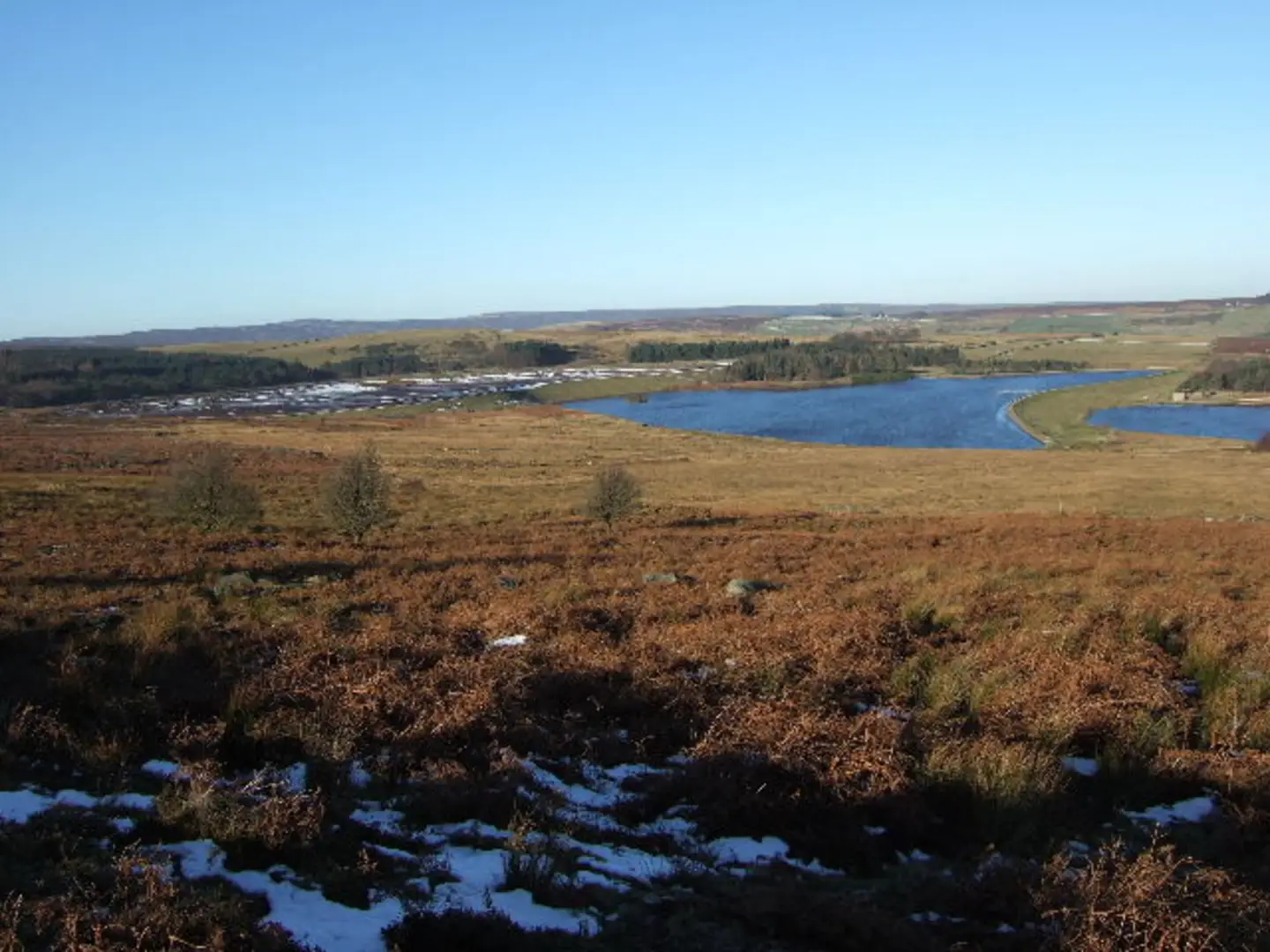
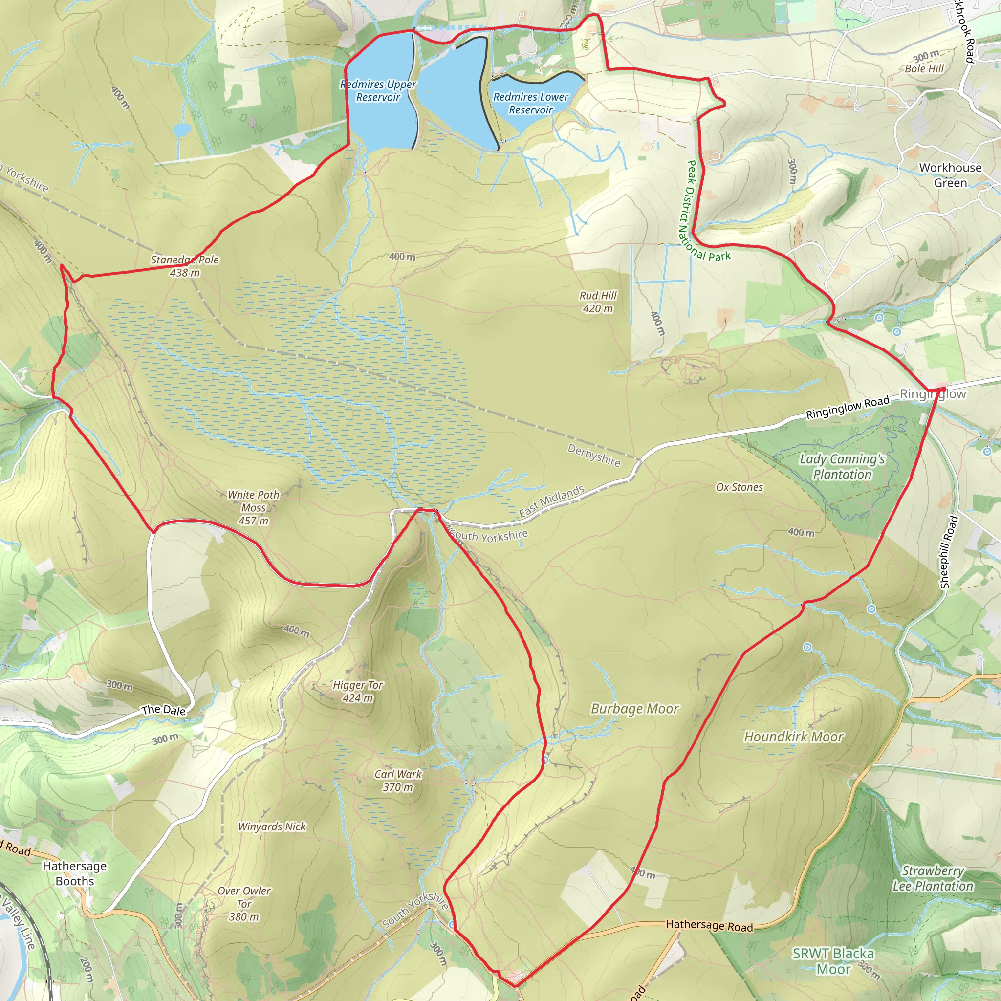
Starting near Sheffield, England, the Ringinglow Western Loop via Redmires Reservoirs is a captivating 20 km (12.4 miles) loop trail with an elevation gain of approximately 400 meters (1,312 feet). This medium-difficulty trail offers a blend of natural beauty, historical landmarks, and diverse wildlife, making it a rewarding experience for hikers.### Getting There To reach the trailhead, you can either drive or use public transport. If driving, head towards Ringinglow Road, Sheffield, where you can find parking near the trail's starting point. For those using public transport, take a bus from Sheffield city center to the Ringinglow area. The nearest bus stop is at Ringinglow Road, which is a short walk from the trailhead.### Trail Overview The trail begins near the picturesque Redmires Reservoirs, a series of three reservoirs that provide a serene start to your hike. As you set off, you'll be greeted by the tranquil waters and the opportunity to spot various bird species, including ducks, geese, and occasionally, herons.### Historical Significance The Redmires Reservoirs were constructed in the mid-19th century to supply water to the growing city of Sheffield. As you hike, you'll notice remnants of old stone structures and walls, offering a glimpse into the area's industrial past. The reservoirs played a crucial role during World War II, serving as a training ground for the Dambusters, the Royal Air Force squadron famous for their daring raids on German dams.### Key Landmarks and Sections - Redmires Reservoirs (0-3 km / 0-1.9 miles): The initial stretch around the reservoirs is relatively flat, making it an easy start. Enjoy the reflections on the water and the surrounding moorland. - Stanage Edge (3-8 km / 1.9-5 miles): As you ascend towards Stanage Edge, the trail becomes steeper, offering panoramic views of the Peak District. This gritstone escarpment is popular among rock climbers and provides stunning vistas of the surrounding countryside. - Ringinglow Bog (8-12 km / 5-7.5 miles): The trail then leads you through the Ringinglow Bog, a unique wetland habitat. Here, you can observe a variety of plant species, including cotton grass and heather, as well as wildlife such as frogs and dragonflies. - Burbage Moor (12-16 km / 7.5-10 miles): Continuing on, you'll traverse Burbage Moor, characterized by its open heathland and scattered rock formations. Keep an eye out for red deer and the occasional peregrine falcon soaring above. - Return to Redmires Reservoirs (16-20 km / 10-12.4 miles): The final leg of the loop brings you back towards the reservoirs, descending gradually and offering a chance to reflect on the diverse landscapes you've encountered.### Navigation and Safety Given the varied terrain, it's advisable to use a reliable navigation tool like HiiKER to stay on track. The trail is well-marked, but weather conditions can change rapidly, especially on the higher sections like Stanage Edge. Ensure you have appropriate clothing, sturdy footwear, and sufficient water and snacks.### Flora and Fauna Throughout the hike, you'll encounter a rich tapestry of flora and fauna. The moorlands are home to heather, bilberry, and various grasses, while the reservoirs attract waterfowl and other bird species. In the woodlands, you might spot squirrels, rabbits, and a variety of songbirds.This trail offers a perfect blend of natural beauty, historical intrigue, and physical challenge, making it a must-visit for any hiking enthusiast.
What to expect?
Activity types
Comments and Reviews
User comments, reviews and discussions about the Ringinglow Western Loop via Redmires Reservoirs, England.
average rating out of 5
0 rating(s)

