Download
Preview
Add to list
More
4.8 km
~1 hrs 13 min
156 m
Loop
“Explore history, lush woodlands, and scenic views on the rewarding 5 km Carr Woods Loop near Plymouth.”
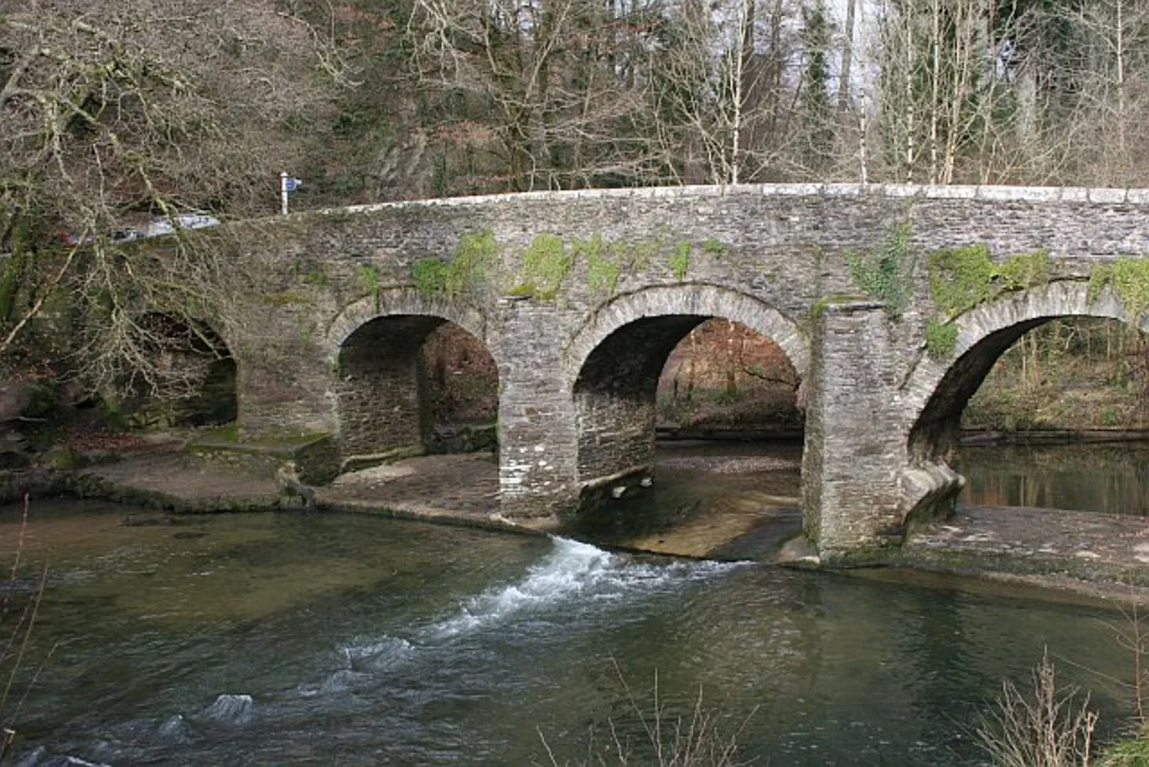
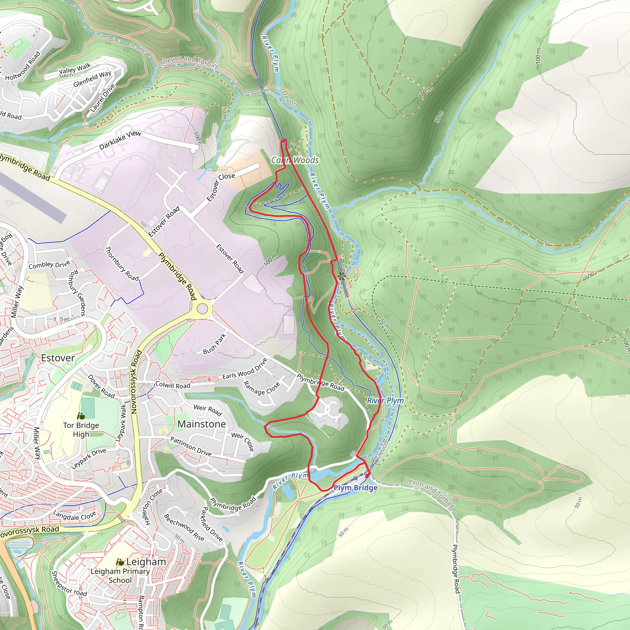
Starting near Plymouth, England, the Carr Woods Loop via Plym Bridge is a delightful 5 km (approximately 3.1 miles) loop trail with an elevation gain of around 100 meters (328 feet). This medium-difficulty trail offers a mix of historical landmarks, lush woodlands, and scenic views, making it a rewarding hike for those looking to explore the natural beauty and history of the area.### Getting There To reach the trailhead, you can either drive or use public transport. If driving, head towards Plym Bridge Road, Plymouth, where you can find parking near the Plym Bridge Woods car park. For those using public transport, take a bus to the Plym Bridge Road stop, which is a short walk from the trailhead.### Trail Overview The trail begins near the Plym Bridge, a historical landmark dating back to the 18th century. As you start your hike, you'll cross the Plym River, which offers picturesque views and a serene atmosphere. The initial part of the trail is relatively flat, making it a good warm-up for the more challenging sections ahead.### Key Landmarks and Nature About 1 km (0.6 miles) into the hike, you'll come across the remains of the Plym Bridge Railway, a testament to the area's industrial past. This section of the trail is particularly rich in history, as the railway was once a vital transport link for the local mining industry. Keep an eye out for informational plaques that provide more details about the railway's significance.As you continue, the trail starts to ascend gently, leading you into Carr Woods. This section is densely wooded, with a variety of tree species including oak, beech, and pine. The forest floor is often carpeted with wildflowers in the spring, and you might spot wildlife such as deer, foxes, and a variety of bird species. The dense canopy provides ample shade, making this part of the hike particularly pleasant during warmer months.### Elevation and Scenic Views Around the 3 km (1.9 miles) mark, you'll reach the highest point of the trail, with an elevation gain of approximately 100 meters (328 feet). From here, you can enjoy panoramic views of the surrounding countryside and the city of Plymouth in the distance. This is a great spot to take a break, have a snack, and soak in the scenery.### Descending and Completing the Loop The descent begins shortly after, leading you back towards the Plym River. This section of the trail is less steep but can be rocky, so watch your footing. As you approach the end of the loop, you'll pass through more open woodland and meadows, offering a different but equally beautiful landscape compared to the earlier dense forest.### Navigation and Safety For navigation, it's recommended to use the HiiKER app, which provides detailed maps and real-time updates to ensure you stay on track. The trail is well-marked, but having a reliable navigation tool can enhance your hiking experience and provide peace of mind.### Historical Significance The Plym Bridge area has a rich history, with its roots in the industrial revolution. The remnants of the railway and old mining sites are scattered throughout the trail, offering a glimpse into the past. The bridge itself is an architectural marvel, having stood the test of time and serving as a reminder of the area's historical importance.This trail offers a perfect blend of natural beauty, historical intrigue, and moderate physical challenge, making it an excellent choice for hikers of all levels. Whether you're a history buff, a nature enthusiast, or simply looking for a scenic hike, the Carr Woods Loop via Plym Bridge has something to offer.
What to expect?
Activity types
Comments and Reviews
User comments, reviews and discussions about the Carr Woods Loop via Plym Bridge, England.
5.0
average rating out of 5
3 rating(s)

