Download
Preview
Add to list
More
362.8 km
~17 days
2885 m
Multi-Day
“Embark on the Midshires Way, a historic and scenic trek through England's heart, dotted with landmarks and natural wonders.”
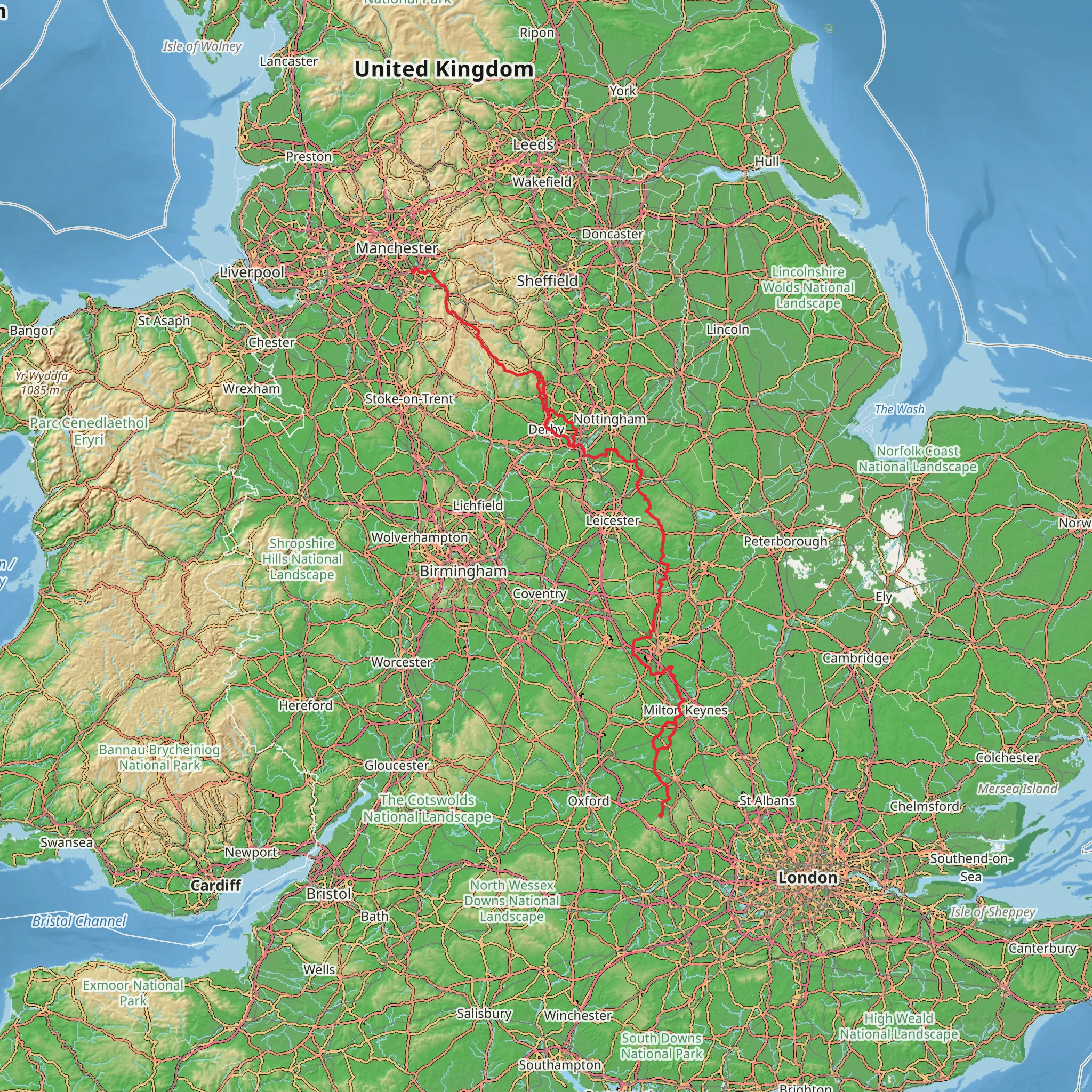
Spanning approximately 225 miles (around 363 kilometers) with an elevation gain of around 9,186 feet (about 2800 meters), the Midshires Way is a long-distance footpath that traverses the heart of England. The trail begins near the picturesque village of Kineton in Oxfordshire, England, and winds its way to Stockport in Greater Manchester, offering a medium difficulty level that caters to both seasoned hikers and those looking to challenge themselves.
Getting to the Trailhead
To reach the starting point of the Midshires Way near Kineton, hikers can use public transport or drive. The nearest significant railway station is in Banbury, from where you can catch a bus or taxi to Kineton. If driving, Kineton is accessible via the M40 motorway, and parking is available in the village or at nearby designated areas.
Route Overview
The Midshires Way connects with several other long-distance paths, including the Oxfordshire Way, the Grand Union Canal Walk, and the Trans Pennine Trail. As you embark on your journey, you'll encounter a tapestry of landscapes, including rolling countryside, serene river valleys, and ancient woodlands.
Historical Significance and Landmarks
The trail is steeped in history, passing through regions that have been shaped by centuries of human activity. Notable historical landmarks include the Battle of Edgehill site, the first major battle of the English Civil War, which lies just off the trail near Kineton. Further along, the trail intersects with the Grand Union Canal, an engineering marvel of the Industrial Revolution, which offers a glimpse into the nation's past transport routes.
Natural Beauty and Wildlife
Nature enthusiasts will appreciate the diverse flora and fauna along the Midshires Way. The trail meanders through several nature reserves and Sites of Special Scientific Interest (SSSI), where you can spot a variety of wildlife, from birds of prey to wildflowers. The Leicestershire section of the trail, for example, takes you through the picturesque Charnwood Forest, known for its distinctive rocky outcrops and ancient woodlands.
Navigation and Planning
For navigation, HiiKER is an excellent tool to help you stay on track and plan your hike effectively. It provides detailed maps and information on the trail, ensuring you can anticipate what's ahead. Given the length of the Midshires Way, it's advisable to plan your hike in sections, and HiiKER can assist in breaking down the route into manageable segments.
Accommodation and Supplies
Along the route, there are numerous villages and towns where hikers can find accommodation, ranging from cozy bed and breakfasts to camping sites. It's essential to plan your stops in advance, especially during peak hiking seasons. For supplies, the trail passes through several larger towns where you can restock on food and water, but always carry enough provisions to last you between these points.
Weather and Gear
The English weather can be unpredictable, so it's crucial to pack appropriate gear for all conditions. Waterproof clothing, sturdy hiking boots, and layers for warmth are a must. Additionally, a good quality backpack, navigation tools, and a first-aid kit are essential for a safe and enjoyable hike.
By preparing adequately and respecting the trail's natural and historical significance, hikers can fully immerse themselves in the beauty and diversity of the Midshires Way.
What to expect?
Activity types
Comments and Reviews
User comments, reviews and discussions about the Midshires Way, England.
4.0
average rating out of 5
5 rating(s)

