Download
Preview
Add to list
More
218.7 km
~11 days
1825 m
Multi-Day
“Embark on an ancient, scenic 219-km trek through England's heart, rich with history and natural splendor.”
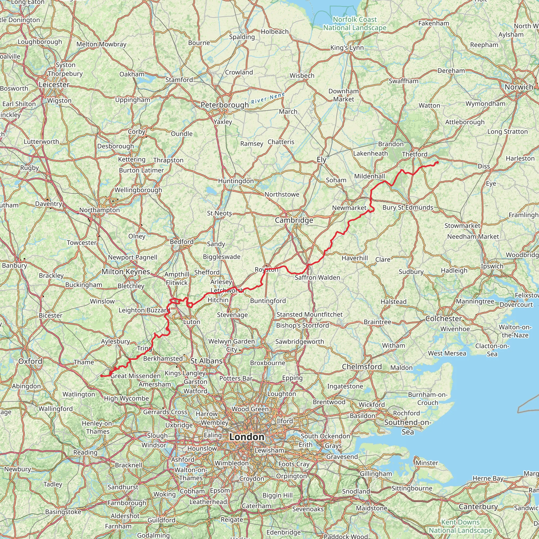
The Icknield Way Trail is a historic path that stretches approximately 219 kilometers (136 miles) across the English countryside, offering a moderate challenge with an elevation gain of around 1800 meters (5905 feet). This point-to-point trail begins near the picturesque Oxfordshire, a county known for its rolling hills and classic English landscapes.
Getting to the Trailhead
To start your journey on the Icknield Way Trail, you can arrive at the trailhead by public transport or car. If you're coming by train, the nearest station is in Goring-on-Thames, Oxfordshire. From there, you can take a taxi or a local bus service to reach the trailhead. For those driving, parking is available near the start of the trail in the vicinity of Icknield Way, close to the village of Lewknor.
Navigating the Trail
As you embark on the trail, it's advisable to use a reliable navigation tool like HiiKER to keep track of your progress and ensure you're following the correct path. The trail is well-marked in most places, but having a digital map can be invaluable, especially in areas where signage might be less obvious.
Historical Significance and Landmarks
The Icknield Way is one of the oldest roads in Britain, with a history that dates back to pre-Roman times. It was a major route for travelers and traders in ancient Britain, connecting the East Anglian coast to the Wessex Downs. As you hike, you'll encounter several historical landmarks, including ancient hill forts, barrows, and chalk figures carved into the hillsides.
One of the notable landmarks you'll pass is the White Horse Hill near Uffington, which features a prehistoric chalk figure believed to be over 3,000 years old. The trail also takes you through the scenic Chiltern Hills, an Area of Outstanding Natural Beauty, where you'll find lush woodlands and traditional English villages.
Flora and Fauna
The Icknield Way Trail traverses a variety of landscapes, from open heathland to dense forests, providing habitats for a diverse range of wildlife. Keep an eye out for red kites soaring overhead, especially in the Chilterns, where these magnificent birds of prey have been successfully reintroduced. The trail's hedgerows and woodlands are home to numerous bird species, while the grasslands support a variety of wildflowers and insects.
Terrain and Difficulty
The terrain along the Icknield Way Trail is varied, with some sections featuring gentle slopes and others presenting steeper climbs. The trail is rated as medium difficulty, making it suitable for hikers with some experience. The elevation gain is gradual, but the distance can be challenging, so it's important to pace yourself and plan for multiple days of hiking if you intend to complete the entire trail.
Preparation and Planning
When planning your hike, consider the time of year, as the trail can be muddy in the winter and early spring. Sturdy, waterproof hiking boots are recommended, along with appropriate clothing for the season. It's also wise to carry sufficient water and food, as some stretches of the trail have limited access to amenities.
Accommodation and Amenities
Along the route, there are opportunities to stay in local inns, B&Bs, or campsites, allowing you to experience the hospitality of the small towns and villages you'll pass through. It's advisable to book accommodation in advance, especially during peak hiking seasons.
Remember to respect the natural environment and the historical sites you visit by following the Leave No Trace principles, ensuring that this ancient trail can be enjoyed by future generations of hikers.
What to expect?
Activity types
Comments and Reviews
User comments, reviews and discussions about the Icknield Way Trail, England.
4.92
average rating out of 5
13 rating(s)

