Download
Preview
Add to list
More
2.8 km
~37 min
49 m
Loop
“Embark on the Burford Loop for a scenic, historical hike through the charming Cotswolds countryside.”
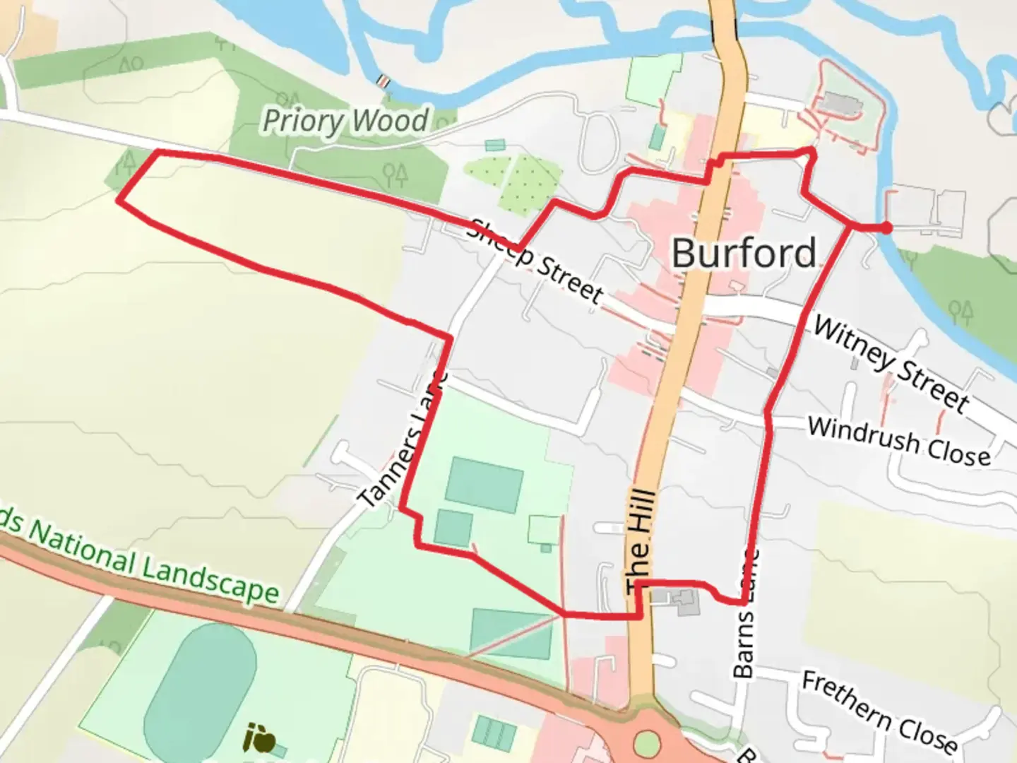
Starting near the picturesque town of Burford in Oxfordshire, England, the Burford Loop is a delightful 3 km (approximately 1.86 miles) trail that offers a gentle and scenic walk through the English countryside. With no significant elevation gain, this loop is accessible to most hikers, though it is rated as medium difficulty due to some uneven terrain and potential muddy patches after rain.
Getting There To reach the trailhead, you can drive to Burford, which is well-connected by road. If you prefer public transport, the nearest major railway station is in Oxford. From Oxford, you can take a bus to Burford. The bus journey typically takes around an hour, and services are frequent. Once in Burford, the trailhead is easily accessible on foot from the town center.
Trail Highlights As you set off from Burford, you'll immediately be immersed in the charm of the Cotswolds. The trail meanders through rolling fields, ancient woodlands, and along the banks of the River Windrush. The first section of the trail takes you through open fields where you might spot local wildlife such as rabbits, pheasants, and various bird species.
#### Historical Significance Burford itself is steeped in history, dating back to Saxon times. As you walk, you'll pass by several historical landmarks. One notable site is the Burford Priory, a former monastery with origins in the 13th century. Although the priory is now a private residence, its impressive architecture can be admired from the trail.
Nature and Wildlife The trail continues through a mix of woodland and open countryside. In the spring and summer months, the fields are often filled with wildflowers, including bluebells and poppies. The woodlands provide a habitat for a variety of birds, so keep an eye out for species such as the great spotted woodpecker and the nuthatch.
Navigation The Burford Loop is well-marked, but it's always a good idea to have a reliable navigation tool. HiiKER is an excellent app for this purpose, offering detailed maps and real-time GPS tracking to ensure you stay on the right path.
Points of Interest About halfway through the loop, you'll come across a charming stone bridge over the River Windrush. This is a perfect spot for a rest and some photos. The river itself is home to ducks, swans, and occasionally, kingfishers.
As you near the end of the loop, you'll pass through more open fields before re-entering Burford. The final stretch takes you along quaint streets lined with honey-colored stone cottages, typical of the Cotswolds.
Practical Information The entire loop can be comfortably completed in about 1 to 1.5 hours, depending on your pace and how often you stop to take in the sights. There are no significant elevation changes, making it a relatively easy walk, though sturdy walking shoes are recommended due to uneven ground in places.
Public amenities such as restrooms and cafes are available in Burford, so you can easily refresh and refuel before or after your hike. The town also offers several charming pubs and tea rooms where you can enjoy a meal or a drink.
The Burford Loop is a delightful way to experience the natural beauty and historical richness of the Cotswolds, making it a perfect outing for both locals and visitors alike.

What to expect?
Activity types
Comments and Reviews
User comments, reviews and discussions about the Burford Loop, England.
average rating out of 5
0 rating(s)