8.6 km
~1 hrs 53 min
101 m
“Explore Nottinghamshire's diverse landscapes and history on the captivating 9 km Slurry Lagoon and Deep Pit Trail.”
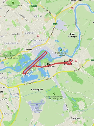
Starting near Nottinghamshire, England, the Slurry Lagoon and Deep Pit and River Trent Walk is a captivating loop trail that spans approximately 9 km (5.6 miles) with an elevation gain of around 100 meters (328 feet). This medium-difficulty trail offers a diverse experience, blending natural beauty with historical significance.
### Getting There To reach the trailhead, you can drive or use public transport. If driving, set your GPS to the nearest known address: Holme Pierrepont Country Park, Adbolton Lane, Nottingham NG12 2LU. For those using public transport, Nottingham Railway Station is the closest major station. From there, you can take a bus or taxi to Holme Pierrepont Country Park.
### Trail Overview The trail begins at Holme Pierrepont Country Park, a well-known recreational area. As you start your hike, you'll quickly find yourself immersed in a variety of landscapes, from serene lagoons to dense woodlands and open fields.
### Slurry Lagoon About 1.5 km (0.9 miles) into the hike, you'll encounter the Slurry Lagoon. This area is a haven for birdwatchers, offering sightings of various species such as herons, kingfishers, and even the occasional osprey. The lagoon is part of a larger nature reserve, so take your time to enjoy the tranquility and perhaps snap a few photos.
### Deep Pit Continuing on, you'll reach the Deep Pit around the 4 km (2.5 miles) mark. This section of the trail is slightly more challenging due to its uneven terrain and minor elevation changes. Historically, this area was part of the extensive coal mining operations that once dominated Nottinghamshire. Remnants of this industrial past can still be seen, adding a layer of historical intrigue to your hike.
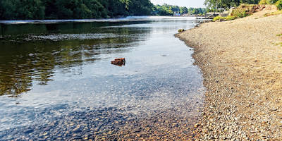
### River Trent As you approach the 6 km (3.7 miles) point, the trail runs parallel to the River Trent. This section is relatively flat and offers stunning views of the river. It's a great spot to take a break, enjoy a picnic, or simply soak in the natural beauty. The River Trent has been a vital waterway for centuries, playing a crucial role in the region's trade and transportation.
### Navigation and Safety Given the trail's moderate difficulty, it's advisable to use a reliable navigation tool like HiiKER to ensure you stay on course. The trail is well-marked, but having a digital map can be incredibly helpful, especially in the more remote sections.
### Flora and Fauna Throughout the hike, you'll encounter a rich variety of flora and fauna. The woodlands are home to oak, ash, and birch trees, while the open fields are often dotted with wildflowers. Keep an eye out for local wildlife, including deer, foxes, and a plethora of bird species.
### Final Stretch The final 3 km (1.9 miles) of the trail loop back towards Holme Pierrepont Country Park. This section is relatively easy, allowing you to wind down as you complete your hike. The park itself offers additional amenities such as restrooms, picnic areas, and even a café where you can relax and refuel.
This trail offers a perfect blend of natural beauty, historical significance, and moderate physical challenge, making it an excellent choice for hikers looking to explore the Nottinghamshire countryside.
Reviews
User comments, reviews and discussions about the Slurry Lagoon and Deep Pit and River Trent Walk, England.
5.0
average rating out of 5
4 rating(s)
Loading reviews...


