Download
Preview
Add to list
More
6.5 km
~1 hrs 32 min
141 m
Loop
“Explore Bestwood Country Park's 7 km loop, rich in history and natural beauty, with moderate challenges.”
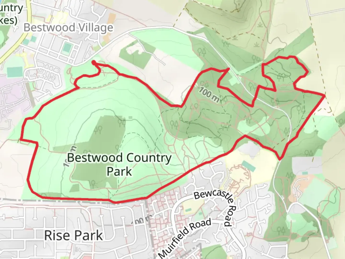
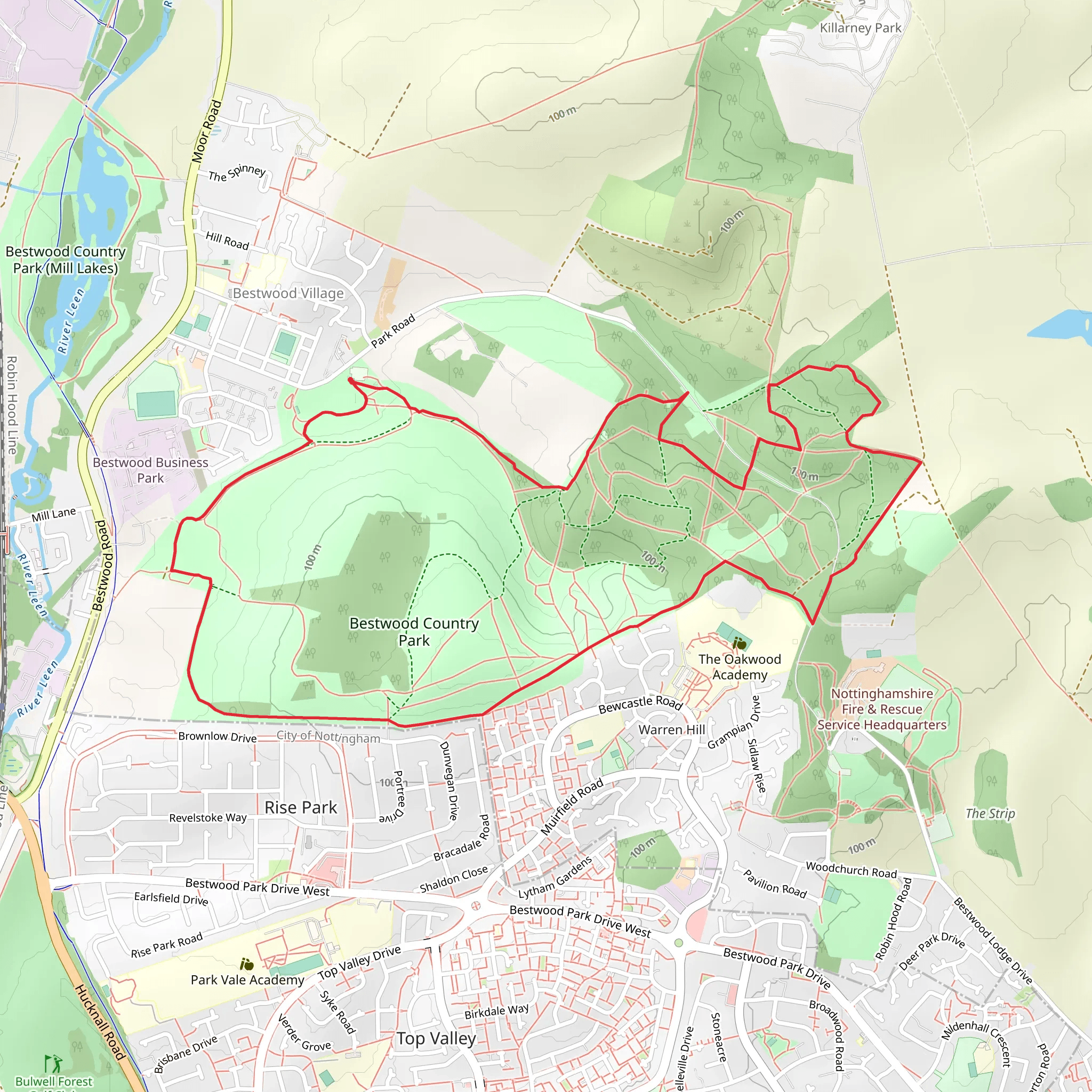
Starting near Nottinghamshire, England, the Bestwood Country Park Long Loop is a delightful 7 km (approximately 4.3 miles) trail with an elevation gain of around 100 meters (328 feet). This loop trail is rated as medium difficulty, making it suitable for moderately experienced hikers.
Getting There To reach the trailhead, you can drive or use public transport. If driving, set your GPS to Bestwood Country Park, Nottinghamshire. There is ample parking available at the park entrance. For those using public transport, the nearest significant landmark is the Bestwood Village tram stop, which is a short walk from the park entrance. From Nottingham city center, you can take the tram towards Hucknall and alight at Bestwood Village.
Trail Overview The trail begins at the main entrance of Bestwood Country Park, a site rich in history and natural beauty. As you start your hike, you'll be greeted by a mix of woodland and open meadows. The first section of the trail is relatively flat, making it a good warm-up for the more undulating terrain ahead.
Historical Significance Bestwood Country Park has a rich industrial history, having been a significant coal mining area in the 19th and early 20th centuries. As you hike, you'll come across the Winding Engine House, a preserved relic of the mining era. This historical landmark is located approximately 1.5 km (0.9 miles) into the trail and offers a fascinating glimpse into the region's past. Interpretive signs provide detailed information about the mining operations and the lives of the miners who worked here.
Nature and Wildlife The park is a haven for wildlife, with diverse habitats ranging from ancient woodlands to wetlands. Keep an eye out for deer, foxes, and a variety of bird species, including woodpeckers and owls. The trail meanders through several different ecosystems, offering a rich tapestry of flora and fauna. Around the 3 km (1.9 miles) mark, you'll pass through a dense section of woodland, where the canopy overhead creates a serene, shaded environment.
Navigation and Waypoints Using HiiKER for navigation is highly recommended, as the trail has several intersecting paths that can be confusing. The app will help you stay on the correct route and provide real-time updates on your progress. Key waypoints to look out for include the Bestwood Lodge Hotel, a Victorian-era building now serving as a hotel, located around 4 km (2.5 miles) into the hike. This is a good spot to take a break and enjoy the scenic views.
Elevation and Terrain The trail's elevation gain is gradual but noticeable, particularly in the second half. After passing the Bestwood Lodge Hotel, you'll encounter a series of gentle inclines and declines. The highest point of the trail is approximately 5 km (3.1 miles) in, offering panoramic views of the surrounding countryside. This section can be a bit challenging, especially after rain, as the path can become muddy and slippery.
Final Stretch The last 2 km (1.2 miles) of the trail loop back towards the starting point, taking you through open meadows and past a small pond, which is a great spot for birdwatching. The terrain here is relatively flat, providing a gentle end to your hike. As you approach the trailhead, you'll pass by the Bestwood Country Park Visitor Centre, where you can find more information about the park's history and natural features.
This trail offers a perfect blend of historical intrigue, natural beauty, and moderate physical challenge, making it a rewarding experience for any hiker.
What to expect?
Activity types
Comments and Reviews
User comments, reviews and discussions about the Bestwood Country Park Long Loop, England.
4.5
average rating out of 5
2 rating(s)
