Download
Preview
Add to list
More
156.3 km
~8 days
2277 m
Multi-Day
“Embark on a scenic hike through history and nature on the St Oswald's Way trail.”
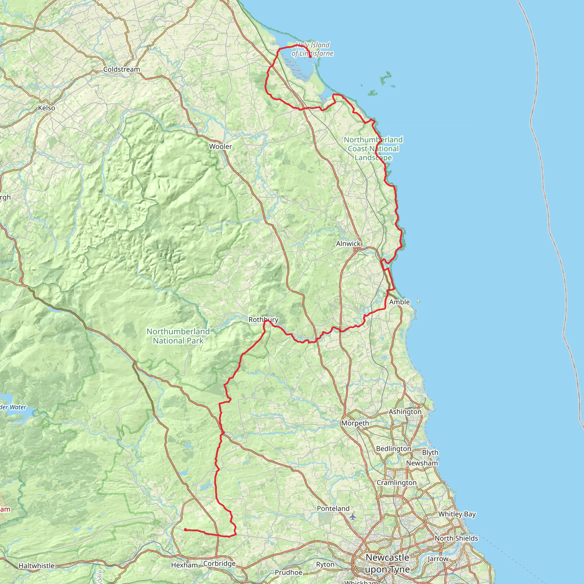
St Oswald's Way stretches approximately 97 miles (156 kilometers) through the picturesque countryside of Northumberland, England. With an elevation gain of around 2200 meters (7218 feet), this point-to-point trail offers a medium difficulty rating, making it accessible to hikers with a moderate level of experience.
Starting near the Holy Island of Lindisfarne, a significant landmark with rich historical importance, the trail head can be reached by taking a local bus service from Berwick-upon-Tweed, which is well-connected by train from major cities like Edinburgh or Newcastle. If driving, parking is available in the area, but be sure to check the tide times as the causeway to Holy Island is tidal.
Historical Significance and Landmarks
As you embark on your journey, you'll be following in the footsteps of St Oswald, the 7th-century King of Northumbria, who played a crucial role in bringing Christianity to this part of Britain. The route takes you past ancient castles, such as Bamburgh Castle, which stands majestically on the coastline approximately 19 miles (30 kilometers) from the start. The castle's history spans over 1,400 years and it's a must-see for history enthusiasts.
Further along, at around the 55-mile (88-kilometer) mark, you'll encounter the market town of Rothbury, nestled within the Coquet Valley. This area is known for its scenic beauty and the nearby Cragside House and Gardens, a Victorian-era marvel and the first house in the world to be lit by hydroelectricity.
Natural Beauty and Wildlife
The trail offers a diverse range of landscapes, from dramatic coastal scenery to rolling hills and riverbanks. As you traverse the coastline, keep an eye out for seabirds such as puffins and guillemots, especially during the breeding season. Inland, the route crosses the heather-clad Cheviot Hills, where the elevation gain is most prominent, offering expansive views of the surrounding countryside.
The path meanders through the Northumberland National Park, a haven for wildlife including the elusive red squirrel, otters, and the majestic osprey. The park's dark skies also make it an excellent spot for stargazing, should you decide to camp overnight.
Navigation and Preparation
To navigate the trail, HiiKER is an excellent tool for planning your route, tracking your progress, and ensuring you stay on the correct path. The app provides detailed maps and information on the trail, which is well waymarked with the St Oswald's Way logo.
Preparation is key for a successful hike. Ensure you have suitable footwear for both coastal and hill walking, waterproof clothing to handle the unpredictable British weather, and enough food and water. It's also wise to carry a first-aid kit and a means of communication in case of emergencies.
Accommodation options along the route vary from campsites to bed and breakfasts, so plan according to your preferences and budget. Remember to book in advance, especially during peak seasons.
Access to the Trail
To reach the start of the trail, public transport options are available. From Newcastle upon Tyne, take a train to Berwick-upon-Tweed and then a local bus service to Holy Island. For those driving, parking is available on the mainland near the causeway; just be sure to check the safe crossing times to avoid being caught by the tide.
St Oswald's Way offers a unique blend of historical exploration, natural beauty, and a true sense of the heritage of Northumberland. With careful planning and respect for the environment, hikers can enjoy a memorable journey through one of England's most storied and scenic regions.
What to expect?
Activity types
Comments and Reviews
User comments, reviews and discussions about the St Oswald's Way, England.
4.5
average rating out of 5
8 rating(s)

